Hiking
Mals/Malles, Vinschgau/Val Venosta
The hiking trail runs past Marienberg Abbey, the highest Benedictine abbey in Europe.
The hiking trail runs past Marienberg Abbey, the highest Benedictine abbey in Europe.
Discover the area of the Kondlwaal (wooden irrigation channel) and sunny Selva from Europe’s highest corn farm.
Marlinger Berg Mountain and Vigiljoch/Monte San Vigilio with starting point at the restaurant/Gasthaus Eggerhof.
Beautiful hike in Matschertal valley to the idyllic mountain lake at the foot of the Saldurkamm ridge.
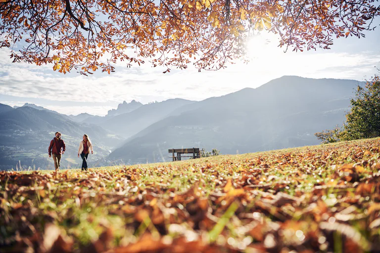
Pleasure Hiking in Marling/Marlengo with start at the railway station.
The Ratschill tour begins right at the San Martino mountain station and heads through the meadows of the Annenberg plain towards the picturesque Oberratschill farm, before continuing up the Lottersteig towards Coldrano.
The Eichhörnchenweg trail trail in Marling/Marlengo functions as an educational nature trail and is identified with the emblem of a squirrel. The one km family-friendly circuit has 23 interactive stations which allow visitors to learn about the local environment while also experiencing adventures for themselves. The circuit is designed as an educational nature trail comprised of games, sports and relaxation, and to help hikers learn about forest life and wood in the process. A high rope facility within the Natur- & Erlebnisweg trail and a natural laboratory is fun for all age groups, encouraging visitors to play and experiment with wood.
From the Schermoos parking place, walk along the E5 European long-distance walking trail until you reach the Möltner Kaser restaurant/mountain hut. Keep on walking along trail no. 23A until you reach the famous "Men of Stone" with its amazing view on the Dolomites. On your way back, follow the path no. 23 and no.5 to reach the Jenesier Jöchl pastures.
From the pastures, go on along trail no. 5 until you reach the parking Schermoos. Walking hours around 5 hours- Drop/rise 730 m
Circular Hike on Marlinger Berg Mountain along the irrigation channel and the Höhenweg of Marlengo.
This walk in the Monte Corno Natural Park provides you with the opportunity to admire unique landscapes and impressive mountain scenery. On a clear sunny day, you can make out the Palla Bianca, the Pennes Pass, the Mendola range of mountains and the Brenta Group.
Easy winter hiking tour in the Avinga valley near the border to Swiss.
Circular Hike on the Marling Waalweg and Höhenweg Trails with start at the Hotel Restaurant Waldschenke.
Alpine tour with impressive views of Ortler and Gran Zebru and overnight-stay possibility at Rifugio Martello or Rifugio Nino Corsi.
This hike goes through both the Monte Corno Natural Park, a scenic jewel rich in flora and fauna, and across the slopes of South Tyrol´s Bassa Atesina. This is where the idyllic villages of Gleno and Casignano can be found. You can enjoy a wonderful view of Castelfeder, the Adige Valley, the Mendola range of mountains and Lake Caldaro to as far away as the mountains above Merano.
Exciting family hike at Laces‘ Monte Tramontana. After the chairlift ride you can discover the Malga di Tarres family circular route characterized by meadows, forests, rustic trees and mystic mythical characters.
You can choose from three different variants to discover the Malga di Tarres circular route. Variant A (easy) starts at the mountain station of the chairlift and leads through the forest and over wooden footbridges until above the Malga di Tarres mountain hut where you can sit on a Hollywood swing and enjoy the view of the valley.Demanding hike that rewards you with innumerous unique views. On this special high mountain trail you can experience Val Martello in a different way.
Start from the Kampidell parkplace and follow trail to the Jenesiener Jöchl and then walk on with the snowshoes along trail no. 23b until you reach Stoanerne Mandlen. On your way back, walk along trail no. 23b until you reach the Möltner Kaser restaurant and trail no. 28 to come back to your starting point. Duration of the excursioin: 5 hours hours - Drop/rise: 350 m
Exciting family hike at Laces‘ Monte Tramontana. After the chairlift ride you can discover the Malga di Tarres family circular route characterized by meadows, forests, rustic trees and mystic mythical characters.
You can choose from three different variants to discover the Malga di Tarres circular route. Variant A (easy) starts at the mountain station of the chairlift and leads through the forest and over wooden footbridges until above the Malga di Tarres mountain hut where you can sit on a Hollywood swing and enjoy the view of the valley.Start from the Kampidell parking space and follow trail to the Jenesiener Jöchl. Continue hiking on the path no. 23/23B until you reach "Stoanerne Mandlen - Men of Stone". On your way back, walk along trail no. 23A until you reach the Möltner Kaser restaurant and trail no. 28 to come back to your starting point. Duration of the excursioin: 4 hours - Drop/rise: 560 m
The San Martino - Egg - Forra trail is also recommended for less experienced hikers.
Follow the E5 European long-distance trail or trail no. 1 and stop at the Gschnofer Stall restaurant. From here, walk along to Tomanegger and come back to the point of departure. Duration of the excursion: 3 hours - Drop/rise: 360 m
Surrounded by larch forests and alpine meadows, the alpine restaurant Lanzenschuster is located on the northern part of the plateau Salten, above Flaas. The restaurant Lanzenschuster serves hearty home-made South Tyrolean specialities with regional products and home made products, like strudel with apple or cheese. During the summer often barbeques and live music are waiting for you, and for children a playground and a petting zoo are offered.
Martinsweg trail is an easily accessible, newly laid circular route named after the small Church of St. Martin, which is located close to the Eggerhöfe farmsteads.
12 kilometers long, the Marlinger Waalweg trail is a popular hiking trail which runs along the former irrigation channels, the longest of its kind in South Tyrol.
Long, very worthwhile and panoramic circular hike in alpine terrain during which you round the Zwölferkreuz peak. And the variant directly takes you to the peak!
The Via Ferrata Murmele close to the Rifugio Nino Corsi (Zufallhütte) in Val Martello, is a choice route for climbers and families alike.
The tour starts at the Hotel Waldheim in Val Martello and goes over the bridge of the Plima. Continue along the path no.5 through the wood untill the "Löcherhof", from there on the old road at the free slope to the meadows of "Hochegghof" and a moderate rise brings you to the "Stallwieshof" (1,926m). From there you go on at the footpath no.8 to the log cabins of the Malga Schluder/Schluderalm. Following the path no.34 up to the forest and then down into the valley. At the end of the tour, cross again the bridge and return to the starting point. A wonderful winter tour with great views!
On the malga Leadner Alm, a former farmstead on the Tschögglberg, delicious homemade food is waiting for you, as well as beautiful surroundings and a fantastic views. The alpine pasture is located at a height of 1530 meters and has a large meadow and in winter there are many opportunities for slidding down hills for children.
Hartelijk dank! Controleer je e-mails, we hebben je een bevestiging gestuurd. Als deze niet in je inbox staat, controleer dan je spamfolder.