Ga meteen naar de inhoud

toegevoegd aan favorieten

verwijderd uit favorieten

Helaas is er een probleem opgetreden. Probeer het opnieuw.

Uw account wordt aangemaakt

Je account is succesvol aangemaakt en je bent nu ingelogd

U bent succesvol ingelogd!

Uw account is succesvol aangemaakt, maar we konden u niet automatisch aanmelden

U bent uitgelogd

Filteren
Geselecteerde filters
    Moeilijkheidsgraad
    Duur
    Afstand in km

    Wandelen in Zuid-Tirol

    De zon schijnt, je hebt alles ingepakt - waar wil je nu naartoe? De toppen, pieken en torens van de Dolomieten schitteren uitnodigend in het ochtendlicht. Zijn ze nog mooier vanaf de top? De valleien zijn doorkruist met paden door wijngaarden en appelboomgaarden, langs imposante kastelen, rond betoverende meren en langs de Waalweg kanaalpaden. Zuid-Tirol heeft meer dan 16.000 km bewegwijzerde wandelpaden door het steeds veranderende natuurlandschap, waaronder themapaden, meerdaagse tochten en hoogalpiene paden.
    Resultaten
    Hiking
    From Aicha/Aica to Spinges/Spinga
    Natz-Schabs/Naz-Sciaves, Brixen/Bressanone and environs

    From Aicha, trail no. 7A leads to Spinges. For the way back to Aicha, take trail no. 9 via Katzenleiter and past the wayside shrine, then continue on trail no. 9A.

    Moeilijkheidsgraad: gemiddeld
    446 m Hoogtemeters
    3h:00 min Duur
    Hiking
    Alpine Hike - Monte Tramontana
    Naturns/Naturno, Meran/Merano and environs
    The most beautiful section of this hike is certainly the fairytale-like Almenweg. This continues from the Mausloch Alm in the direction of Vinschgau and connects the alpine pastures on the Nörderberg. This alpine pasture round can be run excellently as a culinary pleasure walk, because the alpine pastures cultivated during the summer months with typical courts of the region invite to small and bigger refreshments. The hike is especially refreshing in the hot summer months.
    Moeilijkheidsgraad: gemakkelijk
    507 m Hoogtemeters
    2h:28 min Duur
    Hiking
    Easy Hike on Marling Waalweg Trail
    Lana, Meran/Merano and environs

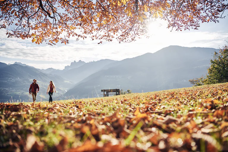
    12 kilometers long, the Marlinger Waalweg trail is a popular hiking trail which runs along the former irrigation channels, the longest of its kind in South Tyrol.

    Moeilijkheidsgraad: gemakkelijk
    287 m Hoogtemeters
    2h:00 min Duur
    Hiking
    Panoramic and idyllic
    Lana, Meran/Merano and environs

    Starting Point: Top station of San Vigilio Cable Car (1,486 m)
    Walking Time: 2 hours
    Distance: 5,815 m
    Altitude Gain: 458 m
    Route: 1 – 34A – 34B – 2 – 9 – 4

    Moeilijkheidsgraad: gemiddeld
    865 m Hoogtemeters
    3h:00 min Duur
    Hiking
    Hike on the Legend Path
    Sand in Taufers/Campo Tures, Ahrntal/Valle Aurina

    The Tauferer Ahrntal (valley) is rich in legends. Some of these are presented on the Tauferer Valley Legend Trail. Children are drawn into an exciting world of magic, adults learn something about the mystics of Taufers. The legends are told on display boards. We hear about the little woman from Oberpurstein, about the Antrischen people, about the castle on Purstein, the treasure at Tobl and the doom of the Walburg Castle.


    Moeilijkheidsgraad: gemiddeld
    193 m Hoogtemeters
    2h:30 min Duur
    Hiking
    Cable car Schlaneid - Lingeralm
    Mölten/Meltina, Bolzano/Bozen and environs

    The Lingeralm is situated above Mölten, in the middle of the sunny highplateau. The Lingeralm offers a beautiful panoramic view over the surrounding mountains and tipical south tyrolean dishes, cakes, as well as small plates. For little children there is a small playground with a swing. The bigger guests awaits a large sun terrace.

    Moeilijkheidsgraad: gemakkelijk
    266 m Hoogtemeters
    1h:19 min Duur
    Hiking
    Bunker recreation area Spinges
    Mühlbach/Rio di Pusteria, Brixen/Bressanone and environs
    In Mühlbach there is an easy walking path that leads to the neighbouring village of Spinges. This walk commands wonderful views and leads past several sights before arriving at the bunker recreation area – a little paradise for families, with a breathing-themed experience, a children’s play area and a fantastic panorama.
    Moeilijkheidsgraad: gemiddeld
    596 m Hoogtemeters
    2h:00 min Duur
    Hiking
    Schlaneid - restaurant Kreuzweg
    Mölten/Meltina, Bolzano/Bozen and environs

    The guest house is located in Verschneid, above the main road. At the traditional Albergo Kreuzweg relaxing and enjoyable hours are waiting for you. The arromatic mixture of spicy South Tyrolean food and of light mediterranean dishes is framed by cordial hospitality. From the traditional "Jausenbrettl" with Speck, over plates with Kanederli or asparagus dishes, to cakes made of buckwheat - the restaurant shows South Tyrol from a traditional side. Only fresh and regional products are used. The menu depends on the seasons.

    Moeilijkheidsgraad: gemakkelijk
    34961 m Hoogtemeters
    1h:55 min Duur
    Hiking
    Walk to the viewpoint "Waldertor"
    Natz-Schabs/Naz-Sciaves, Brixen/Bressanone and environs

    Starting at the church in Natz follow the road „Schlossergasse“ through the village in direction nord, of „Viums“. After about 150 m turn right and follow the sign „Dörferrunde“ through settlements. This will lead you (mostly on an even paths) through fields and woods to the observation point „Waldertor“, where you can enjoy the amazing view oft he castel „Rodenegg“ on the oppsite side. Then continue walking towards west in direction of „Viums“, past the romantic chapel „St. Magdalena. At the village border follow trail no. 1 towards south through fields to the Somersürs biotope. Soon afterwards you will reach the main street Natz-Viums, leading to your starting point in Natz.

    Moeilijkheidsgraad: gemakkelijk
    160 m Hoogtemeters
    1h:30 min Duur
    Hiking
    On the sunny side
    Lana, Meran/Merano and environs

    Start: Bergstation Seilbahn Vigiljoch, 1.486 m
    Gehzeit: ca. 1 Stunde 15 Minuten
    Länge: 3.424 m, Aufstieg 322 m

    Moeilijkheidsgraad: gemiddeld
    371 m Hoogtemeters
    1h:22 min Duur
    Hiking
    From Aicha/Aica to the Stöcklvater Church in Mühlbach/ rio di Pusteria
    Natz-Schabs/Naz-Sciaves, Brixen/Bressanone and environs

    This walk trough interesting Landscapes at the entrance to the Pustertal valley leads trough the upper boundary of orchards and vineyards. There are cultivation trials of apple trees and grape varieties on the sunny slopes of the sunny slopes of Mühlbach. A gem worth seeing is the Stöcklvater chapel, a place of pilgrimage in Mühlbach, as well as the renowned Urlaubstöckl.

    Moeilijkheidsgraad: gemakkelijk
    140 m Hoogtemeters
    2h:30 min Duur
    Hiking
    Am Joch peak in Terenten
    Terenten/Terento, Brixen/Bressanone and environs
    A hike on one of the most spectacular peaks in the  Fundres/Pfunderer  Mountains. Starting point: parking place Schneeberg Terento/Terenten Duration: 2 h
    Moeilijkheidsgraad: gemiddeld
    827 m Hoogtemeters
    2h:30 min Duur
    Hiking
    Play ground Schlaneid - Bacherhof
    Mölten/Meltina, Bolzano/Bozen and environs

    The farmhouse Bacherhof is locadet in the middle of nature and is ideal for families with children. Even the possibility of horseriding is waiting for you.

    Moeilijkheidsgraad: gemakkelijk
    52 m Hoogtemeters
    0h:42 min Duur
    Hiking
    Cikilyrweg
    Mühlbach/Rio di Pusteria, Brixen/Bressanone and environs
    Partendo dalla stazione si passa prima dal cimitero e dal campo di calcio, poi si imbocca il sentiero Cicilyrweg verso Sciaves e infine si torna al punto di partenza. Suggerimento: potete anche trasformare questa passeggiata in un percorso circolare prendendo il sottopasso verso il maso Putzerhof e poi proseguendo sui sentieri 9a e 9 per tornare a Rio di Pusteria.
    Moeilijkheidsgraad: gemakkelijk
    165 m Hoogtemeters
    1h:34 min Duur
    Hiking
    From Church to Church near Natz|Naz
    Natz-Schabs/Naz-Sciaves, Brixen/Bressanone and environs

    This circuit walk leads from the vil lage of Fiumes through the Naz-Sciaves high plateau. The small and romantic St. Magdalena Kirche church on the mound in Fiumes is one of the most beautiful  places of worship in the region.

    Moeilijkheidsgraad: gemakkelijk
    124 m Hoogtemeters
    1h:34 min Duur
    Hiking
    Challenging and spectacular
    Lana, Meran/Merano and environs

    Starting Point: Top station of the San Vigilio Chairlift (1,814 m)
    Walking Time: 3 hours, 30 minutes
    Distance: 12,725 m
    Altitude Gain: 467 m
    Route: 4 – 9 – 9A – 9B – 9 – 2 – 34 B – 34 A – 1

    Moeilijkheidsgraad: gemiddeld
    746 m Hoogtemeters
    3h:40 min Duur
    Hiking
    Wine trail Rebe
    Ritten/Renon, Bolzano/Bozen and environs
    The sunny mountain slope from Bozen up to the Ritten is one of the finest wine-growing areas in South Tyrol. Along the wine steps, the 10 artistic installations offer a fascinating glimpse into the
    culture of wine production. From Signat the trail leads downhill through the gently rolling vineyards to the viewing platform with its magnificent views of Bozen, then on to the Loosmannhof, to the settlement of St. Justina and down to Rentsch in the historic wine-growing estate of Ansitz Waldgries. The same route leads back uphill from Bozen to Signat.
    Moeilijkheidsgraad: gemiddeld
    524 m Hoogtemeters
    1h:45 min Duur
    Hiking
    Circular hike: Niederdorf/Villabassa - Lanaweg
    Niederdorf/Villabassa, Dolomites Region 3 Zinnen
    Along the "Kaspocha Groubm" (nr. 46) you follow the hiking trail to the "Sinna Mihle". Turn right onto the Lanaweg. This leads flat in the direction of Dobbiaco for about 1.5 km. Via the Langwiesn you come back to the village and to the starting point.
    Moeilijkheidsgraad: gemakkelijk
    232 m Hoogtemeters
    1h:37 min Duur
    Hiking
    Lanebach
    Gais, Dolomites Region Kronplatz/Plan de Corones

    This hike is demanding and recommended for those who are well-trained. Lanebach is the last completely preserved mountain school in the entire alpine region and is considered unique. Visit available on request only (phone +39 348 7735477 - Mr. Hochgruber)!

    Moeilijkheidsgraad: zwaar
    662 m Hoogtemeters
    2h:04 min Duur
    Hiking
    Day hike on the Möltnerjoch
    Mölten/Meltina, Bolzano/Bozen and environs

    Mölten, a village close to the mountain Tschögglberg above Boozen, is embedded in the mountain meadows of one of the most beautiful plateaus in South Tyrol.

    The hike is beautiful for every on and the ambience is very variable. On the Möltner Kaser the panorama is breathtaking.

    Moeilijkheidsgraad: gemiddeld
    863 m Hoogtemeters
    5h:17 min Duur
    Hiking
    Round Trip to Stegerbühel Hill
    Natz-Schabs/Naz-Sciaves, Brixen/Bressanone and environs

    Walk from the center in the direction of Schabs and Viums. At the Viummer Kreuz cross chapel, turn left and follow the Stegerbühelrunde sign northwards and clockwise. Walking around the hill will take you along on mossy forest trails that offer great views of Rodenegg Castle and the Rienzschlucht gorge.

    Moeilijkheidsgraad: gemiddeld
    90 m Hoogtemeters
    1h:00 min Duur
    Hiking
    Longer and Family Friendly
    Lana, Meran/Merano and environs

    Starting Point: Top station of the San Vigilio Cable Car (1,486 m)
    Walking Time: 2 hours, 50 minutes
    Distance: 8,737 m
    Altitude Gain: 369 m
    Route: 34 – 9 – 7 – 34

    Moeilijkheidsgraad: gemiddeld
    359 m Hoogtemeters
    2h:27 min Duur
    Hiking
    From Laces to San Martino in Monte
    Latsch/Laces, Vinschgau/Val Venosta

    Deny the same stage like the runners of the oldest still taking place mountain run to San Martino in Monte which yearly in October takes place.

    Moeilijkheidsgraad: zwaar
    1128 m Hoogtemeters
    3h:23 min Duur
    Hiking
    Post trail
    Lajen/Laion

    Before the construction of the road connection to Val Gardena valley, the postman brought mail to the valley using the old Poststeig Trail.

    Moeilijkheidsgraad: gemakkelijk
    138 m Hoogtemeters
    4h:00 min Duur
    Hiking
    Gols and natur solariums in Terenten
    Terenten/Terento, Brixen/Bressanone and environs
    Face the sun to leave the shadows behind!
    The brightness has a positive effect on the mood. To underline the status of the sun, so-called “nature solariums” were realised, the first of this type in South Tyrol. The solariums are situated at two different locations in Terento. In addition to enjoying some healthy vitamin D therapy and deceleration, they also offer a splendid view of the Dolomites.
    Moeilijkheidsgraad: gemiddeld
    580 m Hoogtemeters
    2h:16 min Duur
    Hiking
    Dirsching / Albergo Stella
    Lajen/Laion

    Family hike on the sunny slopes of the north side in Laion with a steady view of the Sassolungo and the Sella

    Moeilijkheidsgraad: gemakkelijk
    286 m Hoogtemeters
    1h:10 min Duur