Ga meteen naar de inhoud

toegevoegd aan favorieten

verwijderd uit favorieten

Helaas is er een probleem opgetreden. Probeer het opnieuw.

Uw account wordt aangemaakt

Je account is succesvol aangemaakt en je bent nu ingelogd

U bent succesvol ingelogd!

Uw account is succesvol aangemaakt, maar we konden u niet automatisch aanmelden

U bent uitgelogd

Filteren
Geselecteerde filters
    Moeilijkheidsgraad
    Duur
    Afstand in km

    Wandelen en bergbeklimmen in Sterzing/Vipiteno en omgeving

    In het Valle Isarco kun je op alle hoogtes actief zijn. Wandel- en fietspaden kronkelen door de valleibodem, langs kastelen en paleizen, door wijn- en boomgaarden, naar zonnige alpenweiden en naar het rijk van de Dolomieten. De 33 rondwandelingen voldoen aan de hoge eisen van een veelzijdige ervaring. Landbouwgrond, bloeiende alpenweiden en trotse bergtoppen vormen het decor van deze 33 wandeltips in het Eisacktal. Deze rondwandelingen, geselecteerd door de respectievelijke vakantieoorden, leiden door mediterrane landschappen en alpine gebieden. Start- en eindpunt zijn op dezelfde plaats, parcours en wandeltijd variëren. Onderweg nodigen kunst- en natuurmonumenten, culturele bezienswaardigheden, uitkijkpunten en rustieke hutten uit om even stil te staan.
    Resultaten
    Hiking
    To the pasture Ladurnerhütte/Malga Ladurns
    Brenner/Brennero, Sterzing/Vipiteno and environs

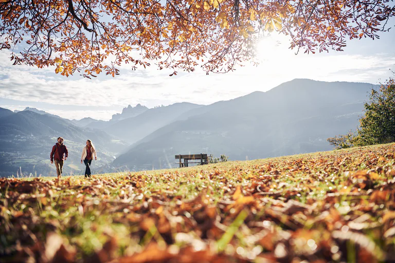
    The Ladurns alpine area offers various beauties for its tranquility. You will arrive to the mountain hut Ladurnerhütte/Malga Ladurns on trail 34, which starts near the Ladurns valley station. Refreshments: Ladurnerhütte/Malga Ladurns.

    Moeilijkheidsgraad: gemiddeld
    596 m Hoogtemeters
    2h:25 min Duur
    Hiking
    Pasture Zirog/Zitago and Mountain hut Enzian/Rifugio Genziana
    Brenner/Brennero, Sterzing/Vipiteno and environs

    Starting point: Village Brennerbad/Terme di Brennero, at the one-time valley station Zirog/Zirago (1.320m)
    The mountain hut is located southwards the Brenner/Brennero and offers shelter and food. The path leads past the old cable car station over a little bridge on path no. 4 to the mountain pasture Badalm and forwards following the signpost “Enzianhütte 4a” to the mountain hut Enzianhütte/Rifugio Genziana.

    Moeilijkheidsgraad: gemiddeld
    597 m Hoogtemeters
    3h:02 min Duur
    Hiking
    Waterfall "Zur Hölle/All'inferno"
    Brenner/Brennero, Sterzing/Vipiteno and environs

    Nice walk to the most famous waterfall in the Pflersch/Fleres Valley. The waterfall "Zur Hölle/All'Inferno" falls 46 meters to the valley bottom.

    Moeilijkheidsgraad: gemakkelijk
    93 m Hoogtemeters
    0h:21 min Duur
    Hiking
    Saxner
    Ratschings/Racines, Sterzing/Vipiteno and environs

    From the end of the valley Ratschings/Racines follow path no. 10, walk steeply at first through the mountain forest, then up through alpine meadows to the inner pasture of Wumblsalm. Following the mark you will reach the pass Schlotterjoch (2,283 m), left from here, on path no. 12 climb to the top of the mountain Saxner. From here you will enjoy a spectacular view, on a clear day as far as to the mountain Ortler-area! The decent follows the same route.

    Moeilijkheidsgraad: gemiddeld
    1303 m Hoogtemeters
    5h:45 min Duur
    Hiking
    Trail Gottschalk to Vallming
    Brenner/Brennero, Sterzing/Vipiteno and environs

    The trail, dedicated to the Gossensass/Colle Isarco tourist office's first president Robert von Gottschalk, starts by the Steckholz/Ceppaia hamlet. You will get over the forestal road to the trail 19A which leads to the Valleming/Valmigna alpine huts. Lunch possibility: Valleming/Valmigna alpine huts.

    Moeilijkheidsgraad: gemiddeld
    732 m Hoogtemeters
    4h:22 min Duur
    Hiking
    From Gossensass/Colle Isarco to the Straßberg ruin
    Brenner/Brennero, Sterzing/Vipiteno and environs

    Short and easy family hike from Gossensass/Colle Isarco to ruins of Straßberg/Castel Strada near Ried/Novale. The castle is located on a hill on the ancient Brenner/Brennero road. At the beginning the castle was equipped with two drawbridges and a wall, but to date there are only some parts, such as sections of the walls, the battlements and the entrance tower preserved.
    The ruin is privately owned and can only be visited from the outside.

    Moeilijkheidsgraad: gemakkelijk
    132 m Hoogtemeters
    1h:06 min Duur
    Hiking
    Mareiter Stein
    Ratschings/Racines, Sterzing/Vipiteno and environs

    Starting from Pardaun/farm Platzhof (parking in Pardaun, no available parking at the farm Platzhof). In front of the farm Platzhof to the left, at first follow a wider path, no. 25, which tightens to a narrow path through the woods and leads into a steeper climb towards the timberline. Then with a wonderful panoramic view along the broad ridge of the mountain to the large summit plateau with its cross. The return follows the same route as the ascent.

    Variant: Starting from Gasse/Entholz along the path no. 24 and later on the path no. 25 to the pasture Wurzeralm. Always on path no. 25 it goes up to the Mareiter Stein. The return goes first on the path no. 25 and then on path no. 25B to the pasture Kerschbaumeralm. Contiune on path no. 23 to the Joggelealm and in the descent briefly on path 24B and 24A down to Gasse. Duration 5 hours.

    Moeilijkheidsgraad: gemiddeld
    1104 m Hoogtemeters
    6h:30 min Duur
    Hiking
    Adventure trail "On the trail of water"
    Brenner/Brennero, Sterzing/Vipiteno and environs

    Welcome to the kingdom of Gossy and Gschnitzy! The two waterdrops tell their exciting story along two trails in North and South Tyrol. You can relive the adventures of the lively drops and learn a lot of interesting facts about water.

    Pflerscherbach/Rio Fleres river boardwalk with various play stations for kids regarding "water" and "climbing". The hike begins at the sports field in Gossensass/Colle Isarco and leads to the valley Pflersch/Fleres. It is possible to return by public bus.

    Moeilijkheidsgraad: gemakkelijk
    278 m Hoogtemeters
    2h:45 min Duur
    Hiking
    Across Toffring to the valley end
    Brenner/Brennero, Sterzing/Vipiteno and environs

    The trails starts by the Ladurns mountain station and goes to the Edelweisshütte alpine hut. Right on to the "Teisljöchl" and here turn right on mark 35. After a few minutes you will arrive to the Dolomieu trail. Follow the trail passing the Toffring Meadows until the Allriss mountain hut. Further on descend on trail 27 to the valley bottom to S. Antonio/St .Anton. Return to the valley station with pubblic bus (313).

    Moeilijkheidsgraad: gemiddeld
    457 m Hoogtemeters
    3h:51 min Duur
    Hiking
    Waterfall Trail in the Pflersch/Fleres Valley
    Brenner/Brennero, Sterzing/Vipiteno and environs

    From the family hotel Feuerstein walk right over a bridge. A narrow forest path leads slightly ascending to the farm houses of Außerstein. Follow the signposts from there along the street, before you turn right into the forest. Reached the highest point of the hiking tour, cross three waterfalls of an impressing height (up to 81m). on the good marked path above the Steinhöfe you reach the parking area “Hölle/Inferno”. A short detour to the observation desk above “Hölle/Inferno”, the most famous waterfall in the valley is definitely worth it! Descent towards St. Anton/S. Antonio via the path no. 6 to the parking area.

    Moeilijkheidsgraad: gemakkelijk
    302 m Hoogtemeters
    2h:02 min Duur
    Hiking
    To the Redwitzplatz/Radura Redwitz
    Brenner/Brennero, Sterzing/Vipiteno and environs

    From the river broadwalk to the Redwitzplatz/Radura Redwitz with its chalybeate spring and from here we have the possibility to arrive at the Alps of Vallming/Valmigna, Rosskopf/Monte Cavallo, Ladurns or back to the river broadwalk.

    Moeilijkheidsgraad: gemakkelijk
    37 m Hoogtemeters
    0h:34 min Duur
    Hiking
    Winterwalk to the Mountain hut Enzianhütte
    Brenner/Brennero, Sterzing/Vipiteno and environs

    About 1,5 km before the village Brennerbad/Terme di Brennero  the road branches to the mountain hut Enzianhütte/Rifugio Genziana. We walk from here to the moutnain hut Enzianhütte/Rifugio Genziana on the forest road. Don't forget your sledge!

    Moeilijkheidsgraad: gemiddeld
    642 m Hoogtemeters
    3h:00 min Duur
    Hiking
    To the mountain hut Hühnerspiel/Gallina
    Brenner/Brennero, Sterzing/Vipiteno and environs

    Start by the Gossensass/Colle Isarco Ibsen square and along the road upwards to the Hotel Nussbaumer. Right behind turn right and upwards in direction east passing the Hotel Gudrun in direction Hochwieden. Here starts the trail 22 which leads to the mountain hut Hühnerspiel/Cima Gallina (1868m). Lunch possibility: mountain hut Hühnerspiel/Rifugio Cima Gallina.

    Moeilijkheidsgraad: gemiddeld
    792 m Hoogtemeters
    3h:21 min Duur
    Hiking
    Family Hike to Wolfsthurn Castle in Mareta/Mareit
    Ratschings/Racines, Sterzing/Vipiteno and environs

    We start in the village of Gasteig/Casateia, cross the main road and go along the Mühlbachlweg trail as far as the signposts. We then follow the trail up the valley towards Stange/Stanghe. At first, a well-marked but narrow trail takes us through an interesting forest with a number of inviting benches to rest on. Soon the trail becomes wider and the scenery more varied: a river biotope, a newly-planted forest, low-growing mixed woodland and meadows. At Stange we go over a bridge and walk along the tarmac cycle path to Mareit/Mareta. If you wish, you can walk to the square by the church where an interesting nature trail begins. Exploring the themes of woodland and water, it takes you past the castle (open for visitors). The return is along the same route. You can also start the hike in Stanghe, which shortens it by about an hour. Quality of the trail: for a short distance, narrow, then wider and tarmac to Stanghe. All types of buggy. Things to see on the way: South Tyrol’s rock garden, museum at Wolfsthurn Castle (Schloss Wolfsthurn), Woodland & Water hiking/nature trail.

    Moeilijkheidsgraad: gemakkelijk
    0 m Hoogtemeters
    2h:15 min Duur
    Hiking
    Circular route Ladurns
    Brenner/Brennero, Sterzing/Vipiteno and environs

    From the top station in Ladurns to a biotope and on the Dolomieu-Trail to the village Wastenegg. Descend to the "Teissljöchl" and to the moutain hut Edelweißhütte.

    Moeilijkheidsgraad: gemiddeld
    319 m Hoogtemeters
    1h:51 min Duur
    Hiking
    Winter walk in the Pflersch/Fleres Valley
    Brenner/Brennero, Sterzing/Vipiteno and environs

    From the Ibsenplatz/Piazza Ibsen in Gossensass/Colle Isarco on the "Silbergasse" to the farms Mooshöfe and later on the Trail in Valley to the Hotels Alpin and Bergkristall and continue to St. Anton/S. Antonio. Back on the same way.

    Moeilijkheidsgraad: gemakkelijk
    367 m Hoogtemeters
    3h:51 min Duur
    Hiking
    Winterhiking tour in Kematen | Pfitsch Valley
    Pfitsch/Val di Vizze, Sterzing/Vipiteno and environs
    Easy winter hike at 1450 meters altitude in the rustic Pfitschtal. It leads through a wonderful winter landscape on the valley floor.
    Moeilijkheidsgraad: gemakkelijk
    12 m Hoogtemeters
    0h:55 min Duur
    Hiking
    Gaismair round trail
    Sterzing/Vipiteno, Sterzing/Vipiteno and environs

    The round trail Gaismair is about 15 kilometers long in a range from 950 to 1200 m above sea level and it runs through and around the town of Sterzing. On the path there are short steep and uneven passages and therefore some segments are not very suitable for strollers. Along the trail lies the village of Tschöfs, where the farmer's son Michael Gaismair was born in 1490. He studied law and stood up for the rights of the farmer population during the peasant uprisings.

    Moeilijkheidsgraad: gemakkelijk
    532 m Hoogtemeters
    3h:49 min Duur
    Hiking
    From Flanes di Sotto to the Simile Mahd hut
    Freienfeld/Campo di Trens, Sterzing/Vipiteno and environs

    The hiking tour starts after the Flanes di Sotto hamlet and follows the Senges creek upwards. The path separates from the creek by the timberline and goes along the green alpine meadows up to the Simile Mahd Alm hut (2011m), in the midst of Pfunderer mountains. Lunch possibilities: Simile Mahd Alm mountain hut.

    Moeilijkheidsgraad: gemakkelijk
    665 m Hoogtemeters
    3h:30 min Duur
    Hiking
    To the pasture Edelweißhütte/Rifugio Stella Alpina
    Brenner/Brennero, Sterzing/Vipiteno and environs

    Starting point: mountain station Ladurns (1.713m)
    From the mountain station of the cable car Ladurns a path leads slightly ascending past the pasture village Ladurns with the farmed mountain hut Ladurnerhütte across the so-called “Mahder” to the mountain hut Edelweißhütte/Rifugio Stella Alpina. On the right there is an alp crucifix and behind it is located a little fishpond. There you can see a rock formation - the huge alpine massif of the summit Tribulaun. Although it is 3.100 high, it overshadows the remaining summits. Tip: delicious apple pie

    Moeilijkheidsgraad: gemiddeld
    245 m Hoogtemeters
    0h:55 min Duur
    Hiking
    Via Crucis from Gossensass/Colle Isarco to Pflersch/Fleres
    Brenner/Brennero, Sterzing/Vipiteno and environs

    A contemplative walk through from Gossensass/Colle Isarco to the chapel Maria Hilf in Pflersch/Fleres. Along the Silbergasse to the Moos farms and here steep upwards at the right side. Further near the railway through the wood, crossing the military street by the chapel Jaggl and by the Ploser cross through the rail underpass. Cross the river and the valley street and follow the trail to the chapel Maria Hilf .

    Moeilijkheidsgraad: gemakkelijk
    156 m Hoogtemeters
    1h:19 min Duur
    Hiking
    "Dein Weg" Ladurns
    Brenner/Brennero, Sterzing/Vipiteno and environs
    A popular half-day tour. Enjoy the beauty of nature and recharge your batteries in Ladurns. Starting at Ladurns mountain station, take the Ladurns circular trail to Hinkerboden, followed by Panoramablick, Wastenegg and Hirschlackn. From there take "Dolomieuweg/6-Almen-Weg" via Toffring to Pfoffnberg, Hauseben, Allrisstal, Plottn and Blintekofl. From Blintekofl descent to St. Anton/San Antonio Pflersch valley to the Bront place of power.
    Moeilijkheidsgraad: gemiddeld
    712 m Hoogtemeters
    6h:00 min Duur
    Hiking
    Excursion to the hut Bärnfiechtalm
    Sarntal/Sarentino, Sterzing/Vipiteno and environs

    Starting point: Mittertal/Val di Mezzo, Jaufental/Val Giovo (1.150m)
    From Mittertal you start on trail no. 13 in the direction of the Sennerberg valley and continue along the trail to the mountain pasture Bärnfiechtalm.

    Moeilijkheidsgraad: gemiddeld
    605 m Hoogtemeters
    2h:02 min Duur
    Hiking
    Over Lotterscharte joke to the Rosskopf
    Brenner/Brennero, Sterzing/Vipiteno and environs

    The trail starts by the mountain station and goes in direction Edelweißhütte mountain hut. Just before the hut tunr left on the steep trail (34) and along the scree upwards to the Lotterscharte joke (2258m). Afterwards on trail 24 to the Ochsenschatre joke and furtheron over the ridge to the Rosskopf summit (2189m). Descend to the Rosskopf mountain station. Return to Ladurns with pubblic bus (313).

    Moeilijkheidsgraad: gemiddeld
    1318 m Hoogtemeters
    5h:55 min Duur
    Hiking
    To the Puntleider See lake
    Sarntal/Sarentino, Sterzing/Vipiteno and environs

    By the Puntleid farms near Le Cave follow the trail 14 upwards through steep forest to the Puntleider See Alm shelter. Passing by the pasture always on trail 14 on easy trail to the Puntleider See lake (1850m). Lunch possibility: Puntleidersee Alm.

    Moeilijkheidsgraad: gemiddeld
    761 m Hoogtemeters
    3h:00 min Duur
    Hiking
    To the pasture Furtalm/Malga Furt
    Brenner/Brennero, Sterzing/Vipiteno and environs

    Starting point: park area Stein/Sasso (1.350m) or park area "Hölle/All'inferno" (1.450m)
    Version 1: starting from Stein/Sasso in Pflersch/Fleres walking towards the valley on the sunny side over the easily accessible pasture path in direction to the mountain pasture Furtalm. Version 2: over the forest path, underneath the Steinhöfe turn left and continue until you reach the mountain pasture Furtalm/Malga Furt. Version 3: from the gate following the signpost “Pflerscher Hölle” on your right and from there you reach the destination over a pasture path after approx. 45 minutes. Tip: special location at the valley basin, hiking tour for families, handmade products.

    Moeilijkheidsgraad: gemakkelijk
    314 m Hoogtemeters
    2h:30 min Duur
    Hiking
    Vallming alpine village
    Ratschings/Racines, Sterzing/Vipiteno and environs

    Comfortable hike to the beautiful alpine village Vallming at Rosskopf / Monte Cavallo at Sterzing / Vipiteno. Start by the Rosskopf mountain station following trail no. 19 until the biotop "Kastellacke" Here turn left on trail no. 19A and descend to the alpine village by the leisure mountain. 

    Moeilijkheidsgraad: gemakkelijk
    271 m Hoogtemeters
    1h:15 min Duur
    Hiking
    Three-pasture-trail
    Brenner/Brennero, Sterzing/Vipiteno and environs

    A nice trail also with families is the Three-Passture-Trail. From Ladurns to the Toffring pasture and then to the Alriss pasture. Afterwards on the 'Sogeweg' trail back to the Ladurns cableway.

    Moeilijkheidsgraad: gemiddeld
    585 m Hoogtemeters
    3h:28 min Duur
    1 2 3 4 5 6