Skip to content
added to favourites
removed from favourites
Oops! Something went wrong. Try again
Your account is being created
Your account has been successfully created and you are now logged in
You are logged out.

What’s the best way to reach the Karerpass?

The Karerpass (1,745 m above sea level - Italian Passo di Costalunga) is situated on the mountain ridge between the legendary Rosengarten massif and the rugged Latemar mountain. It is a  popular destination and starting pointfor those keen to experience the unique landscape of the  UNESCO World Heritage Site of the Dolomites. The  best way is without a car: that’s because on foot, by bike, via cable car or public transport, you can conquer the passes in a sustainable manner whilst enjoying the  superlative backdrop  of the Dolomites. . 

Reaching the Karerpass on foot

One foot after the other is the best way to reach the pass. In addition to sporting activities in the breathtaking landscape of the Dolomites, hikers can also experience the  flora and fauna  of this fascinating mountain world up close and personal.

Tip: Before setting off, inform yourself about safety in the mountains, the current weather conditions and whether the hiking trail of your choice is open.

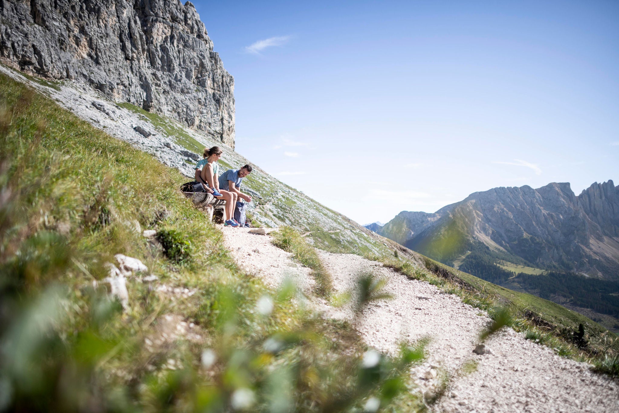
From the Karersee lake:
Duration: 1 hour, Altitude difference: 200 m ↑, Length: 3.2 km
Cross the suspension bridge and follow the hiking trail no. 6 to the Karerpass.

From Welschnofen/Nova Levante:
Duration: 3 hours, Altitude difference: 688 m ↑, 91 m  ↓, Length: 9.1 km
Follow the hiking trail no. 10 A from the civil defence centre in Welschnofen or the hiking trail no. 7 from the car park of the Welschnofen gondola lift to the Hotel Adler, continue along hiking trail no. 10 A to the Karersee lake, then follow the route markings for  no. 10, no. 13 and no. 21 to the Karerpass.

From Obereggen:
Duration: 3:10 hours, Altitude difference: 337 m ↑, 147 m ↓, Length: 11 km
Follow the hiking trail no. 9 and then the hiking trail no. 8 to the Karersee lake. Continue walking along hiking trails no. 10, no. 13 and no. 21 to the Karerpass. 

From St. Zyprian/San Cipriano-Tiers/Tires:
Duration: 4 hours, Altitude difference: 709 m ↑ , 90 m ↓, Length: 11.6 km
Follow the hiking trail no. 1 A to the Karerpass.

From the Nigerpass:
Duration: 2:25 hours, Altitude difference: 156 m ↑, 95 m ↓, Length: 8.2 km
Follow the hiking trail no. 1 A to the Karerpass. 

From the Frommer Alm mountain inn:
Duration: 2 hours, Altitude difference: 132 m ↑, 130 m ↓, Length: 6.7 km
Follow the hiking trail no. 1 A to the Karerpass.

From Moena/Val di Fassa valley:
Duration: 2:30 hours, Altitude difference: 580 m ↑, Length: 6.45 km
Follow the hiking trail no. 519 to the Karerpass.

From Vigo/Val di Fassa valley:
Duration: 4 hours, Altitude difference 485 m ↑, 137 m ↓, Length: 12 km
From Vigo, follow the woodland hiking trail, past the villages of Vallonga and Tamion and on along the hiking trail no. 519  which climbs up from Moena to the Karerpass. 

From Ciampedìe (Vigo di Fassa):
Duration: 3:05 hours, Altitude difference: 358 m ↑, 601 m ↓, Length: 8 km
From Ciampedìe (Vigo di Fassa), walk via the hiking trails no. 545 – 549 – 539 past the Roda di Vael, Baita Marino Pederiva and Paolina Hütte mountain huts and descend down to the Karerpass via the hiking trail no. 552. Alternatively, at the Paolina Hütte hut take the Paolina chairlift down.

From Welschnofen/Nova Levante:
Duration: 2 hours, Altitude gain: 132 m ↑, 130 m ↓, Length: 6.7 km
The Welschnofen Laurin I gondola lift leads to the Frommer Alm mountain inn, then follow hiking trail no. 1 A to the Karerpass. 

From St. Zyprian/San Cipriano-Tiers/Tires:
Duration: 2 hours, Altitude difference: 132 m ↑ , 130 m ↓, Length: 6.7 km
The Tiers cable car runs to the Frommer Alm then follow the  hiking trail no. 1 Ato the Karerpass. 

From the Val di Fassa valley:
Duration: 3:05 hours, Altitude difference: 358 m ↑, 723 m ↓ Length: 8 km
From Vigo di Fassa, take the Rosengarten cable car to Ciampedìe and from here, walk along hiking trails n no. 545/"Vial de le Feide"/548/549/539/552, past the Roda di Vael, Baita Marino Pederiva and Paolina Hütte mountain huts. From the Paolina Hütte hut, you can take the chairlift back. 

Tickets for the cable cars and lifts can be purchased directly on site or from the Tourist Info offices. In addition to one-way tickets, the following advantage cards are available:

  • the Eggental Mountain Pass: with the Eggental Mountain Pass, you can enjoy unlimited travel on 3 days in 7 or 5 days in 7 (from date of ticket punching) using 18 lift facilities.
  • the Val di Fassa Panorama Pass: with the PanoramaPass, you can enjoy unlimited travel on 3 days in 6, on 6 days in 6 or  on 7 days in 13 (from date of ticket punching) using 33 lift facilities.

    Note: You may not use the lifts with the Eggental Guest Pass und Val di Fassa Guest Card.

The most scenic hikes to Karerpass

Leisurely and partially wheelchair accessible trails lead to the Karerpass  as well as challenging routes - magnificent panoramic views of the Latemar, Rosengarten and surrounding Dolomite massifs are guaranteed!

Hike from Nova Levante the Passo Costalunga

Hike from Nova Levante the Passo Costalunga

Hike from San Cipriano/Passo Nigra/Malga Frommer hut to Passo Costalunga

Hike from San Cipriano/Passo Nigra/Malga Frommer hut to Passo Costalunga

Reaching the Karerpass by bike

Easily reach the Karerpass via racing bike,  mountain bike or e-bike. We recommend finding out in advance if the route of your choice is open in addition to the current weather. Also, please obey fair and safe cycling practices. According to the local road code, the pass is passable via bike using the provincial road (SS241) without restrictions.

  • Please note: It is not possible to take bicycles on public transport around the Dolomite passes.

From Welschnofen/Nova Levante:
King Laurin Trail Tour
Length: 14.2 km, Altitude difference: 750 m ↑,  178 m ↓, Duration: 2:45  hours, Difficulty rating: difficult 
Start: Welschnofen gondola car park. From Welschnofen head along the cycle path no. 359 to the Karerpass.

From Obereggen:
Length: 11 km, Altitude difference: 294 m ↑,  104 m ↓, Duration: 1:20 hours, Difficulty rating: easy/medium 
Start: District heating plant – upper Obereggen car park. First along the cycle path no. 354 (Latemar Ronda), then follow the cycle path no. 356 (Karersee lake tour) to the Karerpass.

From Eggen/Ega:
Length: 12.9 km, Altitude difference: 637 m ↑,  14 m ↓, Duration: 2:30  hours, Difficulty rating: medium
Start: Eggen village square. Follow the cycle path no. 363 (connecting Latemar Ronda – Eggen) to Bewaller in Obereggen, then take the cycle path no. 354 (Latemar Ronda) and cycle path no. 356 (Karersee tour) to the Karerpass.

From Deutschnofen/Nova Ponente:
Length: 21.9 km, Altitude difference: 693 m ↑, 304 m ↓, Duration: 2:45  hours, Difficulty rating: easy
Start: Gibitzplatz car park in Deutschnofen. Take the cycle path  connecting Deutschnofen-Obereggen , then follow the cycle path no. 354 (Latemar Ronda) and cycle path no. 356 (Karersee tour) to the Karerpass.

From Petersberg/Monte San Pietro:
Length: 28.6 km, Altitude difference: 948 m ↑, 565 m ↓, Duration: 3:40  hours, Difficulty rating: medium
Start: Petersberg church square. First take the cycle path connecting Petersberg-Maria Weissenstein then the Laab Alm Tour towards Deutschnofen, then the cycle path connecting Deutschnofen - Obereggen, then cycle path no. 354 (Latemar Ronda) and cycle path no. 356 (Karersee tour) and on to the Karerpass.

From St. Zyprian/San Cipriano-Tiers/Tires: 
Length: 12.8 km, Altitude difference: 734 m ↑, 114 m ↓, Duration: 2:50 hours, Difficulty rating: easy/medium
Start: Tiers cable car car park. Cycle along cycle path no. 289 to the Niger Pass, then take cycle path no. 358 (Farm Tour) to the Frommer Alm mountain inn, then cycle path no. 356 (Karersee tour) to the Karerpass.

From Welschnofen/Nova Levante:
Length: 10.4 km, Altitude difference: 690 m ↑, 120 m ↓, Duration: 3:10 hours, Difficulty rating: easy
Start from the Welschnofen gondola car park. Take the Welschnofen Laurin I gondola lift to the Frommer Alm mountain inn, then cycle path no. 356 (Karersee tour) to the Karerpass.

From St. Zyprian/San Cipriano-Tiers/Tires:
Length: 10.5 km, Altitude difference: 751 m ↑, 131 m ↓, Duration: 2:35 hours, Difficulty rating: easy
Start: Tiers cable car car park. Take the Tiers cable car to the Frommer Alm, then cycle path no. 356 (Karersee tour) to the Karerpass.

Tickets for the cable cars and lifts can be purchased directly on site or from the Tourist Info offices. In addition to one-way tickets, the following advantage cards are available to cyclists:

  • the Supersummer Card: 120 lift facilities in the Dolomites can be used with the Supersummer Card (day pass/3 out of 4 days/5 out of 7 days/season pass), including bike transport. The ticket is valid for all lift facilities on the aforementioned Sellaronda tours.

Note: You may not use the cable cars and lifts with the Eggental Guest Pass und Val di Fassa Guest Card.

The most scenic bike tours to the Karerpass

Are you keen to pedal on the mountain pass road, , or would you prefer a flowing mountain-bike trail in the Eggental valley spruce forest? There are plenty of tours on two wheels up to and around the Karerpass and past the Karersee lake.

Well equipped & fully charged

To make sure that nothing gets in the way of your cycling experience around the Karerpass, there are numerous bike rental shops and e-bike charging stations nearby.

Unfortunately we could not find any result

With the Guest Card to the Karerpass

With the Mobilcard or various guest cards (e.g. Guest Pass Eggental) , you can enjoy unlimited use of virtually all forms of public transport within South Tyrol, including the regional and regional express trains. Mobilcards are available from all Tourist Info offices and guest cards are issued by the hosts. By the way: children up to 6 years of age travel for free.

With the Val di Fassa Guest Card and the Trentino Guest Card, you can enjoy unlimited use of all public transport within the province of Trento as well as the bus line no. 180 to Bolzano/Bozen and the bus line no. 471 to the Sellajoch pass and the Pordoijoch pass.

Dogs must be kept on a leash and muzzled if necessary. Small dogs travel free of charge.

From Tiers/Tires 
Take the Tiers – Frommer cable car (every 20 minutes) and seasonal bus line no. 186 Frommer – Paolina (hourly) or take a one-way ticket on bus line no. 186 St. Zyprian – Nigerpass – Frommer – Paolina

From Bolzano/Bozen
Hourly using bus line no. 180

From Welschnofen/Nova Levante 
Hourly with bus line no. 180 or take a one-way ticket on bus line no. 184

From Deutschnofen/Nova Ponente - Petersberg/Monte San Pietro - Weissenstein
Take a one-way ticket on bus line no. 184 direct to the Karerpass or hourly on bus line no. 181 to Birchabruck/Ponte Nova – then change to bus line no. 180

From Obereggen - Eggen/Ega
By bus line no. 184 either directly with a one-way trip or hourly, changing in Birchabruck onto bus line no. 180

From Steinegg/Collepietra-Gummer/San Valentino in Campo 
Hourly (two-hourly on Sundays and public holidays) with bus line no. 182 to Birchabruck/Ponte Nova - change in Birchabruck onto bus line no. 180 or a one-way trip via bus line no. 187 to Welschnofen/Nova Levante centre - change in Welschnofen onto bus line no. 180 or bus line no. 184

From Vigo di Fassa - Pozza di Fassa - Pera di Fassa
The hourly bus line no. 180 sets off from the Val di Fassa valley, usually from Pera di Fassa, but during the months of July and August only from Vigo di Fassa when heavy car use does not allow for reliable journeys in the Val di Fassa. In this case, travel from Pera and Pozza to Vigo using the Trentino Trasporti buses

Reaching the Karerpass by private vehicle

Although it is  permitted to drive to the Karerpass in summer by private vehicle we advise against it due to road congestion and for reasons of sustainability. Parking at the Karerpass is limited. Parking on the side of the road is sanctioned by law enforcement officers according to the road code.
Please note: Traffic jams and other inconveniences can be expected at any time during the summer months. For the current traffic situation or possible pass closures, we recommend consulting the traffic information centre.  

In South Tyrol, sustainable transportation is a top priority. For this reason, it is recommended that visitors use sustainable forms of transport whenever possible and use public transport to get to the desired starting points for hikes or other activities.

Question:  Are there public toilets at the Karerpass?
Answer:  There are no public toilets on the Karerpass, but there are several places to stop at the top of the pass (bars and restaurants) with toilets. On the South Tyrolean side of the Karerpass, there are public toilets approx. 2 km below the pass in the village of Karersee/Carezza at the valley station for the Paolina chairlift.

Question:  When is the best time to visit the Karerpass?
Answer: The Karerpass can be visited all year round. Due to the large crowds especially during the summer months, we recommend visiting the Karerpass outside of core hours (9:00 am - 12:00 pm).

Question:  Where can I get more information about the Karerpass and the surrounding area?
Answer:  In the relevant Eggental or Val di Fassa Tourist Infos:
-Tourist Info Eggental: Tel. +39 0471 619500,  info@eggental.com, www.eggental.com
-Tourist Info Val di Fassa: Tel. +39 0462 609500, info@fassa.com, www.fassa.com

More information about this area

Accommodation image
Finish your booking for
Accommodation name
0  room rooms Not selected No board Breakfast Half board Full board All inclusive
Total price: 0 €
(incl. VAT / excl. local tourism tax)