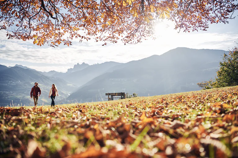
From Niederrasen (house Hölzl) > on the left side walk on the edge of the woods > foresty road > "Alte Goste".
The sun is out, you’re fully packed – now where do you want to go? The peaks, pinnacles and towers of the Dolomites gleam invitingly in the morning light. Are they even more beautiful from the summit? The valleys are criss-crossed with trails through vineyards and apple orchards, past imposing castles, around enchanting lakes and along the Waalweg canal trails. South Tyrol has more than 16,000 km of signposted hiking trails that run through the ever-changing natural landscape, including themed trails, multi-day tours and high-Alpine trails.
From Niederrasen (house Hölzl) > on the left side walk on the edge of the woods > foresty road > "Alte Goste".
From Camping Corones > on the "Dorfrundweg Rasen" slightly uphills to the road Redensberg > downwards and turning left up to the "Jagdhaus" > turning right until reaching a bar > continue on the edge of the woods reaching the barbecue area > cross the main road > path to the river > along the river back to Oberrasen or Niederrasen.
A pleasant winter walk to relax and simply enjoy life in a quite area on Seiser Alm. This route offers a breathtaking view of the Schlern/Sciliar mountain, almost within hand’s reach from the Spitzbühl, and leads onwards over endless snow-covered alpine meadows back to the starting point.
From Antholz Niedertal > crossing the river to the Walderhöfe > slightly downwards to Bad Salomonsbrunn > return on path n. 1 to the starting point.
This winter hike starts in Saltria and leads along the hiking trail towards Piz. From there the trail runs through the snow-covered landscape with a wonderful panoramic view of the Dolomites.
From Niederrasen (Pfaffingerhöfe) > following the edge of the woods (Dorfrundweg) > Jagdhaus > on the asphaltic road (mark n. 3) down to Oberrasen > back to Niederrasen along the river.
The Gumperer Trail in Seis, at the foot of the Schlern Mountain, is a pleasure for all your senses. Here is where you can dawdle as long as you like.
Made by children, for children: the five stations invite you to discover the five senses. In a playful way, you get to know more about yourself and your surroundings. The more time you give yourself, the deeper you can dive into the wonderful world of nature, discovery and adventure.
From Niederrasen to Oberrasen > along the river > Bad Salomonsbrunn (5 km).
From Antholz Mittertal > Riederhof > Müllerkofl trail (route n. 1) > Nösslerhof > further on the forest road n. 2 back towards Antholz Mittertal until you reach the turnoff for trail n. 2 (signposted Antholz Mittertal) > continue on the forest road n. 8a (Burgegger mill) > the last part back on path n. 1 to Antholz Mittertal.
A very nice and not to long hike trough absolutely quiet woods and marshy fields. Please keep on the path because this area is home to rare species like the capercaillie cock. Bring a good map because orientation is a little bit tricky and food and drinking. The first hut/restaurant is the Camping. Description of the way: From Moos/Moso we go right upwards to the Froneben Gasthaus (1540 m). Now we walk on way nr. 139 across the marshy fields "Obere Oltl" until the forest street nr. 13. This way takes us trough tight wood to a crossing (1.756 m - Saumahd) and a high cross. We go right (left you reach the Klammbach alp) and arrive again in the forest. We follow the forest street up and reach a big clearing. The path 132 on the left side brings us to the Monte Cavolo/Seikofel (1.908 m), passing wonderful marshy countries, rare flowers and animals. Some pools are remains from the bombs of the World War I. The Monte Cavolo was an ideal lookout in the war and an important point. Now we take the path nr. 131 down towards Passo Monte Croce/Kreuzbergpass. After a short way going up you reach a crossing, there we take the large forest street on the right side (nr. 130) which passes to the black lake (Schwarzsee) and another murshy field. We arrive at a sign towards Camping which takes us left down on the path nr. 13 passing the caravan park - Camping and reaching the way nr. 1. We follow this way and return back at Moos/Moso. Summary: a very nice panoramic tour who takes us in a little natural paradise - far away from noise and people.
An entertaining alpine circuit for the entire family!
Scenically beautiful Alpine ridgeway with views of the main peaks of the Sexten Dolomites.
No car is necessary for this long, but not difficult, circular hike due to the dense network of trails, but you will need a good hiking map!
Traditions and a glimpse of times long gone
The mountain farmsteads on the southern hillside of the Pusteria/Pustertal valley are a remnant of the times when the Romans began to settle in the area. Only a little is left of the ancient baths of Ilistra/Ilstern, to which the locals once flocked in search of the soothing medicinal effect of their spa waters. Not far off, a small chapel has successfully defied the centuries and can easily be reached on a meditation trail. But hiking along Monghezzo/Getzenberg also offers plenty of impressions of the hard life and labor of mountain farmers, and the ancient farmhouses are often named after the dwellers' special dedication: The Vögler farmstead, for example, recalls the old Tyrolean tradition of fowling, or bird-catching.
Half-way up the route at 1112 m, the Jausenstation Hoferhof inn is a fine place for a break and some refreshments. A small, carefully restored chapel is all that is left of a hermitage, which is said to have been located not far from the Getzenbergerhof inn. The Kustoler-Hof farmstead was named after the Romance term for a fortified area, and the Roman milestone on the western edge of the hamlet Casteldarne/Ehrenburg is yet another witness of the ancient settlements in and around Chienes/Kiens.
From Niederrasen > Pfaffingerhöfe > Burgfriedenhof > path n. 4 > Redensberg > mark n. 22 > "Schweinberg" > Rauterhöfe > descent on path n. 8 to Niederrasen or following mark n. 22 to Neunhäusern > Camping Corones > Niederrasen.
From Antholz Niedertal > passed the church > Maierhöfe (Pfaffingerhof) > Wiesemannhof > Ausserweger sawmill > Antholz Mittertal and lastly back to Antholz Niedertal on the main road.
This hike can also be started from Antholz Mittertal!
From Antholz Niedertal > passed the curch > Maierhöfe (Pfaffingerhof) > Wiesemannhof > Ausserweger sawmill > Antholz Mittertal and lastly back to Antholz Niedertal on the main road.
This hike can also be started from Antholz Mittertal!
The Watles Cross Tour is the ideal tour to discover the Watles adventure mountain and all its different facets. This hike leads from the Plantapatsch mountain hut up to the summit cross and back again via the Pfaffensee lake.
From Antholz Mittertal > Riederhof > mark n. 1 > Burgegger Mühle > Nösslerhof > Berghotel Johanneshof > back to Antholz Mittertal.
This hike can also be started from Antholz Niedertal!
From Niederrasen > Camping Corones > foresty road in the woods > Neunhäusern.
Caution: use the path under the bridge of the statal road.
The “Katzenleiter” path is made up of about 550 steps cut out from the rock and leads along the impressive Rio Nero gorge until Aldino. From the porphyry slabs near the gorge you can admire a breathtaking view of the famous waterfall. On the way, the many viewpoints offer magnificent vistas over the wine village of Ora.
From Niederrasen (Pfaffingerhöfe) > on the edge of the woods (circular path) to the hunting lodge (Jagdhaus) > Burgfriedenhof > turn on the chapel > ascent to the ruins of the Neurasen Castle.
From Oberrasen> mark n. 3.
The Rasun Nuova Castle in Oberrasen is privately owned and belongs to the Burgfrieder farm.
Tales and stories of Mount Kienberg
With its 1222 m, Mount Kienberg stands out from its surroundings like an island. A plutonic rock formed during the creation of the Alps, it emerged from the heart of the earth only to be smoothed down by passing glaciers over the course of countless years. Today, Kienberg is a broad, rotund ridge shrouded in legends: The hike along the Kienberg trail from Casteldarne/Ehrenburg to Mantana/Montal runs past the Plattnerhof farm. Legend has it that once upon a time, it was the home of a stone-hearted man. One day, the farmer chased away a hungry beggar with nothing but insults and threats, upon which the beggar cursed the mountain, making all its springs run dry.
After a short break at the hamlet of Mantana/Montal, the hike runs back to Casteldarne/Ehrenburg along an old trail depicting the Stations of the Cross. Every year, pilgrims from Predoi/Prettau in the Aurina/Ahrntal valley flock here to ask the Madonna of the Grains to bless their home and livestock and to grant their fields favorable weather.
The highest point of the ridge is 1222 m above sea-level. This hike is ideal for those who love quiet trails far from the beaten track. Stop for a break at Gasthof Alpenrose (Mantana/Montal), Hofschenke Lerchner's (Ronchi/Runggen), or Gasthof Obermair.
From Niederrasen (Linde) > path n. 8 (steep) > Rauterhöfe > turn left on path n. 22 or passing the farm on the right following the panorama path > Redensbergerhöfe > paved raod n. 4 > Pfaffingerhöfe > Niederrasen.
Antholz Mittertal > Ausserweger sawmill > mark n. 6 > after 300 m turn right > path "Franzosensteig" n. 11 > Wanzlerhof > Klammer > Eggerhöfe > sports area > back to the starting point.
Legends and stories about the Sextner Tal valley and the Alta Pusteria/Hochpustertal valley have been told and passed on here for years. Now these many fairytales and stories have been used to create a Fable Trail (Fabelweg) in Sesto. Figures depicting characters from all kinds of legends have been set up along the route, giving visitors an insight into a different world.
From Niederrasen > passing the church > continue on the asphaltic road on the edge of the woods (mark n. 20) > Oberstallerhöfe > path of return following mark n. 5 > Oberrasen.