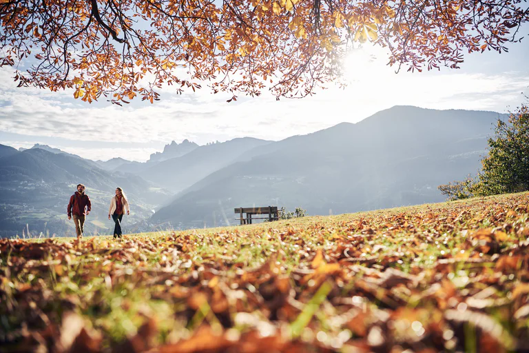
Skip to content

added to favourites

removed from favourites

Oops! Something went wrong. Try again

Your account is being created

Your account has been successfully created and you are now logged in

You’ve been logged in successfully!

You are logged in successfully!

You are logged out.

Filter
Selected filters
    Level of difficulty
    Duration
    Distance in KM

    Hiking Trails in Bolzano/Bozen and environs

    Walking is the best way to enjoy wonderful stretches of greenery. During your spring in South Tyrol, you can witness the awakening of nature in the valley and on the alpine meadows in bloom. Midsummer days are equally surprising:  people are lured to mountain peaks, marvel at sweeping views and indulge in the traditional dishes served in quaint mountain huts. Go on a hike to watch the spectacle of autumn’s glorious colours and relax in nature.

    Results
    Hiking
    Dolomites World Heritage Geotrail II – Stage 1: from the Bletterbach to the Lavazèjoch pass- From land to sea
    Aldein/Aldino, Bolzano/Bozen and environs

    The first stage of the Geotrail climbs up from the Bletterbach gorge to the summit of the Weisshorn. We pass through stunning scenery that reveals various layers of rock with the oldest at the bottom, the most recent at the very top. Like a book, these layers tell a story – a story that has lasted 40 million years, with the transformation of the Dolomites of the time from a landmass into a sea.

    Difficulty: medium
    1101 m elevation gain
    4h:37 min duration
    Hiking
    Renon/Ritten: Sigmund Freud's Promenade
    Ritten/Renon, Bolzano/Bozen and environs
    On a walk in Freud’s footsteps from Soprabolzano, past Stella and on to Collalbo, you will also meet donkeys and horses.

    Start: Oberbozen/Soprabolzano
    End: Klobenstein/Collalbo
    Trail type: easy hiking trail
    Tour points: Aphorisms on the Freud Promenade, panorama Dolomites, possible return to Oberbozen by riding the famous railway
    Difficulty: easy
    78 m elevation gain
    1h:19 min duration
    Hiking
    Small Alpine Hike of Aldein
    Aldein/Aldino, Bolzano/Bozen and environs
    The small alpine hike of Aldein starts at the alpine hut Lahneralm. From there you will hike a small, shady track through the forest, on a slight incline, to the alpine hut Schmiederalm. Once arrived, you can enjoy the view of the mountains surrounding Meran, the Mendola Ridge and the Ortler and Brenta group in the background. From there you will move forward through a forest road, first through the thick, shady forest, then on a sunny alpine trail to the alpine hut Schoenrastalm. The cows that graze in the summer month complete the picture of the idyllic Alp, and the sunny spot is an invitation to linger. From the Schoenrastalm we will continue on to a shady path through the Koesertal and then downhill back to the alpine hut Lahneralm, where local farmers tend to the sheep in the summer.
    You can stop for a bite at any of the Inns, which will invite you in with plenty of traditional South-tyroelan dishes to enjoy. The Kids can have fun in the playground while you enjoy a snack.
    Not suitable for baby prams.
    Difficulty: easy
    214 m elevation gain
    1h:28 min duration
    Hiking
    Mölten - Knottnkino (Vöran)
    Vöran/Verano, Bolzano/Bozen and environs

    The so called Knottnkino on the rock Rotsteinkogel is a special view point. Enjoy a wonderful panorama on the Rotsteinkogel. From here you have a view on the mountains Texel, Penegal and you can see even the Weißhorn. The Etsch-Valley spreads under the rock. There are 30 armchairs made of steel and chestnut wood. If you sit down, you can enjoy nature as a whole, as you where sitting in a cinema.

    Difficulty: medium
    511 m elevation gain
    2h:57 min duration
    Hiking
    Oclini - Corno Bianco round hike
    Aldein/Aldino, Bolzano/Bozen and environs
    With this interesting loop trail, you can discover the Bletterbach gorge from one of its most spectacular viewpoints and then continue to the summit of the Corno Bianco, from which you can admire an enchanting panorama over the entire Adige Valley and the sorrounding peaks.
    Difficulty: medium
    364 m elevation gain
    2h:15 min duration
    Hiking
    San Jacob´s path in South Tyrol
    Bolzano/Bozen, Bolzano/Bozen and environs
    The Way of St. James leads along the slope over the Ritten. On the Keschtnweg from Klausen to Barbian and further to Lengstein to Siffian and Unterinn. There up to Wolfsgruben via Oberbozen down to Bozen. Romanesque, Gothic and Baroque churches and chapels, hospices, castles and countless works of art created by important painters and sculptors await pilgrims right along the way.
    Difficulty: medium
    820 m elevation gain
    6h:37 min duration
    Hiking
    a walk through the farms of Mölten
    Mölten/Meltina, Bolzano/Bozen and environs
    The hike through the Mölten farm landscape starts in the center of Mölten (1140 m) and leads past beautiful farms with a wide view into the valley.
    Difficulty: medium
    341 m elevation gain
    2h:23 min duration
    Hiking
    Oclini - Passo Cugola
    Aldein/Aldino, Bolzano/Bozen and environs
    Beautiful, little frequented, hike through the forests of Passo Oclini. The destination is the Passo Cugola with its self-catering hut.
    Difficulty: medium
    294 m elevation gain
    2h:30 min duration
    Hiking
    Freud Promenade
    Ritten/Renon, Bolzano/Bozen and environs
    Freud Promenade: named after its most famous guest, the founder of psychoanalysis Dr Sigmund Freud, the promenade is ideal for a leisurely walk from Oberbozen to Lichtenstern and Klobenstein.
    Difficulty: easy
    123 m elevation gain
    1h:13 min duration
    Hiking
    Hiking on the "Keschtnweg
    Ritten/Renon, Bolzano/Bozen and environs

    Hiking & "törggelen": This ancient South Tyrolean custom alone is worth a trip. From October to the beginning of the Advent season, you meet the "törggelen" in the Renon inns and taverns with young wine, sweet cider and hearty delicacies. When the chestnuts are roasted over the "Keschtnfeuer", you feel as if you have travelled back in time. One-time quaint!

    Difficulty: medium
    707 m elevation gain
    4h:46 min duration
    Hiking
    Anterivo Trail of Legends (Sagenweg Altrei)
    Altrei/Anterivo, Bolzano/Bozen and environs

    Above Anterivo/Altrei, a small mountain town on South Tyrol’s language border, some mythical figures are making trouble for some time. Through oral transfer, people of Anterivo have succeeded in preserving their legends until the present day. The local library has collected and written down the legends with children of Anterivo. The primary school staff and pupils used this as a chance to develop the "Trail of Legends".

    The hiking trail, which is about 2 km long, starts at the "Lärchenheim" and passes massive larch trees and a partly dense forest until it reaches the sports centre "Ebnerrast".

    Difficulty: easy
    0 m elevation gain
    1h:30 min duration
    Hiking
    GEOTour GEOMuseum Redagno - Bletterbach Canyon
    Aldein/Aldino, Bolzano/Bozen and environs

    The GEOTour starts at the GEOMuseum Radein/Redagno which shows the Bletterbach canyon’s special geological features. Our tour leads through a forest to the so called “Zirmersteig” (trail). Then we go down the canyon and follow the river upwards to the head of the valley (“Gorz”). From here we have to walk back to the “Gorzsteig”. This trail leads to the Visitor Centre GEOPARC Bletterbach in Aldino. From here we have two possibilities to return to Redagno/Radein: to walk back or to take the bus.

    Difficulty: medium
    431 m elevation gain
    2h:22 min duration
    Hiking
    Anterivo- Monte Corno- Anterivo
    Altrei/Anterivo, Bolzano/Bozen and environs

    We follow the forestry trail no. 2 through a shady forest. After a while, the path gets straighter and winds over big meadows with larches on it until it passes idyllic chalets. We will often get past cured moors. Then we follow the forestry trail E5, which is the European Long Distance Path, and we get back to the "Trudner Horn" on 1.710m where we can enjoy a marvellous view over the Alps of Val die Fiemme. After a rest on the alpine cabin "Trudner Horn Alm" we walk down to the "Ziss-Sattel" and follow the forestry road no. 3 past the lime kiln through spruce and fir forests back to Anterivo.

    Difficulty: difficult
    736 m elevation gain
    5h:07 min duration
    Hiking
    The Path of Breath
    Altrei/Anterivo, Bolzano/Bozen and environs
    The breath path measures 661 meters and was created at 1300 meters above sea level. above the sports field of Anterivo.
    The breath path is effective
    • when you have to breathe your way of life
    • when you need to be helped to walk
    • when you have to look for solutions to problems.
    The breath path should always be used with:

    • slowness
    • caution in the movements
    • spirit of listening and reflection.
    Before embarking on the path of breath, read calmly the sign written in 4 languages. You are now free to know all the places on the path.
    Difficulty: easy
    0 m elevation gain
    0h:07 min duration
    Hiking
    Kalkofenwanderung am Weißhorn
    Aldein/Aldino, Bolzano/Bozen and environs

    The tour starts from the Auerleger alp following the way nr. 2 to Jochgrimm. Arriving on the street we turn right and follow the way nr. 1 to the Neuhütt alp.

    After 2km we reach the calcium stove, which was built in the 19th century with the stones of the Weißhorn mountain. The calcium was used to built and paint houses. The people filled the pit with the stones and firewood coverd with clay. They set it on fire, which burned for seven hours. When the fire stopped burning they took the stones out to be further processed in the village.

    To return to the Auerleger alp we follow the same way back.

    Difficulty: easy
    109 m elevation gain
    1h:03 min duration
    Hiking
    Around Trodena/Trodena
    Truden/Trodena, Bolzano/Bozen and environs
    Due to its isolated position, Trodena still retained many testimonies of what men have conceived, built and transformed here over the centuries. On the circular route of Trodena we will learn about the centuries-old urban culture. From the town square we move towards the upper part of the town, pass in front of a 700-year-old lime tree and walk along the paved road up to the entrance to the town. From there we follow trail marker 3 to a parking lot. From the panoramic road (3A) we come to a viewing platform, a sort of balcony. from which we can admire the "3 horns": Corno Nero, Corno Bianco and Monte Corno. This is where the geological "line" of Trodena develops. The view over the roofs of Trodena testifies to the division of the farms that has taken place for generations. We then walk until we reach the Via Cislon. From here we follow trail no. 1 to return to the starting point of Trodena, which we will reach through the historic center.
    Tip: take a walk in the village to discover the "The walls tell" project ... The brochure is available at the tourist office. Also discover the Monte Corno Visitor Center
    Difficulty: easy
    76 m elevation gain
    0h:31 min duration
    Hiking
    Oclini - Pietralba
    Aldein/Aldino, Bolzano/Bozen and environs
    A long walk through beautiful forests leads us from Passo Oclini to one of the oldest and most important sanctuaries in South Tyrol: the Pietralba Sanctuary (or Maria Weißenstein).
    Difficulty: difficult
    591 m elevation gain
    5h:00 min duration
    Hiking
    Renon/Ritten: Funimal Forest
    Ritten/Renon, Bolzano/Bozen and environs
    At the eight stations along the trail, kids and adults alike will learn about the animals that are important for the survival of our woodland. So we start the trip to visiting Ivo, Bella, Walter & Co.
    With Pyramix we follow the tracks of the wild animals on the sunny high plateau Renon. The nature experience trail with the marking no. 16 leads us from Soprabolzano through woods and meadows over the village from Soprabolzano past to the farm Lobis and its mill.
    At the beginning of the trail Pyramix welcomes us and tells us a lot about the wildlife on Renon. Curiosity is already aroused and off we go!
    We already see the first coloured spots between the trees. What could this be? ...It is Fiona, the clever Mrs. Fox. Here in the forest she has found a great place for her earth.
    The path leads us further to Ivo, a companion with a spiky hairstyle, which you can find especially at night while looking for food. Well, which animal do you think is meant?
    Again and again we pass various forest and meadow inhabitants. Whether it's Walter, the busy woodpecker, who hammers a cave for his chicks into the tree, or Sissi, the busy squirrel, who collects his stocks.
    At each of these stations, children will find great opportunities to play and learn about the characteristics of the animals in a playful way, and of course there is also a description of the wild animal with its special features.
    Entertainment and fun for young and old are therefore guaranteed.The nature trail is simply FUNtastic!
    Difficulty: easy
    120 m elevation gain
    1h:00 min duration
    Hiking
    Mill walk
    Aldein/Aldino, Bolzano/Bozen and environs
    Hike through lush meadows and mixed forest to the Möserbiotop and the Aldein mills
    Difficulty: easy
    110 m elevation gain
    1h:00 min duration
    Hiking
    GEOPARC Bletterbach - Dolomiti UNESCO World Heritage site
    Aldein/Aldino, Bolzano/Bozen and environs

    At the Dolomites UNESCO World Heritage GEOPARC Bletterbach you can find adventure parks, learning center, nature monuments and an impressive Canyon with its geological treasures and diverse landscapes. Discover the history of earth in one of the most beautiful areas in the south of South Tyrol.

    Difficulty: medium
    0 m elevation gain
    4h:00 min duration
    Hiking
    Walking on the Jochgrimm
    Aldein/Aldino, Bolzano/Bozen and environs
    A walk with panoramic views. It is also worth a tour on the “H” trail to the lookout point in the GEOPARCBletterbach, Dolomites UNESCO World Natural Heritage Site.
    Difficulty: easy
    157 m elevation gain
    1h:21 min duration
    Hiking
    Circular route "Wildeich"
    Aldein/Aldino, Bolzano/Bozen and environs

    This hiking tour is easy and tranquil - perfect for a walk with your family. You will come through peaceful woods and pass the small brook of Aldino.

    Difficulty: easy
    103 m elevation gain
    1h:06 min duration
    Hiking
    Spring hike to the flower meadows
    Mölten/Meltina, Bolzano/Bozen and environs

    Experience a unique nature experience: "The Crocus Flower". Every year, between the beginning of March and the end of April, the meadows on the "Giogo di Meltina" are transformed into a sea of crocus flowers.

    Difficulty: easy
    425 m elevation gain
    3h:04 min duration
    Hiking
    Circular walk Aldein/Aldino - Kronberg - Lerch
    Aldein/Aldino, Bolzano/Bozen and environs
    Worthy morning hike with wonderful views of the Etschtal, theÖtztalAlps, theOrtlermassif. Fiemmemountains, Brentagroup, Paganella, etc.
    Difficulty: easy
    301 m elevation gain
    2h:16 min duration
    Hiking
    Jochgrimm — Kugelalm — Jochgrimm
    Aldein/Aldino, Bolzano/Bozen and environs

    Following the road nr. 4, next to the Hotel Oclini, we reach the Kugeljoch. From there we go downwards to the Kugel-alp, which isn`t farmed. A crushed rock road leads us to othe sheds, past the Gurndin alp and back to the Hotel Oclini.

    Difficulty: medium
    538 m elevation gain
    3h:01 min duration
    Hiking
    Renon/Ritten: From Collalbo/Klobenstein to the Earth Pyramids
    Ritten/Renon, Bolzano/Bozen and environs
    Bizarre natural landscape design on the sunny plateau of Renon

    Europe’s tallest and most perfectly shaped earth pyramids are to be found on the Renon mountain in several locations: in the gorge of the Finsterbach creek between Longomoso and Monte di Mezzo, in the Katzenbach-creek gorge below Soprabolzano, and in the gorge of Gasters in Auna di Sotto. 

    Tour points: earth pyramids, magnificent Dolomite panorama, Commandery Lengmoos/Longomoso.
    Difficulty: easy
    115 m elevation gain
    1h:22 min duration
    Hiking
    Radein/Redagno-Jochgrimm/Passo Oclini
    Aldein/Aldino, Bolzano/Bozen and environs
    From Radein to Jochgrimm. Starting point: GEOMuseum
    Level of difficulty=easy
    Walking time: approx. 2 hours
    Difference in altitude: 435 m
    Difficulty: medium
    355 m elevation gain
    1h:38 min duration
    Hiking
    Path of history Flaas
    Mölten/Meltina, Bolzano/Bozen and environs

    On May 30th 2014 the students of Flaas have inaugurated the Path of History. On the way between Lanzenschuster and Kampitell you can learn a lot about the history of Flaas. Old tecniques have been tried out and old barracks have been reconstructed.

    The history trail was opened on May 30, 2014 by the elementary students of the small village Flaas.On the way between the mountain lodge Lanzenschuster and the parking lot Kampidell one learns a lot about the history of Flaas on the basis of different stations.Old techniques were tried, first huts were rebuilt .

    route descripition:
    Starting from the guesthouse Lanzenschuster, you follow hiking path n. 8 to the two farms Steger and Lueger, then by choosing path n. 5 you can return to Lanzenschuster.


    Difficulty: easy
    169 m elevation gain
    1h:15 min duration
    Hiking
    Altrei/Anterivo- Krabes Alm
    Altrei/Anterivo, Bolzano/Bozen and environs

    From Altrei on Town Hall Square (1,212 m) above the paved trail no. 5 direction Long moss, we walk through meadows and woods to get to the Long Moss (1,452 m). Following the forestry trail No.9 we reach the service area "Krabesalm" (1,540 m). Then we continue over the forestry trail No.9 with the direction "Ziss-Sattel". From there back to Altrei along path no. 3

    The Krabes hut is open from 1 May to 2 November.Day off Tuesday, July and August, no days off!

    Difficulty: medium
    403 m elevation gain
    3h:21 min duration
    Hiking
    GEOTour Bletterbah - End of valley
    Aldein/Aldino, Bolzano/Bozen and environs

    The GEOTour Bletterbach – End of the Valley starts at the Visitor Centre GEOPARC Bletterbach in Aldino. On our way down the canyon we pass two fascinating viewpoints with an outlook over the lower part of the Bletterbach canyon. We go up the valley, passing by the so called “Floscherbründl” (fountain), until we reach the head of the valley called “Gorz”. At the Corno Bianco le canyon opens up like an amphitheatre and gives a view of the Permian–Triassic extinction event which happened 250 million years ago.

    Difficulty: medium
    320 m elevation gain
    1h:49 min duration
    1 2 3 4 5 6 7 8