
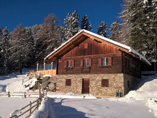
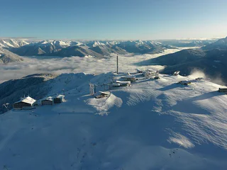
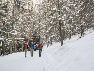
Winterwalk St. Lorenzen/San Lorenzo – Maria Saalen/Maria Sares
Fassing/Fassine, St.Lorenzen/San Lorenzo di Sebato, Dolomites Region Kronplatz/Plan de Corones
easy
Poziom trudności
176 m
Wzlot
1h:19 min
czas trwania
| Przeżyj zimową przygodę podczas wędrówek w regionie Dolomitów Kronplatz. Odkryj urokliwe trasy, które oferują piękne widoki i doskonałe warunki do zimowego trekkingu. |
Fassing/Fassine, St.Lorenzen/San Lorenzo di Sebato, Dolomites Region Kronplatz/Plan de Corones
easy
Poziom trudności
176 m
Wzlot
1h:19 min
czas trwania
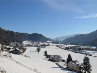
Rasun di Sopra/Oberrasen, Rasen-Antholz/Rasun Anterselva, Dolomites Region Kronplatz/Plan de Corones
easy
Poziom trudności
173 m
Wzlot
1h:18 min
czas trwania
Plata/Platten - Falzes/Pfalzen, Pfalzen/Falzes, Dolomites Region Kronplatz/Plan de Corones
easy
Poziom trudności
126 m
Wzlot
2h:00 min
czas trwania
Valdaora di Sopra/Oberolang, Olang/Valdaora, Dolomites Region Kronplatz/Plan de Corones
easy
Poziom trudności
24 m
Wzlot
0h:16 min
czas trwania
1/2
Longiarù/Campill, Al Plan/San Vigilio, Dolomites Region Kronplatz/Plan de Corones
medium
Poziom trudności
449 m
Wzlot
1h:26 min
czas trwania
1/3
Chienes/Kiens, Kiens/Chienes, Dolomites Region Kronplatz/Plan de Corones
medium
Poziom trudności
418 m
Wzlot
2h:43 min
czas trwania
Rasun di Sopra/Oberrasen, Rasen-Antholz/Rasun Anterselva, Dolomites Region Kronplatz/Plan de Corones
easy
Poziom trudności
231 m
Wzlot
2h:27 min
czas trwania
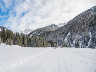
Anterselva di Sopra/Antholz-Obertal, Rasen-Antholz/Rasun Anterselva, Dolomites Region Kronplatz/Plan de Corones
medium
Poziom trudności
360 m
Wzlot
1h:45 min
czas trwania
1/2
Valdaora di Mezzo/Mitterolang, Olang/Valdaora, Dolomites Region Kronplatz/Plan de Corones
easy
Poziom trudności
5 m
Wzlot
0h:25 min
czas trwania
Sopranessano/Aschbach, Percha/Perca, Dolomites Region Kronplatz/Plan de Corones
easy
Poziom trudności
243 m
Wzlot
1h:00 min
czas trwania
Rasun di Sopra/Oberrasen, Rasen-Antholz/Rasun Anterselva, Dolomites Region Kronplatz/Plan de Corones
easy
Poziom trudności
193 m
Wzlot
1h:40 min
czas trwania

1/4
Chienes/Kiens, Kiens/Chienes, Dolomites Region Kronplatz/Plan de Corones
easy
Poziom trudności
380 m
Wzlot
3h:00 min
czas trwania
Nove Case/Neunhäusern, Rasen-Antholz/Rasun Anterselva, Dolomites Region Kronplatz/Plan de Corones
easy
Poziom trudności
26 m
Wzlot
0h:45 min
czas trwania
1/2
Antholz-Obertal/Anterselva di Sopra, Rasen-Antholz/Rasun Anterselva, Dolomites Region Kronplatz/Plan de Corones
easy
Poziom trudności
0 m
Wzlot
0h:30 min
czas trwania
Anterselva di Sotto/Antholz-Niedertal, Rasen-Antholz/Rasun Anterselva, Dolomites Region Kronplatz/Plan de Corones
easy
Poziom trudności
30 m
Wzlot
1h:00 min
czas trwania
San Vigilio, Al Plan/San Vigilio, Dolomites Region Kronplatz/Plan de Corones
medium
Poziom trudności
601 m
Wzlot
2h:04 min
czas trwania
1/2
San Vigilio, Al Plan/San Vigilio, Dolomites Region Kronplatz/Plan de Corones
easy
Poziom trudności
1109 m
Wzlot
3h:28 min
czas trwania
1/6
Longiarù/Campill, San Martin /San Martino, Dolomites Region Kronplatz/Plan de Corones
easy
Poziom trudności
122 m
Wzlot
0h:49 min
czas trwania
1/6
Chienes/Kiens, Kiens/Chienes, Dolomites Region Kronplatz/Plan de Corones
easy
Poziom trudności
50 m
Wzlot
1h:30 min
czas trwania
1/5
Longiarù/Campill, San Martin /San Martino, Dolomites Region Kronplatz/Plan de Corones
medium
Poziom trudności
284 m
Wzlot
1h:40 min
czas trwania
San Vigilio, Al Plan/San Vigilio, Dolomites Region Kronplatz/Plan de Corones
easy
Poziom trudności
248 m
Wzlot
0h:54 min
czas trwania
Valdaora di Mezzo/Mitterolang, Olang/Valdaora, Dolomites Region Kronplatz/Plan de Corones
medium
Poziom trudności
506 m
Wzlot
1h:49 min
czas trwania
1/2
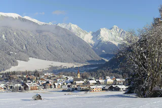
Riscone/Reischach, St.Lorenzen/San Lorenzo di Sebato, Dolomites Region Kronplatz/Plan de Corones
easy
Poziom trudności
343 m
Wzlot
1h:00 min
czas trwania
Anterselva di Sopra/Antholz-Obertal, Rasen-Antholz/Rasun Anterselva, Dolomites Region Kronplatz/Plan de Corones
easy
Poziom trudności
4 m
Wzlot
0h:30 min
czas trwania
Nove Case/Neunhäusern, Rasen-Antholz/Rasun Anterselva, Dolomites Region Kronplatz/Plan de Corones
easy
Poziom trudności
81 m
Wzlot
1h:00 min
czas trwania
Anterselva di Sopra/Antholz-Obertal, Rasen-Antholz/Rasun Anterselva, Dolomites Region Kronplatz/Plan de Corones
easy
Poziom trudności
434 m
Wzlot
2h:10 min
czas trwania
Anterselva di Sopra/Antholz-Obertal, Rasen-Antholz/Rasun Anterselva, Dolomites Region Kronplatz/Plan de Corones
easy
Poziom trudności
263 m
Wzlot
1h:19 min
czas trwania
Rasun di Sopra/Oberrasen, Rasen-Antholz/Rasun Anterselva, Dolomites Region Kronplatz/Plan de Corones
easy
Poziom trudności
147 m
Wzlot
1h:22 min
czas trwania
Valdaora di Sopra/Oberolang, Olang/Valdaora, Dolomites Region Kronplatz/Plan de Corones
easy
Poziom trudności
25 m
Wzlot
0h:15 min
czas trwania
Valdaora di Sopra/Oberolang, Olang/Valdaora, Dolomites Region Kronplatz/Plan de Corones
easy
Poziom trudności
14 m
Wzlot
0h:40 min
czas trwania
Dziękujemy za zapisanie się!
Rejestracja już aktywna
Potwierdź rejestrację
Aby zakończyć rejestrację, otwórz e-mail, który właśnie wysłaliśmy, i kliknij link potwierdzający.
Nie widzisz wiadomości? Sprawdź folder spam.
Otrzymujesz już nasze wyjątkowe oferty, przydatne wskazówki i specjalne propozycje, aby w pełni cieszyć się wakacjami.
Już próbowałeś zapisać się do naszego newslettera, ale nie potwierdziłeś rejestracji. Właśnie wysłaliśmy ci ponownie e‑mail. Sprawdź swoją skrzynkę odbiorczą i folder ze spamem i potwierdź teraz.


