Südtirol Guide App Logo
Skip to content

added to favourites

removed from favourites

Oops! Something went wrong. Try again

Your account is being created

Your account has been successfully created and you are now logged in

You’ve been logged in successfully!

Your account was created successfully, but we couldn't log you in automatically

You are logged out.

Filter
Selected filters
    Level of difficulty
    Duration
    Distance in KM

    Winter hikes in Kronplatz

    Results
    Summer
    Winter walk: San Vigilio - Lé dla Creda
    Al Plan/San Vigilio, Dolomites Region Kronplatz/Plan de Corones

    The stroll begins on Str. Fanes: Walk through the Pes-Pesc playground, then continue along the paved dirt road parallel to the cross-country skiing slope (pedestrians: please keep off the slope) until just before you reach the C´iamaor sports grounds. The forest trail will take you to C´iamaor (to the left of the football pitch). Having passed the C´iamaor bridge, keep left and continue along the picturesque trail past Horse Trekking Mareo until you get to Lé dla Creda.

    Difficulty: easy
    96 m elevation gain
    0h:55 min duration
    Hiking
    Winter hike: Circular Path Antholz Mittertal
    Rasen-Antholz/Rasun Anterselva, Dolomites Region Kronplatz/Plan de Corones
    Antholz Mittertal > Ausserweger sawmill > mark n. 6 > after 300 m turn right > path "Franzosensteig" n. 11 > Wanzlerhof > Klammer > Eggerhöfe > sports area > back to the starting point.
    Difficulty: easy
    147 m elevation gain
    1h:22 min duration
    Hiking
    Winter hike: Camping Antholz- Lake Anterselva
    Rasen-Antholz/Rasun Anterselva, Dolomites Region Kronplatz/Plan de Corones

    From Camping Antholz > left opposite the main road following the signs > Antholz Obertal > at the underpass we cross the main road again > Sporthotel Wildgall > from there along the sidewald to Lake Antholz.

    Difficulty: medium
    360 m elevation gain
    1h:45 min duration
    Summer
    Winter hike to Plan de Corones/Kronplatz
    Al Plan/San Vigilio, Dolomites Region Kronplatz/Plan de Corones

    This trail is fascinating even without skis – just get yourself a cable car return ticket to the top of Mount Kronplatz. The view from up there is simply breath-taking! From the impressive Concordia bell, marvel at the 360° peak relief depicting the mountains surrounding Kronplatz and gaze out into the fascinating Alpine panorama.

    Difficulty: easy
    1109 m elevation gain
    3h:28 min duration
    Hiking
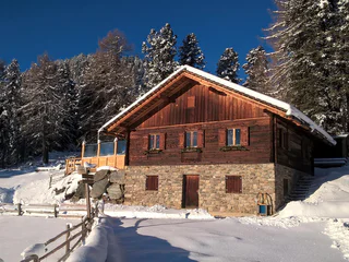
    Winter hike - Stone trail
    Olang/Valdaora, Dolomites Region Kronplatz/Plan de Corones

    This historical winter walk begins in Niederolang at the large playground in the Aue area. You can reach Niederolang easily with Skibus 22, Citybus 435.2, or the CallBus. The correct stop is “Niederolang, Erlenweg” – from there, it’s about a 5-minute walk to the playground.

    The trail leads you through a picturesque forest where large stones from all over South Tyrol share fascinating insights into the world of geology. After about 1 km, you reach the “Spitziges Stöckl”, marking the end of this relaxing winter walk.

    From there, it’s only about 7 minutes on foot to the village centre. You can continue walking back – or simply order the CallBus for a comfortable return.

    Difficulty: easy
    25 m elevation gain
    0h:15 min duration
    Barrier-Free
    Walk along the river Rienz to Bruneck
    St.Lorenzen/San Lorenzo di Sebato, Dolomites Region Kronplatz/Plan de Corones

    This leisurely walk next to the river Rienz leads from St. Lorenzen/San Lorenzo to Bruneck/Brunico.

    Difficulty: easy
    30 m elevation gain
    1h:30 min duration
    Summer
    Hike from Rina/Welschellen to the Munt da Rina mountain inn
    Al Plan/San Vigilio, Dolomites Region Kronplatz/Plan de Corones

    From the Rina sports grounds, a marked trail leads to the Munt da Rina/Welchellener Alm (catering facilities). The Munt da Rina

    mountain inn is open during the winter months. Return along the same route.


    Difficulty: medium
    449 m elevation gain
    1h:26 min duration
    Hiking
    Winter hike to the Staller Saddle
    Rasen-Antholz/Rasun Anterselva, Dolomites Region Kronplatz/Plan de Corones

    Winter hike with sledding possibility

    From the parking place at the Biathlon Center > pass the Tiroler Hut >along the street to the Enzianhütte hut > on the groomed trail up to the Staller Saddle.

    Difficulty: easy
    434 m elevation gain
    2h:10 min duration
    Hiking
    Winter hike: Niederrasen - Oberstall - Oberrasen
    Rasen-Antholz/Rasun Anterselva, Dolomites Region Kronplatz/Plan de Corones

    From Niederrasen > passing the church > continue on the asphaltic road on the edge of the woods (mark n. 20) > Oberstallerhöfe > path of return following mark n. 5 > Oberrasen.

    Difficulty: medium
    166 m elevation gain
    1h:00 min duration
    Hiking
    Winter hike circular route: Bad Salomonsbrunn
    Rasen-Antholz/Rasun Anterselva, Dolomites Region Kronplatz/Plan de Corones

    From Antholz Niedertal > crossing the river to the Walderhöfe > slightly downwards to Bad Salomonsbrunn > return on path n. 1 to the starting point.

    Difficulty: easy
    30 m elevation gain
    1h:00 min duration
    Hiking
    Winter hike - panoramic path
    Olang/Valdaora, Dolomites Region Kronplatz/Plan de Corones

    The Panorama Trail starts at the bus stop by the App. Hotel Familiaris. The correct stop for Skibus No. 21 and Citybus No. 435.1 is “Olang Oberolang, Winkelwiese.” You can, of course, also reach the starting point using the CallBus.

    From there, this easy walk leads you through the snow-covered meadows and fields of Oberolang and Mitterolang, offering beautiful views of Mitterolang along the way. You’ll pass the Panorama Restaurant, where you can stop for a short break and enjoy something warm.

    You then continue past the “Spitziges Stöckl” until, after about 1 hour and roughly 2.7 km, you reach Niederolang, the end of the route.

    For your return, you can take the Skibus, Citybus or the CallBus, which conveniently bring you back to Niederolang, Mitterolang, Oberolang, or Geiselsberg.

    Difficulty: easy
    14 m elevation gain
    0h:40 min duration
    Hiking
    Winter Hike - Hut path
    Olang/Valdaora, Dolomites Region Kronplatz/Plan de Corones

    A true culinary delight awaits you on this winter hike, as the trail leads you past three welcoming mountain huts: the Niederegger Hut, the Oberegger Hut, and the Lorenzi Hut. Each offers delicious South Tyrolean specialties, perfect for a tasty break along the way.

    The hike starts in Sorafurcia near the church, easily accessible by Citybus 435.2 as well as the convenient CallBus. From there, the route follows a paved, easy-to-walk road, winding gently through snow-covered forests and passing all three huts.

    Your destination is the Lorenzi Hut, where a fantastic view of Olang awaits you. You return along the same route. Shortly after the Niederegger Hut, you'll find a Citybus and CallBus stop that take you comfortably back to Mitterolang.

    Difficulty: easy
    291 m elevation gain
    1h:07 min duration
    Summer
    Winter hike to Maurerberg
    Al Plan/San Vigilio, Dolomites Region Kronplatz/Plan de Corones

    From Antermoia, take the hiking trail up to Passo delle Erbe. At the peak station, follow trail no. 1 to the Montemuro inn (closed in winter).

    Difficulty: medium
    865 m elevation gain
    3h:06 min duration
    Hiking
    Winter hike: to the "Alte Goste"
    Rasen-Antholz/Rasun Anterselva, Dolomites Region Kronplatz/Plan de Corones

    From Niederrasen (Haus Hölzl) > on the left side walk on the edge of the woods > foresty road > Alte Goste.

    Difficulty: easy
    81 m elevation gain
    1h:00 min duration
    Hiking
    Winter hike - Gassl
    Olang/Valdaora, Dolomites Region Kronplatz/Plan de Corones

    This charming winter walk is perfect for a short break in nature. In about 20 minutes, you reach the Kronplatz valley station starting from the Mittermühlbacherhof, which is easily accessible by Citybus 435.2, Skibuses 21 and 22, or the convenient CallBus.
    The trail gently winds through sparkling snow-covered fields, with the impressive Kronplatz peak drawing closer and the stunning UNESCO Dolomites scenery accompanying you along the way.

    Once at the valley station, the Gassl Restaurant invites you to warm up with a hot drink or enjoy a light snack. Afterwards, you can comfortably return to the center of Olang using the skibuses.

    Difficulty: easy
    24 m elevation gain
    0h:16 min duration
    Hiking
    Winter hike: Maierhöfe - Wiesemann
    Rasen-Antholz/Rasun Anterselva, Dolomites Region Kronplatz/Plan de Corones

    From Antholz Niedertal > passed the church > Maierhöfe (Pfaffingerhof) > Wiesemannhof > Ausserweger sawmill > Antholz Mittertal and lastly back to Antholz Niedertal on the main road.

    This hike can also be started from Antholz Mittertal!

    Difficulty: easy
    193 m elevation gain
    1h:40 min duration
    Hiking
    Winter panorama trail - Kronplatz
    Al Plan/San Vigilio, Dolomites Region Kronplatz/Plan de Corones

    From the Ruis cable car peak station (2275 m) at the top of Mount Kronplatz, turn left in the direction of the race track. Walk along the beaten track until you reach a lookout point with a cross, offering a stunning view onto the Dolomites and the three villages of Marebbe: San Vigilio, Pieve Marebbe and Rina. If you keep walking, the trail will take you to the Graziani inn (2080 m). For the return journey, follow the same route as the outward journey.

    Difficulty: easy
    5 m elevation gain
    0h:45 min duration
    Hiking
    Passo delle Erbe: circular trail
    San Martin /San Martino, Dolomites Region Kronplatz/Plan de Corones

    From Passo delle Erbe, this hike runs along the forest road at the foot of Sasso Putia and back to the starting point. There are plenty of signs for orientation. Pedestrians: please keep off the cross-country skiing slope!

    Difficulty: medium
    284 m elevation gain
    1h:40 min duration
    Summer
    Winter hike to Medalghes
    San Martin /San Martino, Dolomites Region Kronplatz/Plan de Corones

    From the Pares car park, take the forest road no. 5, 5A which leads gently uphill through the woods and on to the Medalghes pastures.

    Difficulty: medium
    769 m elevation gain
    2h:43 min duration
    Hiking
    Winter hike: Niederrasen - Neunhäusern
    Rasen-Antholz/Rasun Anterselva, Dolomites Region Kronplatz/Plan de Corones

    From Niederrasen > Camping Corones > forestry road in the woods > Neunhäusern.

    Caution: use the path under the bridge of the statal road!

    Difficulty: easy
    26 m elevation gain
    0h:45 min duration
    Hiking
    Winter walk from Picolin to Ju
    San Martin /San Martino, Dolomites Region Kronplatz/Plan de Corones

    PICULIN – JU (H: 1 hour 15) From the cable car parking, walk in the direction of San Martin de Tor until you reach the bridge. There, take a left and continue along the paved road for some 3.7 km. On the peak, there are several mountain inns to take a well-deserved break. To return, you can hike back to Picolin or take the cable car.

    Difficulty: easy
    532 m elevation gain
    1h:48 min duration
    Hiking
    Winter hike to the Fanes pasture
    Al Plan/San Vigilio, Dolomites Region Kronplatz/Plan de Corones

    From Pederü, follow the road to the Fanes pastures.
    Our suggestion: Walk on to the Limo pass (15 minutes’ walking distance from the Fanes inn) to enjoy a breath-taking panoramic view out onto the “Fanes realm”.

    Difficulty: medium
    540 m elevation gain
    2h:01 min duration
    Hiking
    Passo delle Erbe - Costaces and back
    San Martin /San Martino, Dolomites Region Kronplatz/Plan de Corones

    Setting off from Passo delle Erbe, take the forest road which runs just above the Ütia de Börz mountain inn in either direction.

    Difficulty: easy
    122 m elevation gain
    0h:49 min duration
    Hiking
    Winter hike - circular route Oberolang
    Olang/Valdaora, Dolomites Region Kronplatz/Plan de Corones

    Treat yourself to a relaxing 30-minute walk through the peaceful fields and meadows of Oberolang. You can easily reach the center of Oberolang with Citybus 435.1 or the CallBus. Just a few metres from the cemetery, you’ll find the starting point of this charming route.

    The path leads you for about 1.7 km through the quiet winter landscape and brings you back to the hamlet of Oberolang. There, several inviting places to stop await you, including Café Pfiff, Hotel Messnerwirt and Hotel Rainegg.

    For your return, you can continue on foot or comfortably take the Citybus or CallBus back to your accommodation.

    Difficulty: easy
    62 m elevation gain
    0h:39 min duration
    Hiking
    Winter walk: San Vigilio - Sarjei
    Al Plan/San Vigilio, Dolomites Region Kronplatz/Plan de Corones

    Setting off from Hotel Les Alpes, follow the trail until you reach Sarjëi (food and drinks available at Agriturismo Soleseid).

    Difficulty: easy
    248 m elevation gain
    0h:54 min duration
    Hiking
    Winter walk: San Vigilio - Tamersc - Pederü
    Al Plan/San Vigilio, Dolomites Region Kronplatz/Plan de Corones

    The stroll begins on Str. Fanes: Walk through the Pes-Pesc playground, then continue along the paved dirt road parallel to the cross-country skiing slope (pedestrians: please keep off the slope) until just before you reach the Ciamaor sports grounds. The forest trail will take you to Ciamaor (to the left of the football pitch). Having passed the Ciamaor bridge, keep left and continue along the picturesque trail until you get to Lé dla Creda. Continue along the main road until you reach the Tamersc fields and, after 3 km, the Pederü mountain inn.

    Difficulty: easy
    352 m elevation gain
    6h:30 min duration
    Hiking
    Winter hike: Circular Path Rasen
    Rasen-Antholz/Rasun Anterselva, Dolomites Region Kronplatz/Plan de Corones

    From Camping Corones > on the "Dorfrundweg Rasen" slightly uphills to the road Redensberg > downwards and turning left up to the "Jagdhaus" > turning right until reaching a bar > continue on the edge of the woods reaching the barbecue area > cross the main road > path to the river > along the river back to Oberrasen or Niederrasen.

    Difficulty: easy
    231 m elevation gain
    2h:27 min duration
    1 2