
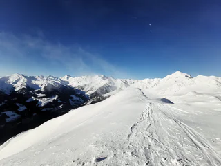
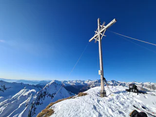
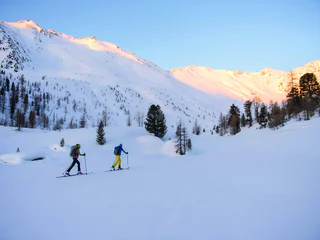
Skitour Valbenair peak
S.Valentino /St. Valentin, Graun im Vinschgau/Curon Venosta, Vinschgau/Val Venosta
difficult
Difficulté
1301 m
Gain d'altitude
5h:01 min
durée
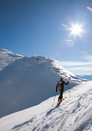
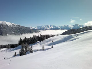
Un paysage intact, une quiétude absolue en dehors des pistes et des pentes bien enneigées avec de la poudreuse et des névés. Vous voulez partir à l'assaut des Dolomites ? Ou bien préférez-vous des sommets aux pentes plus douces ? Raffolez-vous des vues panoramiques ? Ou seuls les plus hauts sommets sont-ils capables de vous satisfaire ? Quel que soit le type de randonnée à ski que vous choisissez, le Sud-Tyrol vous donne la garantie de profiter d'aventures sportives et d'expériences uniques dans la nature.
S.Valentino /St. Valentin, Graun im Vinschgau/Curon Venosta, Vinschgau/Val Venosta
difficult
Difficulté
1301 m
Gain d'altitude
5h:01 min
durée
Stelvio/Stilfs, Stilfs/Stelvio, Vinschgau/Val Venosta
medium
Difficulté
1119 m
Gain d'altitude
3h:49 min
durée
1/4
San Leonardo i.P./St. Leonhard i.P., Moos in Passeier/Moso in Passiria, Meran/Merano and environs
easy
Difficulté
819 m
Gain d'altitude
2h:30 min
durée
medium
Difficulté
1541 m
Gain d'altitude
5h:00 min
durée
1/8
S. Giacomo/St. Jakob - Val di Vizze/Pfitsch, Pfitsch/Val di Vizze, Sterzing/Vipiteno and environs
difficult
Difficulté
1572 m
Gain d'altitude
4h:47 min
durée
S.Valentino /St. Valentin, Graun im Vinschgau/Curon Venosta, Vinschgau/Val Venosta
difficult
Difficulté
1268 m
Gain d'altitude
4h:12 min
durée
1/3
Maso Corto/Kurzras, Schnals/Senales, Vinschgau/Val Venosta
easy
Difficulté
968 m
Gain d'altitude
3h:34 min
durée
Casere/Kasern, Sand in Taufers/Campo Tures, Ahrntal/Valle Aurina
medium
Difficulté
1518 m
Gain d'altitude
4h:04 min
durée
1/5
Plata/Platt, Moos in Passeier/Moso in Passiria, Meran/Merano and environs
medium
Difficulté
1073 m
Gain d'altitude
4h:00 min
durée
1/2
Ridanna/Ridnaun, Moos in Passeier/Moso in Passiria, Meran/Merano and environs
difficult
Difficulté
1429 m
Gain d'altitude
4h:58 min
durée
S. Martino/St. Martin - Casies/Gsies, Rasen-Antholz/Rasun Anterselva, Dolomites Region Kronplatz/Plan de Corones
medium
Difficulté
439 m
Gain d'altitude
2h:10 min
durée
medium
Difficulté
1023 m
Gain d'altitude
3h:30 min
durée
Plata/Platt, Moos in Passeier/Moso in Passiria, Meran/Merano and environs
medium
Difficulté
856 m
Gain d'altitude
3h:00 min
durée
Braies di Fuori/Ausserprags, Prags/Braies, Dolomites Region 3 Zinnen
medium
Difficulté
856 m
Gain d'altitude
3h:07 min
durée
1/4
Maso Corto/Kurzras, Schnals/Senales, Vinschgau/Val Venosta
medium
Difficulté
1099 m
Gain d'altitude
3h:46 min
durée
S.Valentino /St. Valentin, Graun im Vinschgau/Curon Venosta, Vinschgau/Val Venosta
medium
Difficulté
1036 m
Gain d'altitude
3h:58 min
durée
San Vigilio, Al Plan/San Vigilio, Dolomites Region Kronplatz/Plan de Corones
medium
Difficulté
0 m
Gain d'altitude
4h:00 min
durée
Ridanna/Ridnaun, Moos in Passeier/Moso in Passiria, Meran/Merano and environs
difficult
Difficulté
1294 m
Gain d'altitude
3h:30 min
durée
1/3
Valgiovo/Jaufental, Ratschings/Racines, Sterzing/Vipiteno and environs
easy
Difficulté
949 m
Gain d'altitude
2h:52 min
durée
Solda/Sulden, Stilfs/Stelvio, Vinschgau/Val Venosta
medium
Difficulté
938 m
Gain d'altitude
4h:31 min
durée
1/2
Stanghe/Stange, Ratschings/Racines, Sterzing/Vipiteno and environs
medium
Difficulté
1213 m
Gain d'altitude
3h:51 min
durée

1/2
Ridanna/Ridnaun, Ratschings/Racines, Sterzing/Vipiteno and environs
medium
Difficulté
1005 m
Gain d'altitude
3h:16 min
durée
S.Valentino /St. Valentin, Graun im Vinschgau/Curon Venosta, Vinschgau/Val Venosta
medium
Difficulté
1141 m
Gain d'altitude
4h:25 min
durée
S. Maddalena/St. Magdalena - Funes/Villnöss, Villnöss/Funes, Dolomites Region Lüsen Villnöss
medium
Difficulté
921 m
Gain d'altitude
3h:01 min
durée
1/3
Maso Corto/Kurzras, Schnals/Senales, Vinschgau/Val Venosta
difficult
Difficulté
1517 m
Gain d'altitude
5h:24 min
durée
S. Maddalena/St. Magdalena - Funes/Villnöss, Brixen/Bressanone, Brixen/Bressanone and environs
medium
Difficulté
934 m
Gain d'altitude
4h:12 min
durée
1/3
Ridanna/Ridnaun, Ratschings/Racines, Sterzing/Vipiteno and environs
medium
Difficulté
1072 m
Gain d'altitude
3h:25 min
durée
S.Valentino /St. Valentin, Graun im Vinschgau/Curon Venosta, Vinschgau/Val Venosta
medium
Difficulté
1013 m
Gain d'altitude
3h:07 min
durée
1/3
Certosa/Karthaus, Schnals/Senales, Vinschgau/Val Venosta
medium
Difficulté
1392 m
Gain d'altitude
5h:25 min
durée
1/4
S. Giacomo/St. Jakob - Val di Vizze/Pfitsch, Pfitsch/Val di Vizze, Sterzing/Vipiteno and environs
medium
Difficulté
1266 m
Gain d'altitude
3h:58 min
durée