
Restaurant Pizzeria Schießstand
Tramin an der Weinstraße/Termeno sulla Strada del Vino, Alto Adige Wine Road
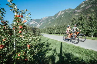
| Pour vos vacances à Eppan/Appiano sur la route du vin dans le Sud-Tyrol, sous le signe du bien-être et du divertissement, vous pouvez choisir parmi de nombreux hébergements qui répondent à vos souhaits. |
Tramin an der Weinstraße/Termeno sulla Strada del Vino, Alto Adige Wine Road
S. Michele/St. Michael - Appiano/Eppan, Eppan an der Weinstaße/Appiano sulla Strada del Vino, Alto Adige Wine Road
Caldaro Paese/Kaltern Dorf, Kaltern an der Weinstraße/Caldaro sulla Strada del Vino, Alto Adige Wine Road
easy
Difficulté
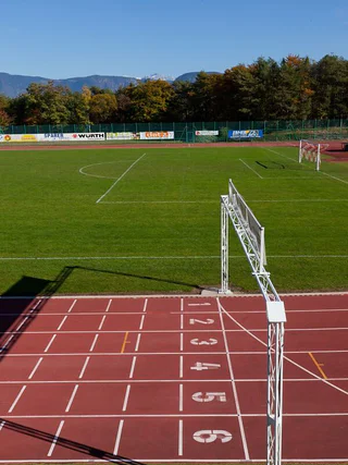
20 m
Gain d'altitude
0h:06 min
durée
Kurtinig/Cortina s.s.d.V., Kurtinig an der Weinstraße/Cortina sulla Strada del Vino, Alto Adige Wine Road
Kurtatsch/Cortaccia s.S.d.V., Kurtatsch an der Weinstraße/Cortaccia sulla Strada del Vino, Alto Adige Wine Road
medium
Difficulté
346 m
Gain d'altitude
1h:37 min
durée
1/13
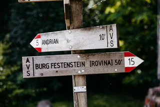
Avenes/Afens, Andrian/Andriano, Alto Adige Wine Road
medium
Difficulté
726 m
Gain d'altitude
3h:22 min
durée
1/2
Terlano/Terlan, Terlan/Terlano, Alto Adige Wine Road
Ora/Auer, Auer/Ora, Alto Adige Wine Road

1/3
Caldaro Campi al lago/Kalterer Klughammer, Kaltern an der Weinstraße/Caldaro sulla Strada del Vino, Alto Adige Wine Road
Kurtinig/Cortina s.s.d.V., Kurtinig an der Weinstraße/Cortina sulla Strada del Vino, Alto Adige Wine Road
Tramin an der Weinstraße/Termeno sulla Strada del Vino, Alto Adige Wine Road
1/4
Pianizza di Sopra/Oberplanitzing, Kaltern an der Weinstraße/Caldaro sulla Strada del Vino, Alto Adige Wine Road
1/4
Ora/Auer, Auer/Ora, Alto Adige Wine Road
easy
Difficulté
264 m
Gain d'altitude
1h:57 min
durée
St. Michael/S. Michele - Eppan/Appiano, Eppan an der Weinstaße/Appiano sulla Strada del Vino, Alto Adige Wine Road
1/3
St. Anton-Pfuss/S. Antonio-Pozzo, Kaltern an der Weinstraße/Caldaro sulla Strada del Vino, Alto Adige Wine Road
1/20
Pianizza di Sotto/Unterplanitzing, Kaltern an der Weinstraße/Caldaro sulla Strada del Vino, Alto Adige Wine Road
Caldaro Paese/Kaltern Dorf, Kaltern an der Weinstraße/Caldaro sulla Strada del Vino, Alto Adige Wine Road

1/2
Tramin an der Weinstraße/Termeno sulla Strada del Vino, Alto Adige Wine Road
1/4
Cauria/Gfrill, Salorno/Salurn, Alto Adige Wine Road
medium
Difficulté
1741 m
Gain d'altitude
121.4 Km
distance
Ora/Auer, Auer/Ora, Alto Adige Wine Road
Unterplanitzing/Pianizza di Sotto, Kaltern an der Weinstraße/Caldaro sulla Strada del Vino, Alto Adige Wine Road
1/11
Pianizza di Sopra/Oberplanitzing, Kaltern an der Weinstraße/Caldaro sulla Strada del Vino, Alto Adige Wine Road
1/3
Schernag/Schernag, Tisens/Tesimo, Alto Adige Wine Road
easy
Difficulté
26 m
Gain d'altitude
0h:09 min
durée
Egna/Neumarkt, Neumarkt/Egna, Alto Adige Wine Road
Kaltern Dorf/Caldaro Paese, Kaltern an der Weinstraße/Caldaro sulla Strada del Vino, Alto Adige Wine Road
Glen/Gleno, Montan/Montagna, Alto Adige Wine Road
1/15
S. Giuseppe al Lago/St. Josef am See, Kaltern an der Weinstraße/Caldaro sulla Strada del Vino, Alto Adige Wine Road
Caldaro Paese/Kaltern Dorf, Kaltern an der Weinstraße/Caldaro sulla Strada del Vino, Alto Adige Wine Road
Tramin an der Weinstraße/Termeno sulla Strada del Vino, Alto Adige Wine Road
1/3
Caldaro Campi al lago/Kalterer Klughammer, Kaltern an der Weinstraße/Caldaro sulla Strada del Vino, Alto Adige Wine Road


