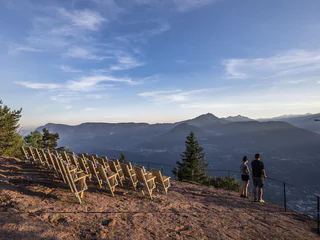
| Merano a okolí je rájem pro milovníky zimní turistiky. Užijte si procházky zasněženou krajinou. |
Circular route over the Töllgraben dig. The Töllgraben dig located west of Partschins represents the border designation of the municipalities of Partschins and Algund.
The Three-Alpine-Farms Hike, which leads to three different alpine farms, affords fabulous views as it leads hikers through the plateau’s unique winterlandscape and past the Bruggen Pond.
From the last bend in the road under the Jaufenpass mountain pass marked as “Römerkehre”, take trail no. 12a to the Flecknerhütte inn. The return is back the same way.
The Knottnkino (Rock cinema) is an open-air cinema—but the only film playing is a spectacular panoramic mountain view.
The Mühlwaal along the Wasserfallweg and the Pröfingweg was renovated by the canal guards in 2011. It draws its water from the Zielbach stream, coming from the well-known Zieltal valley, and is used to irrigate the Rabland/Rablà orchards that spread along the east and south sides of the village. In winter, the historic Waal is used for fire fighting by the volunteer fire brigades.
The Algund irrigation channel pathway, or Waalweg, is a 10 km long path running alongside the old irrigation channel. Flat and even almost all the way, the trail boasts incredible views over the Meran/o area and leads you through Plars, Algund/Lagundo village and Gratsch/Quarazze until you get to the Saint Magdalena Chapel and then along the Tappeiner path to Meran/o city.
Easy and interesting walk with many views from Tisens/Tesimo and Prissian/Prissiano. Suitable for push chairs, section illuminated at night.
Easy family hike from Töll to Partschins and its district Vertigen and back to the starting point.
Walk suitable for children and buggies!
Easy and eventful hike through orchards and forest, largely suitable for prams in winter. The path is mostly cleared in winter.
This picturesque hike along the Schenner Waal irrigation channel runs along an unspoilt trail through the chestnut grove and orchards high above the spa town of Merano, and is also thoroughly recommended for hot summer days.
An amazing hiking tour to the traditional farms on the Nörderberg/Monte Tramontana!
Walk suitable for children and buggies!
Light forests and mountain meadows alternate along the entire route, with easy climbs and flat sections. In winter, the track is regularly maintained with a snow groomer.
In addition, during the winter season the Lazins Inn and the Lazins Alm Alp are also open, inviting visitors to enjoy a cosy break.
The Lazinser Alm is located at the end of the Pfelderertal valley at the foot of the Hohe Wilde mountain. The Lazinser Alm is a favourite hiking goal for young and old, with a wonderful location that has been left natural but is still easy to reach. The Lazinser Alm is more of a stately house than a mountain hut, where one can enjoy the summer days outdoors on their large veranda. Like at the Timmelsalm mountain hut, numerous cattle graze the pastures of the Lazinser Alm.
Difficulty: a problem-free hike in every aspect, suitable even for weaker hikers or children. Walking time from Pfelders/Plan, approx. 1 hour and 15 minutes.
Source: Alpine farm hikes in Passeiertal valley.
Starting from the inn Alpenrose the path leads to the church. Before reaching the church, turn left at a little supermarket and continue walking through meadows till you nearly reach the housing area “Sagstatt”. At the little chapel turn right and take the way uphill. You’ll pass the “Auerhof” and then continue walking to the “Wanserhof”. From there the path leads through meadows and forest and back to the inn “Innerwalten”. Follow the pavement for about 200 m till you reach the inn “Jägerhof”, then turn left and follow the signposts. After about 30 min. the path leads alongside the so-called “Römerweg” (path of the Romans), which leads to the Jaufen Pass. After about 200 m follow the signposts to the left and follow the meadow path uphill about 100 m and then take the forest path to the “Santlhof”. From there, you walk downhill to the inn “Alpenrose”, the starting point.
In winter some sections of the route may be covered in snow or ice.
The path is not suitable for pushchairs.
The climatic terrain cure is a special form of exercise therapy characterised by activity adapted to one’s fitness level, endurance training, and time spent in the outdoors experiencing the landscape, which is carried out through a personalised walking programme.
So-called terrain hiking improves endurance and agility, increases speed and flexibility, reinforces the cardiovascular system, stimulates breathing activity and strengthens muscles, ligaments and joints. It has a positive impact on the metabolism, activates the digestive system and noticeably increases the expenditure of calories.
The climatic terrain cure is recommended for functional cardiovascular disorders, respiratory and metabolic disorders, and above all is a tried and tested method of primary prevention and general health promotion.
The "Terrainkur" trails in Partschins/Parcines have been certified by the Ludwig-Maximilians-University of Munich.
The Marlinger Waalweg is one of the most beautiful irrigation channels in the Meran region. With a length of 12 km, it is the longest irrigation channel path in South Tyrol. It starts in Töll/Tel (municipality of Partschins) and leads through the villages of Forst (municipality of Algund), Marling, Tscherms and Lana. The trail runs almost level along the irrigation channel and is ideal for families and children. Between chestnut groves and extensive orchards, the magnificent views of the Meran basin are inspiring. The ideal hiking time for this irrigation canal trail is spring (when the trees are in blossom) and autumn.
Discover the Nörderberg/Monte Tramontana with your family!
Walk suitable for children and buggies!
Easy but eventful hike with beatuiful views above Tesimo/Tisens.
Attention: the path is not cleared in winter and can be icy in places. Always wear good shoes!
In winter some sections of the route may be covered in snow or ice.
Easy hike above Tisens/Tesimo with beautiful viewpoints of the Tisner Mittelgebirge mountain range.
Attention: the path is not cleared in winter and can be icy in places. Always wear good shoes!
This easy hike from Vöran/Verano to Hafling/Avelengo is suitable for everyone and even doable with a stroller. There are several places to stop and eat along the way -all of which have terraces with delightful views.
At 12 stations, we will share fascinating details about apple cultivation with you. Simply scan the QR code at each station to gain immediate access to explanatory videos and information. Then, at each station, you'll encounter questions with 4 answer options. If you have answered all the questions correctly and entered your data in the app, you can pick up a gift at the Partschins tourist office. Have fun!
In Meran and surroundings you can promenade along the ancient water canals, the so-called "Waalwege". The Waalweg in Rabland/Rablà is a tranquil circular hiking trail, perfect for a pleasant walk the whole year round for the whole family!
The Knottnkino in Vöran/Verano is a lookout point. It's outfitted with thirty cinema seats, where the hikers can take a seat and enjoy the unique experience. The site overlooks the whole of the Adige Valley so visitors enjoy stunning views that encompass the Texelgruppe Mountains, Mount Penegal, and even Weißhorn farther afield.
Signposted as „Sonnenrundweg“ trail (Sun Path), this simple 1 hr. 45 min. hiking circuit crossing over sunny slopes and through shady woods leads off the parking lot near the church. In winter the wooded sections are ideal for snowshoe hiking.
Refreshment stops: Various taverns in Stulles
The trail is not suitable for pushchairs.
In good conditions and when there’s enough (but not too much) snow, this hike can be completed without any problems. The trail is regularly maintained using a tracked snow groomer. On the farm track along the hairpin bends are clearly-marked shortcuts, but in winter these tracks are usually inaccessible or should at least be negotiated with care.
Start: Cable Car mountain station: 1.486 m
Hiking time: 3:30 h
Length: 9.452 m - Ascent: 414 m
From San Felice/St. Felix via the Lake of San Felice/St. Felix to the 1865 m high Macaion/Gantkofel, a first-class viewpoint.
Attention: the path is not cleared in winter and can be icy or covered with deep snow. Always make sure you have good shoes and appropriate equipment!