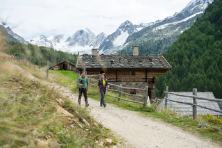
This high-Alpine trail presents the hiker with dramatic views and scenic highlights.
The entire Merano High Mountain Trail (no. 24), one of the most stunning trails in the entire Alpine region, is 100 km in length, requires four to six days of hiking and is accessible from the beginning of July to the end of September (depending on the snow situation). At a relatively consistent altitude, this trail connects, to an extent, the high mountain climate of the Texel Group and the sub-Mediterranean climate of the Etschtal Valley. The hike through the various segments gives us a good insight into the world of the mountain farmers who worked to create and maintain this mountain and cultural landscape over the centuries.
The Via Monachorum, also referred to as “Silentium“ (Path of tranquillity) connects the villages of Madonna di Senales/Unser Frau and Monte S. Caterina/Katharinaberg with Certosa/Karthaus. There was a historic monastery there, founded by the Carthusian monks in the 14th century. Dressed in their white robes, the monks lived in silence. Some large parts of the monastery walls have been preserved, as are the Gothic cloister and the former monastery kitchen. There are a number of plaques along this themed trail with philosophical quotations relating to tranquillity and silence. The trail is signposted using life-sized figures of monks.
The mountain pasture Mastaun (open from the beginning of May to the end of October) is in the eponymous high mountain valley that branches off near Madonna di Senales/Unser Frau west of the Schnalstal Valley and extends up to a crown of 3000 m-peaks. A stream of crystal-clear water runs through the valley. The farmstead Mastaunhof, to which the mountain pasture belongs, was recorded in documents as early as 1356 and is one of the largest farms in the Schnalstal Valley. The pastures surrounding the mountain passture are unusually well-tended and simply magnificent. There are indications that many centuries ago the mountain pasture Mastaun was already in operation all year round.
On the high plateau at around 2,450 meters a.s.l. is located the Lazaun mountain hut. From there two red ski-runs with a medium level of difficulty start and bring skiers directly in the village center of Maso Corto/Kurzras.
An easy but fascinating archaeological trail from Monte Santa Caterina/Katharinaberg up to Obermairalm Mountain Hut, along an almost level trail to Dickeralm Mountain Hut, through a beautiful larch forest to the Linthof farm and from there to the gondola lift that takes us down to Naturno/Naturns in a few minutes.
This unglaciated peak on the southern edge of the Ötztal Alps is on the border between Italy and Austria and is one of the easiest 3000 m-peaks to climb in the mountain range. It offers a wonderful panorama view towards the southern Schnalstal Valley and the Weißkugel (3,739 m a.s.l.).
A great tour from Maso Corto/Kurzras up to a splendid summit with a glorious view.
Starting point: Certosa/Karthaus (1,327 m a.s.l)
Ascent: 1,602 m elevation gain, 4.5-5 hours
Best time: December to May
Also orographically speaking to the right of the Penaudtal Valley and more southerly towards Vinschgau Valley. The ascent is also from Certosa/Karthaus into the Penaudtal Valley, as with the ski tour to the Grubenspitze, but to Mountain pasture Penaud; continue up the Penaudtal Valley, take a left at altitude 2,500 and climb the lateral valley in a south-easterly direction. It is possible to reach the summit on skis. Descend by the same route.
For good skiers.
Archaeological trail A5 begins in the village of Certosa/Karthaus where you can visit the cloister of the former Carthusian monastery. It then leads into the Penaud valley as far as the area known as “Karl Sumperer”. From here, you can view virtually the entire valley, with a panoramic view to the summits of the Similaun group of mountains. Arriving at Niederjöchl shortly after, you will have a magnificent view of Vinschgau valley, of the ice-capped peaks of the Cevedale and of the Martelltal valley. This is followed by the long descent to Sankt Martin am Kofel and its pilgrimage church. From here, it’s only a few minutes by cable car to Laces/Latsch.
Starting point: Pfossental Valley, car park Gasthof Jägerrast inn (1,693 m a.s.l)
Ascent: 1,625 m elevation gain, 5-6 hours
Best time: March to mid-June
The Texelspitze is not only well known for its Nature Park but is also very popular because of the wonderful ski touring run. However, the tour is somewhat difficult due to the long climb through the Pfossental valley. After travelling along the forest path on the bottom of the valley for about 5 km you’ll arrive at Maso Gelato/Eishof farm at 2,069 m a.s.l. Take a right here over the stream and southwards, firstly on a sleep slope and then across splendid ridges to arrive at the Texelferner glacier. Cross the glacier, the trail rising in a southerly direction as far as the south-west side of the summit. The final steps to the summit can be taken once you’ve removed your skis. The best descent is by the same route.
For good skiers with Alpine experience
A hike with amazing views of probably the oldest meadows in South Tyrol
Section of the Archaeological Trail A 7 - The Archaeological Hiking Map with additional information is available free of charge at the archeoParc Schnalstal or at the Tourism Office Schnalstal Valley
A delightful scenic circuit of the lake requiring some concentration.
Starting point: Madonna di Senales/Unser Frau (1,508 m a.s.l)
Ascent: 1,472 m elevation gain, 4.5 hours
Best time: December to May
Together with the Kleinen Wigenspitze that is slightly northwards, the Hohe Wiegenspitze rises between the Mastauntal and the Penaudtal valleys. Climb from Unser Frau through the Mastauntal valley, passing by the beautifully situated Mountain pasture Mastaun (1,810 m a.s.l). At the end of the valley, once you have negotiated the steep slope you will be on flat ground again. The trail continues, taking a sharp left, over the hollows of a wide valley and finally rising sharply over the western ridge to the summit. Descend by the same route.
For good skiers with Alpine experience
The „Hasen-Abfahrt“, which means rabbit descent and takes its name from the Hasen-Kofel locality (rabbit hill), branches off from the „Transhumanz“ slope and leads skiers through a larch forest and along the hotels to the valley station of the Lazaun cable car. The Hasen-Abfahrt ski run is 920 metres long, 6 metres wide on average, with a maximum gradient of 29.7% and an altitude difference of 127 metres.
Archaeological trail A10 is a particularly beautiful hike but somewhat longer and at times at higher altitudes.
Hiking trail through the untouched Lagauntal high valley to the former Heilbronner refuge lodge
Challenging Alpine tour, which leads via the Similaunhütte mountain hut to the discovery site of the famous “iceman”.
Starting point: Maso Corto/Kurzras, car park (2,011 m a.s.l)
Ascent: 1,445 m elevation gain, 5 hours
Best time: December to May
The Schwemserspitze is south of the Weißkugel with which it creates a massif between the Schnalstal valley and Matschertal valley. The ascent is from Maso Corto/Kurzras across along Sommerweg (summer path) as far as the bridge, then in each case turning left into the Langgrubtal Valley. Then turn towards the north and climb the steep slopes as far as the Schwemser Ferner glacier. The easiest way to climb the glacier is by the south-west ridge. You can descend along the same route.
For good skiers with Alpine experience
Starting point: Mountain station Grawand (3,212 m a.s.l) or Refuge Bella Vista (2,842 m a.s.l)
Best time: March to May
Degree of difficulty: for good skiers with Alpine experience
Day 1 ascent: 600 m elevation gain, 4 hours
The same ascent route as ski tour to the Ötzi discovery site; the trail then takes you downhill on the Niederhochferner glacier and briefly uphill to the Refuge Similaun (3,019 ma.s.l).
Day 2 ascent: 600 m elevation gain, 2 hours
The ascent goes from the Similaun lodge to Similaun in a south-easterly direction over the Niederjochferner glacier, rising only slightly to begin with but becoming steeper, up to a narrow and often monitored summit ridge.
Descent A: descend back along the ascent route.
Descent B: eastwards to the Similaunjoch pass and then northwards over the Marzellferner glacier to the Mountain hut Martin-Busch and on to Vent (A)
Descent C: eastwards to the Similaunjoch pass and then southwards over the Grafferner glacier and Graftal Valley to Inn Jägerrast (Vorderkaser) in the Pfossental Valley.
Of the 3 options, descent C (down into the Pfossental Valley) is highly recommended but only in good conditions.
The looped trail around the lake is well worth the effort because a pastoral pathway runs directly along the waterfront and is, of course, particularly beautiful from about mid-July when the reservoir is full. In the winter, water is released from the reservoir to generate electricity and, depending on the water level, the tower of the immersed church may be visible. There are some photos on display in the chapel in Vernagt of the flooded plain and farms.
Alpine hike to the one-time highest grain farm in Europe the Finailhof farm (1,973 m).
Easy and magnificent path from the mountain hut Vorderkas/ inn Jägerrast to the mountain pasture Eishof, also suitable for children and elderly people. In the further course more and more surefootedness is required.
Tips: the informational boards along the Alpine Pasture Experience Trail (Almerlebnisweg) are interesting. Not far from mountain pasture Rableid, there is a lime kiln, in which the limestone from the Hohe Weiße mountain was fired to make building lime, which was also presumably used to construct the monastery in Certosa/Karthaus.