Přeskočit na obsah

přidáno k oblíbeným

odebráno z oblíbených

Jejda! Došlo k problému, zkuste to prosím znovu

Vytváří se váš účet

Váš účet byl úspěšně vytvořen a nyní jste přihlášeni

Jste úspěšně přihlášeni!

Váš účet byl úspěšně vytvořen, ale nepodařilo se nám vás automaticky přihlásit

Jste odhlášeni

Filtr
Vybrané filtry
    Úroveň obtížnosti
    Doba trvání
    Vzdálenost v km

    Objevte krásy Meranu a okolí

    Merano a jeho okolí vás okouzlí svou historií, termálními lázněmi a nádhernými zahradami.
    Výsledky
    Hiking
    Hiking to the San Felice lake
    U.L.Frau i.W.-St. Felix/Senale-S.Felice, Meran/Merano and environs

    Enjoyble hiking tour through the forests and alpine pastures of Alta Val di Non, highly recommended over the late spring - early summer months because of the great variety of alpine flowers and in autumn due to its glowing larches. The hike starts at the parking area “Klammbrücke” just above the village of San Felice. From there the hiking trail no. 9 leads you directly to the San Felice lake (called also Felixer Weiher or Lago di Tret) in about 1 hour. The hike takes you through rough forests and mountain grassland whit panoramic views to the Val di Non and the Brenta Dolomites. The swimming lake (1604 m) has preserved itself as a natural biotope and has been rewarded for its excellent water quality. Not far from the lake there is the Felixer Alm - Malga di San Felice where you can rest end enjoy local dishes. The forest road from the Felixer Alm brings you back to the parking area. This hiking is also recommended for families with children.

    Obtížnost: nízká
    0 m nadmořská výška
    1h:10 min doba trvání
    Hiking
    Völlan - Gruberhof - Platzers
    Lana, Meran/Merano and environs

    This eventful hike for practiced mountain hikers starts at the church in Foiana, passes the old Nagelehof farm, branches off behind it to the left at the crossroads (trail no. 4) towards Jochweg, and leads, climbing gradually, through forests and mountain meadows to the Gruberhof.

    Above the farm, trail no. 2 leads through woodland and meadows onwards to Unterplatzers (Hauser). Here trail no. 2 meets trail no. 10, which leads from the Völlaner Badl hotel up into the village of Platzers. Now follow this trail to the little church of St. Sebastian in Platzers. It dates from the 16th century. The small village of Platzers is the remotest parish in the district of Tesimo.

    Possible return route: from the village of Platzers on trail no. 10 to Unterplatzers (Hauser) and continue via the Völlaner Badl to Völlan.

    Obtížnost: střední
    768 m nadmořská výška
    3h:53 min doba trvání
    Hiking
    Irrigation channel di Marlengo from Lana
    Tscherms/Cermes, Meran/Merano and environs

    10.5 km long, comfortable walk at 450 m altitude, above the villages of Lana, Tscherms and Marling.

    Those who are not yet tired of the hike can take the Algunder Waalweg (end Marlinger Waalweg, across the road, cross the small bridge in the direction of Lagundo) and then the Tappeinerweg (to Merano center) in the hike.

    Obtížnost: nízká
    150 m nadmořská výška
    3h:30 min doba trvání
    Running and fitness
    Nordic Walking Tour 6: "Alter Kirchweg"
    Naturns/Naturno, Meran/Merano and environs

    This track connects the Nordic walking Route in the valley to paths on the slopes of the Sonnenberg mountain. Starting from the Nischlhof farm, the way leads along the Kirchbachgraben to Engelsburg and then up towards the Salten Kirchweg to Höfl and on upwards to the Unterstell farm at 1,300mt. You can then take the Unterstell/Naturno cable-car back to the valley. Please remember to check the cable-car timetable.

    Obtížnost: střední
    762 m nadmořská výška
    1h:28 min doba trvání
    Lifts
    Cablecar Aschbach/Rio Lagundo, Rabland/Partschins
    Partschins/Parcines, Meran/Merano and environs

    Straight up to the cylists’ and hikers’ paradise at Aschbach/Riolagundo and Vigiljoch/San Vigilio.
    ... simply take the Panorama Cable Car to Aschbach and the Vigiljoch High Plateau at 1,793mt.
    The fully re-modernised and renovated cable-car in Rabland/Rablá next to Partschins/Parcines has a capacity of 35 passengers.
    525 mt. - Rabland valley station - 1,342 mt. - Aschbach mountain station

    During busy periods, bicycle transport is not possible from 10.00 to 12.00.

    Obtížnost: nízká
    0 m nadmořská výška
    0h:04 min doba trvání
    Hiking
    Völlan - Talmühle - Naraun - Tisens
    Tisens/Tesimo, Meran/Merano and environs

    From the Farming Museum in Foiana trail no. 8 (Mühlenweg) branches left through deciduous forest. At the Talmühle inn it crosses over the Brandisbach stream on a stone bridge dating from the 17th century, then continues through Scots pine forest and orchards until reaching the Obermairhof farm.

    After passing the Narauner Weiher pond, which is located at the foot of the Pöltener Bühel, the trail reaches Gampenstrasse (detour to St. Hippolyt). After crossing this road, you will reach another road to Tesimo, the destination of your hike.

    Obtížnost: nízká
    80 m nadmořská výška
    1h:04 min doba trvání
    Hiking
    Castle Giovo - Sun walk in St. Leonhard/S. Leonardo
    St.Leonhard in Passeier/San Leonardo in Passiria, Meran/Merano and environs

    Starting at the tourist office, follow the main road to the left and then right along Kirchweg, take the first road on the left into Schaffeld and then the right path at the fork. Carry on along the road to Brunst and then cross the bridge to the Jaufenburg. Continue on along Schlossweg, past the Holy Cross Chapel and right into the Sonnenrundgang. Follow the signs to Schlossweg and then along the Jaufenstraße back to the centre of the village.

    Obtížnost: nízká
    182 m nadmořská výška
    1h:30 min doba trvání
    Hiking
    The Marlengo/Marling irrigation channel path
    Marling/Marlengo, Meran/Merano and environs

    The Waalweg trail -Hiking along the irrigation channel
    Spectacular views of the surrounding mountains can be seen along the entire length of the Marlinger Waalweg trail. The agricultural landscape lining the irrigation channels is also impressive, with meadows and forests alternating with vineyards and orchards. Along the Marlinger Waalweg trail there are also impressive views of the Merano basin, the Val Passiria/Passeier Valley, and the imposing Texelgruppe mountain range.

    Obtížnost: nízká
    162 m nadmořská výška
    1h:45 min doba trvání
    Hiking
    Völlan - Gruberhof - Gallhof - Völlaner Joch - Platzers
    Lana, Meran/Merano and environs

    This hike for practiced mountain hikers starts at the church in Foiana, passes the old Nagelehof farm, branches off behind it to the left at the crossroads (trail no. 4) towards Jochweg, and leads, climbing gradually, through forests and mountain meadows to the Gruberhof and Traterhof, then onwards to the Gallhof farms (closed).

    From here the trail continues to the right. You will hike through shady woodland below the Jochberg as far as the Jagdhütte refuge (no refreshments), via the Völlaner Joch plateau and eventually from there onwards along a rather steep path to Platzers.

    Possible return route: from the village of Platzers take trail no. 10 to Unterplatzers (Hauser) and continue via the Völlaner Badl to Foiana.

    Obtížnost: střední
    1009 m nadmořská výška
    4h:37 min doba trvání
    Hiking
    Maiser Waalweg Trail
    St.Martin in Passeier/San Martino in Passiria, Meran/Merano and environs

    Waalwege are paths along the ancient irrigation channels. From the car park of the Hirzer cable car in Saltaus/Saltusio, head down to the Passerdammweg trail until reaching the Apfelhotel Torgglerhof hotel. From here, the canal trail leads into the centre of Scena/Schenna or after the Waalerhütte hut to Riffian/Rifiano and Meran/Merano.
    After a comfortable hike of approx. 1.5 hours, you reach the small city centre of Merano, where you can, for example, take the bus back to Saltusio.

    Obtížnost: nízká
    46 m nadmořská výška
    2h:30 min doba trvání
    Hiking
    The Passer Promenade
    Meran/Merano, Meran/Merano and environs

    Named after the torrent that flows through the city, this promenade winds along the right bank of the Passer River, in the centre of Merano/Meran. There are two stretches, one between the Ponte della Posta and Ponte Teatro, the other that hence takes to the Ponte di Ferro.

    In the first part there are many artistic flower-beds, palms, ice-cream shops and cafes. Here you can admire the liberty architecture of the Kurhaus, whereas on the lower part of the promenade, surrounded by various historical buildings, you’ll find the artworks of the Human Figures project.

    The promenade is easily walkable with pushchairs, too.

    Obtížnost: nízká
    0 m nadmořská výška
    0h:16 min doba trvání
    Hiking
    Kuenser Waalweg Trail
    Kuens/Caines, Meran/Merano and environs

    Waalwege are paths along the ancient irrigation channels. From the Ungericht Hof farm (Neolithic engraved stone), follow the road for approx. 10 minutes up to the Mutlechnerhof farm (837m) from where the markers lead in a further 15 minutes to the 600-year-old Caines canal along a more or less flat trail. Follow this to its origin, the irrigation canal frame at the Finelebach stream (1,020m). This will take about 90 minutes. On the other side of the bridge, hike to the right of the canal some 100 m down into the valley, then turn sharply to the left onto the lower canal trail that takes you through shady woods back to the Ungericht Hof.

    The path is not suitable for pushchairs.

    Obtížnost: střední
    290 m nadmořská výška
    2h:45 min doba trvání
    Hiking
    Summer Promenade
    Meran/Merano, Meran/Merano and environs

    A twin to the Winter Promenade located on the opposite side of the river, the Summer Promenade has wonderfully lush vegetation: cedars of Lebanon, giant redwoods, poplars and various species of pines provide shade and a cool respite from hot summer days. At the beginning of the promenade, you’ll find Sissi Park; an elegant sculpture of Empress Elisabeth of Austria, done in Lasa marble, presides regally over the park.

    Obtížnost: nízká
    13 m nadmořská výška
    0h:10 min doba trvání
    Hiking
    Marling Waalweg, the longest of all the irrigation channel trails
    Lana, Meran/Merano and environs

    Twelve kilometers long, the Marlinger Waalweg trail is a popular hiking trail which runs along the former irrigation channels, the longest of its kind in South Tyrol. Starting at the Töllbrücke bridge, the 250 year-old path gently ascends through apple orchards and woods to firmer and more level ground. After pausing to admire the medieval Lebenberg Castle, hikers continue slightly downhill along the slope of Marling mountain to the village of Lana.

    Obtížnost: nízká
    458 m nadmořská výška
    3h:12 min doba trvání
    Hiking
    Winter Promenade
    Meran/Merano, Meran/Merano and environs

    Very sunny and well sheltered from the wind, the Winter Promenade runs along the river; it is the natural continuation of the Passer Promenade. Its most distinctive landmark is the Wandelhalle covered passageway, which provides shelter from inclement weather. The Wandelhalle also houses a gallery of paintings depicting landscapes of South Tyrol and busts of significant figures in the city’s history.

    Obtížnost: nízká
    24 m nadmořská výška
    0h:10 min doba trvání
    Hiking
    Magic path
    Kuens/Caines, Meran/Merano and environs
    The magic trail in Riffian with 20 stations invites children and adults to discover a fantastic world of magic and sorcery. It leads into the deep forest, past a wishing wheel, the labyrinth with the petrified face, eerie voices and obstacles to climb through. Once we reach the highest point, the giant magic wand awaits us, leaving nothing to be desired. On the way back, we pass a witches' village, ringing trees and a magic tunnel. With the flying carpet, we float through the gate into the children's factory town. There we can take part in building the city. After skilfully overcoming the city moat and dusting off the magic dust, "only" the experience remains. The artistically designed stations have been created from materials provided by the forest and thus contribute to the magic of the trail.
    Obtížnost: nízká
    137 m nadmořská výška
    0h:31 min doba trvání
    Hiking
    Riffianer Waalweg Trail
    Riffian/Rifiano, Meran/Merano and environs

    Waalwege are paths along the ancient irrigation channels. Ascend to the canal trail via the Kirchweg or Rösslweg streets. After approx. 300 m the Rösslweg branches to the left from the Kirchweg and rises gently to the shooting range where the Riffianer Waalweg trail begins. It runs between forest edge and meadows as far as Kuens/Caines and ends in the Kuensertal valley. Return either via the Kuenserstraße street, the Valtmaunweg trail or via the Hohlgasse street. If you wish, you can drive to the starting point in the Kuensertal valley by car, park there and then hike as far as Rifiano/Riffian (approx. 45 min).

    The path is not suitable for pushchairs or strollers.

    Obtížnost: nízká
    157 m nadmořská výška
    1h:30 min doba trvání
    Running and fitness
    Uphill Vigiljoch
    Tscherms/Cermes, Meran/Merano and environs

    Also from Lana to Vigiljoch there are two well-marked courses that challenge the ambitious hikers, one of them offers an additional variant.

    Start is at the valley station of the cable car. The various trails lead initially for a short time in the direction of Marling Waalweg / Tscherms and then, east or west accordingly on the ways No. 33, 33 B and 34 steeply up to the Vigiljoch. About the self-explanatory Ochsentodweg No. 38 it goes in tight, steep turns uphill. Between 6.7 and 8.5 km measure the routes, which lead over 1200 Hm largely through the forest and therefore also offer in the hot summer months.

    If the descent is too steep, you have the opportunity to float down to the valley once a day until 11 pm by cable car. Interested parties can buy a discounted 20-point card.

    Obtížnost: vysoká
    1200 m nadmořská výška
    3h:49 min doba trvání
    Running and fitness
    Just for Fun
    Naturns/Naturno, Meran/Merano and environs
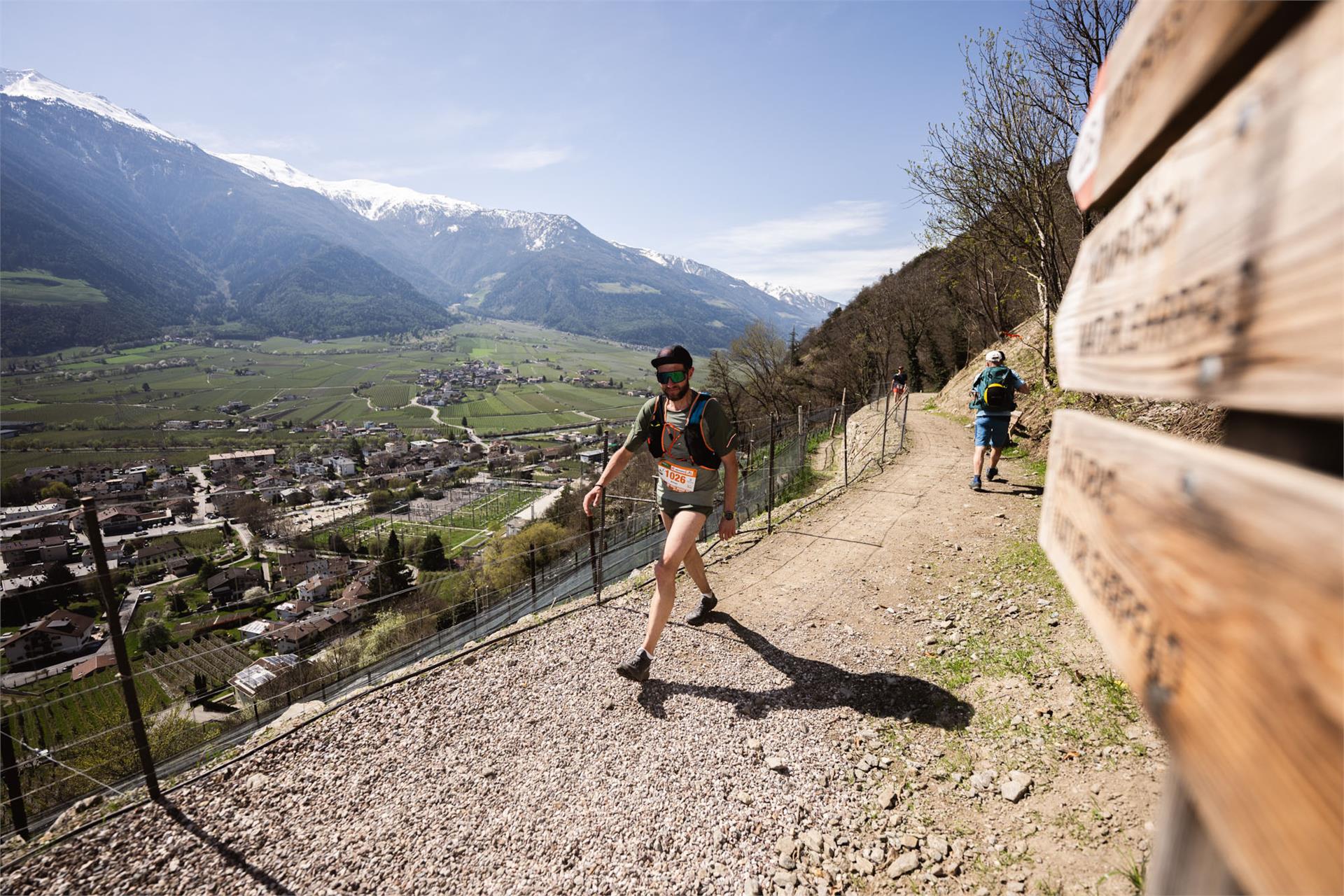
    Route of the Alpenplus Ötzi Trailrun at the Sonnenberg mountain Naturno
    Obtížnost: střední
    399 m nadmořská výška
    2h:31 min doba trvání
    Hiking
    Chestnut Experience Trail
    Lana, Meran/Merano and environs

    There are various stations where visitors can learn lots about chestnuts. The Chestnut Experience Trail (Kastanienerlebnisweg) is especially recommended for families and those who like a gentle walk. Along the trail one can learn a lot about the tree's wood, its fruit and the various types of chestnut.

    Parking is available next to the church in Foiana/Völlan or at the football ground. Follow the Propst-Wieser-Weg trail. After the sporting grounds a Keschtnigl, a spiky chestnut the size of a person, advertises the Chestnut Experience Trail.

    Follow the signs past the Weinreichhof farm to the start of the Chestnut Experience Trail. The trail is designed to be easy and interesting for young and old. Ten stations, some of them interactive, await visitors on a hike through the chestnut trees where it is all about the precious fruit.

    Obtížnost: nízká
    131 m nadmořská výška
    0h:49 min doba trvání
    Hiking
    Wine educational trail Algund/Lagundo
    Algund/Lagundo, Meran/Merano and environs


    The vineyards along the Algunder Waal and the Schlundensteinweg are a special example of a cultural landscape shaped by the diligence of farmers. On the Algund Wine Trail, the history of the cultural vineyard landscape comes to life and is tangible for hikers. The simple panels describe the Algunder Waal, the old grape varieties and the work of the vineyard watchman known as the Saltner. His job was to watch over the ripe harvest.

    Obtížnost: nízká
    244 m nadmořská výška
    1h:34 min doba trvání
    Marked Ski Paths & Slopes
    Slope Teufelsegg 2
    Schnals/Senales, Meran/Merano and environs

    The Teufelsegg slopes offer challenging ski-runs with spectacular views. At theirs end the Teufelsegg mountain hut invites to a culinary break.

    Obtížnost: vysoká
    0 m nadmořská výška
    0h:00 min doba trvání
    Marked Ski Paths & Slopes
    Slope Teufelsegg 1
    Schnals/Senales, Meran/Merano and environs

    The Teufelsegg slopes offer challenging ski-runs with spectacular views. At theirs end the Teufelsegg mountain hut invites to a culinary break.

    Obtížnost: střední
    0 m nadmořská výška
    0h:00 min doba trvání
    Hiking
    Irrigation channel path Merano - 5th stage: Lana - Töll
    Partschins/Parcines, Meran/Merano and environs

    This path between the water irrigation channels, so called Waalwege, embraces the valley basin of Merano and allows hikers to experience the area on a 80 km walking path.

    The road joins eleven separate paths allowing the discovery of huts along the channels and even castles, churches and natural wonders. The path between the Merano channels isn't at high altitude, but cut into the valley between 400 and 900 meters in height.

    Hikers can walk the entire trail in eight stages over one week, or alternatively experience one leg as a day tour. The path between the Merano irrigation channels supplements the beloved Merano High Mountain Trail.

    "The channels" are artificially created canals for irrigation originating from the thirteenth century. A narrow bridge was built to maintain and care for each channel. In the past, the farmers dedided to build the channels using rudimentary tools to regulate the distribution of water, a very clever idea. Today, the paths along these water irrigation channels have become popular hiking trails and walks, suitable at any time of the year.

    Obtížnost: nízká
    245 m nadmořská výška
    4h:00 min doba trvání
    Hiking
    Badlweg Trail S. Pancrazio
    St.Pankraz/San Pancrazio, Meran/Merano and environs

    A challenging path, partially paved, partially steep, runs in the footsteps of historic bathhouses. Located 200 m above the Lotterbad oasis is a water intake with mineral-rich spring water.

    Obtížnost: nízká
    0 m nadmořská výška
    0h:30 min doba trvání
    Hiking
    Foiana Panoramic Trail
    Lana, Meran/Merano and environs

    The Foiana Panoramic Trail (partly also a narrow mountain path) offers a breathtaking view of the Merano basin. The route begins behind the old Nagelehof farm at the crossroads. Turning left, follow trail no. 4 past the Gruberhof and Tratterhof. At the first left-hand bend the panoramic trail forks right. The path then runs level through the trees to the first viewing point, known as Kitzerknott, and after a somewhat steep descent to the second point, Schöne Aussicht. The hike continues to trail no. 9 which leads steeply downhill. At the Steinweiherhof, turn right, and once past the sports ground you will return to your starting point.

    Obtížnost: střední
    432 m nadmořská výška
    2h:07 min doba trvání
    Hiking
    Paths along the irrigation channels in Merano
    Partschins/Parcines, Meran/Merano and environs

    The Merano irrigation channels trails (Waalwege) represent a union of eleven trails around Meran/Merano in South Tyrol. Waalwege trails are narrow walking paths that run along historic water canals. These channels were once used to irrigate the fields and date back to the 13th century.

    Vines, apple trees, pines, cypresses, firs and larches line these special Waalwege canal trails, which in South Tyrol can only be found around Meran and in the Vinschgau valley. Castles, palaces and chapels along the way offer insights into the culture of the region. Meanwhile, traditional inns invite you to take a break.

    The circular tour on the Merano Canal Trails is approx. 80 km long, going round the entire Meran basin. Remaining at nearly the same elevation throughout, the circular tour runs along the Etschtal valley’s mountains. This makes the entire route and also the individual stages ideal for leisure hikers and families.

    The Merano Canal Trail can be hiked all year round and connects eleven irrigation canals (Waalwege) with one another: the Algunder Waalweg, the Kuenser Waalweg, the Waalweg Riffian, the Maiser Waalweg, the Schenner Waalweg, the Brandiswaalweg in Lana, the Tschermser Waalweg, the Marlinger Waalweg, the Partschinser Waalweg, the Rablander Waalweg and the Wallburgweg in Naturns/Naturno.

    • Stage: Töll/Tel - Kuens/Caines: 11 km
    • Stage: Kuens/Caines - Saltaus/Saltusio: 7.6 km
    • Stage: Saltaus/Saltusio - Naiftal valley: 11 km
    • Stage: Naiftal valley - Burgstall/Postal - Lana: 13 km
    • Stage: Lana - Töll/Tel: 13 km
    • Stage: Töll/Tel - Rabland/Rablà: 6 km
    • Stage: Rabland/Rablà - Naturns/Naturno: 9.6 km
    • Stage: Naturns/Naturno - Töll/Tel: 11 km
    Obtížnost: nízká
    0 m nadmořská výška
    25h:45 min doba trvání
    Hiking
    Falzeben to Scena via Gsteier
    Schenna/Scena, Meran/Merano and environs

    This lovely mountain hike in the Merano 2000 hiking area passes through the breathtaking landscape at the foot of the Ifinger mountain. Along the way there are cozy huts and rustic mountain inns offering refreshments.

    Obtížnost: střední
    230 m nadmořská výška
    3h:30 min doba trvání
    Running and fitness
    Speedhiking from Burgstall to Vöran
    Lana, Meran/Merano and environs

    Speedhiking from Burgstall to Vöran. From the valley station of the cable car going up to the upper parking lot. Along the stone protective wall it goes on until the road in the former increase from Postal opens. Not too steep to go about turns and right up a narrow, steep path branches off (marked "Sunnseitnsteig"). About this trail until you reach old flagstone. This performs the mixed forest sometimes very steep and demanding up to a cable car tower, where you will find a paved courtyards access. Keep to the left and is much less steep on the asphalt road continues until a right curve a narrow little path through the meadow and older. Following this, you will again reach a signpost with the words "Sunnseitnsteig". Continue through the forest and at the end through meadows up to the mountain station of the cable car Verano. The total climb is well signposted.

    Obtížnost: vysoká
    0 m nadmořská výška
    2h:45 min doba trvání
    Hiking
    The path „Erlweg“
    St.Leonhard in Passeier/San Leonardo in Passiria, Meran/Merano and environs

    Starting point: the parking area at the inn “Sandwirt” (MuseumPasseier)

    Obtížnost: střední
    520 m nadmořská výška
    3h:15 min doba trvání