Přeskočit na obsah

přidáno k oblíbeným

odebráno z oblíbených

Jejda! Došlo k problému, zkuste to prosím znovu

Vytváří se váš účet

Váš účet byl úspěšně vytvořen a nyní jste přihlášeni

Jste úspěšně přihlášeni!

Váš účet byl úspěšně vytvořen, ale nepodařilo se nám vás automaticky přihlásit

Jste odhlášeni

Filtr
Vybrané filtry
    Úroveň obtížnosti
    Doba trvání
    Vzdálenost v km

    Horolezectví

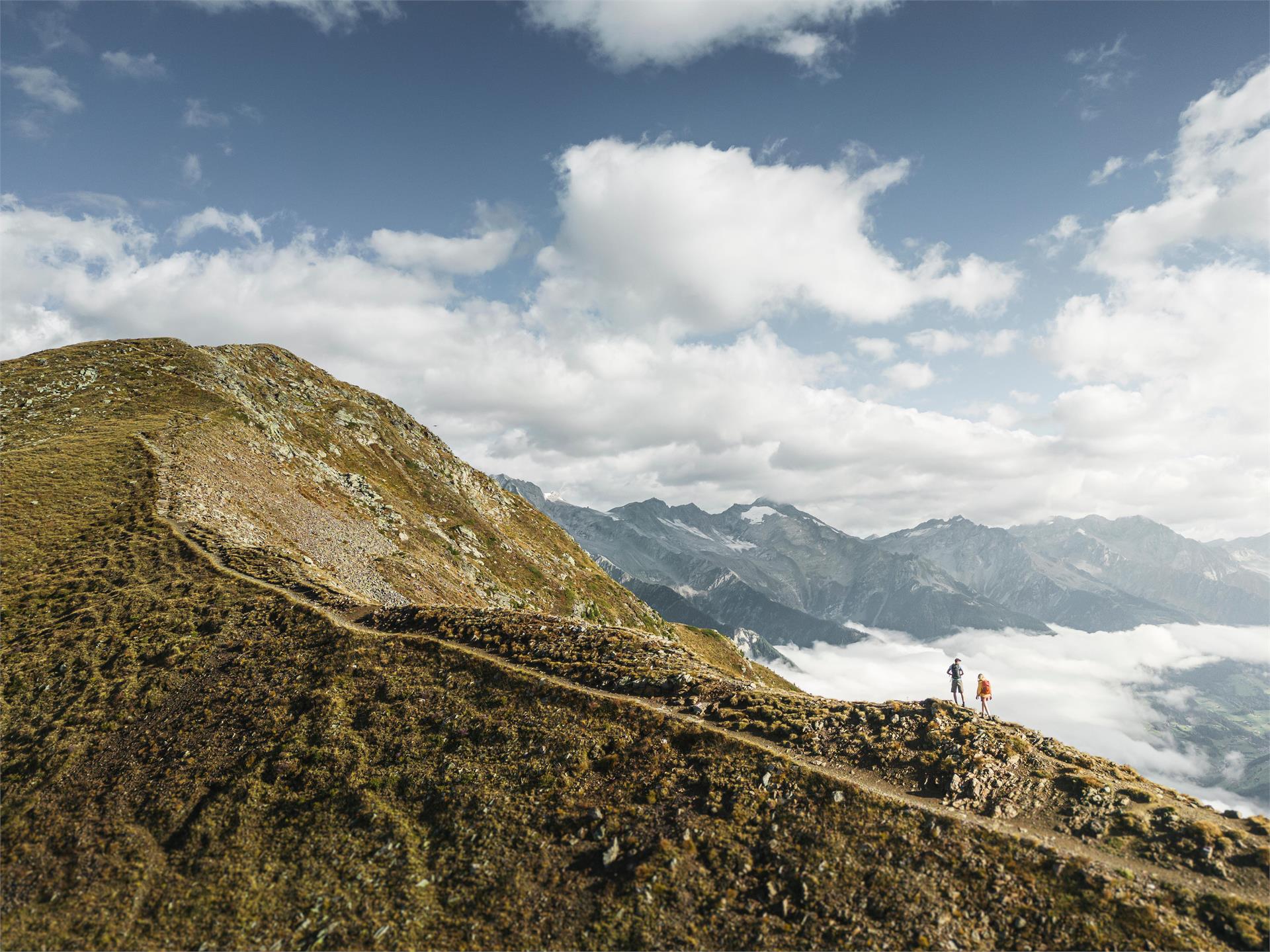
    Sportovní výzva, dechberoucí výhled a pocit svobody: jaké to je stát na vrcholu? Najděte nejlepší trek ve svém okolí zde.
    Výsledky
    Mountaineering
    Hiking Circuit from Klausen to Gufidaun via Albions and back
    Klausen/Chiusa, Brixen/Bressanone and environs
    Start at the Parish Church in Klausen (512 m) and cross the "Eisackbrücke" bridge to "Andreasplatz" square. From here, trail no. 5 leads through the subway under the railway line and climbs up to the Dürerstein (Dürer's memorial stone). Cross the provincial road to Gröden and continue through the forest and up the steeper slopes on the meadows as far as the village of Albions (890 m). From Albions, take trail no. 10 slightly downhill into the Löchlbachgraben ditch then ascend up to the refreshment point at Ansitz Fonteklaus Residence. Along the tarred access road descend steeply onto trail no. 4 and turn sharp right onto the Zickerbachgraben ditch. The trail leads through the forest to Gufidaun, from where it's worth visiting the old village centre. To return, take trail no. 7.
    Obtížnost: střední
    577 m nadmořská výška
    3h:37 min doba trvání
    Mountaineering
    Shortened high altitude trail Laives
    Laives/Leifers, Bolzano/Bozen and environs

    A shortened trail of the High altitude trail of Laives/Leifers, with start and finish in Laives.
    Change of path along the hike:

    Obtížnost: střední
    824 m nadmořská výška
    3h:43 min doba trvání
    Mountaineering
    Crossing the Sella
    Sëlva/Selva, Dolomites Region Val Gardena

    The Sella group is the massive which divides and at the same time joins togheter four valleys: Val Gardena, Val Badia, Val di Fassa and Arabba. The Sella group is composed of two large platforms, imposing walls and towers that rise high towards the sky. Starting from one end the excursion will lead you to the other end. You will reach the highest point called Piz Boè from where you will be amazed of the view.


    Obtížnost: vysoká
    0 m nadmořská výška
    6h:30 min doba trvání
    Mountaineering
    To the Watleskreuz
    Mals/Malles, Vinschgau/Val Venosta
    A mountain, which offers spectacular views in the Sesvenna mountain group, which is relatively easy to reach
    Obtížnost: střední
    842 m nadmořská výška
    2h:49 min doba trvání
    Mountaineering
    The St. James pilgrimage route in the Ahrntal valley
    Vintl/Vandoies, Ahrntal/Valle Aurina

    This pilgrimage route leads from Krimml in Pinzgau (AUT) to the Tauern Pass (Ahrntal valley, South Tyrol), then on to St. Jakob/San Giacomo, Weißenbach/Rio Bianco and the Chemnitzer Hütte refuge (Lappach/Lappago). It then continues to the Edelraut Hütte refuge (Lappach/Lappago), via the Pfunderer Valley (Puster Valley) to the trail junction at Niedervintl, and then down in to Switzerland (Müstair) via the Eisack and Vinschgau valleys or via the Brenner Pass to Innsbruck (AUT).

    Starting from the historic Tauernweg trail, the route continues from Heilig Geist in Kasern/Casere towards St. Jakob/San Giacomo, Weißenbach/Rio Bianco and the Chemnitzer Hütte and Edelraut Hütte refuges with a descent through the Weitental Valley to Niedervintl. The extended route leads along the existing Way of St. James through the Eisack Valley to Bolzano, the Vinschgau Valley and Müstair in Switzerland. Alternatively, from Mühlbach there is another variant, which heads further north to Sterzing and Brenner and finally to St James' Cathedral in Innsbruck.

    Obtížnost: střední
    4762 m nadmořská výška
    27h:00 min doba trvání
    Mountaineering
    From the Mountain hut Edelweiß/Stella Alpina to the peak Wetterspitze/Cima del Tempo
    Brenner/Brennero, Sterzing/Vipiteno and environs

    From the mountain hut Edelweiß/Stella Alpina on the trail nr. 34 to the yoke Teissljöchl. From here to the Valley Toffring (Toffringtal) and from here under the mountainsides of the Peak Wetterspitze/Cima del Tempo. Then to the peak. Possibility to descend to the pasture Allriss and on the "Sogeweg" back to Ladurns.

    Obtížnost: střední
    1737 m nadmořská výška
    7h:43 min doba trvání
    Mountaineering
    Hut to hut hiking: The smugglers' trail Ahrntal valley
    Prettau/Predoi, Ahrntal/Valle Aurina

    A ROUTE ON HISTORICAL PATHS FROM THE AHRNTAL VALLEY IN SOUTH TYROL TO MAYRHOFEN IN TYROL AND BACK AGAIN

    Route: Steinhaus/Cadipietra - Kasern/Casere - Plauener Hütte - Mayrhofen - Kasseler Hütte - Steinhaus/Cadipietra

    5 days - 4 nights

    The mountain tour is classified as moderately difficult - difficult and offers unforgettable moments. Sure-footedness, good physical condition, experience and good equipment are required.


    The yoke crossings are known as the old paths of smugglers between the Ahrntal valley and Austria. Especially the Keilbachjoch. This prompted the Kassel section of the German Alpine Club and Martin Gamper, hut keeper of the Kasseler Hütte, to call this tour "Ahrntaler smuggler paths".

    Obtížnost: vysoká
    4800 m nadmořská výška
    30h:00 min doba trvání
    Mountaineering
    Mountain tour to the Rötspitze
    Prettau/Predoi, Ahrntal/Valle Aurina
    From the Rötspitze you can enjoy one of the most impressive views of the Venice Group.
    Obtížnost: vysoká
    1971 m nadmořská výška
    6h:07 min doba trvání
    Mountaineering
    Villabassa/Niederdorf - Monte Serla / Sarlkofel
    Niederdorf/Villabassa, Dolomites Region 3 Zinnen

    Start in Villabassa  in direction of Bad Maistatt. Bevor the bridge turn right and follow the marking No. 15. At the hut Putzalm, turn left on path no.16 to the junction no.16B, Sarlsattel (2338m) and finally over the south slope (sure-footedness required) to the summit, 2378m. Walking time from Niederdorf approx. 3.5 hours. The hut Putzalm is open in the summer.

    Obtížnost: vysoká
    1254 m nadmořská výška
    4h:02 min doba trvání
    Mountaineering
    Alpine tour on the summit of the „Große Windschar”
    Gais, Dolomites Region Kronplatz/Plan de Corones

    Hike through the Mühlbach/Riomolino valley to the western peak of the Rieserferner Group. It is a challenging route recommended only for well-trained hikers.

    Obtížnost: vysoká
    1430 m nadmořská výška
    7h:30 min doba trvání
    Mountaineering
    Covolo lakes circular hike
    Kastelbell-Tschars/Castelbello-Ciardes, Vinschgau/Val Venosta

    A one-day tour on the Nörderberg mountain from Castelbello–Ciardes/Kastelbell–Tschars to the impressive mountain lakes.

    Obtížnost: vysoká
    970 m nadmořská výška
    5h:30 min doba trvání
    Mountaineering
    Mountain hike: To the mountain Rudlhorn starting from Tesido (2448m)
    Welsberg-Taisten/Monguelfo-Tesido

    The “giant” above Tesido

    Starting point: Monguelfo-Tesido – Tesido, parking lot above the mountain restaurant Mudler
    Distance: 5,8 km
    Descent: along the same route
    Walking time: 02:30 h
    Difficulty: medium
    Difference in altitude: 826 m
    Information: www.suedtirolmobil.info - Lin. 438 / 441  

    Obtížnost: střední
    831 m nadmořská výška
    2h:46 min doba trvání
    Mountaineering
    Mountain tour to the Große Windschar
    Gais, Ahrntal/Valle Aurina

    Distinctive high peak with impressive views of the Zillertal Alps, the Venediger and Rieserferner mountain ranges and the Dolomites.

    Obtížnost: vysoká
    1460 m nadmořská výška
    7h:00 min doba trvání
    Mountaineering
    Alpine tour: Ski tour Sasso di Sesto/Sextner Stein
    Sexten/Sesto, Dolomites Region 3 Zinnen

    Dream panorama in the Dolomites of Sesto - medium-heavy tour starting from the Fischleintal valley with a wonderful view of the Three Peaks.

    Obtížnost: střední
    1085 m nadmořská výška
    3h:30 min doba trvání
    Mountaineering
    Amthorspitze/Cima Amthor Peak
    Brenner/Brennero, Sterzing/Vipiteno and environs

    From the Ibsenplatz/Piazza Ibsen in Gossensass/Colle Isarco on the trail nr. 22 to the mountain hut Hühnerspielhütte/Rifuggio Cima Gallina and then to the Amthor Peak. Same way back.

    Obtížnost: vysoká
    1672 m nadmořská výška
    6h:42 min doba trvání
    Mountaineering
    Yoke Sandjoch
    Brenner/Brennero, Sterzing/Vipiteno and environs

    From the hamlet Innergiggelberg/Moncucco di Dentro the trail nr. 1 guides us to the york Sandjoch/Passo del Santicolo. Back on the same way.

    Obtížnost: vysoká
    839 m nadmořská výška
    4h:32 min doba trvání
    Mountaineering
    "Rittner Horn"
    Barbian/Barbiano, Brixen/Bressanone and environs

    From the Huber Kreuz we take the forest road to the direction of "Pian" and follow the trail 3B and 3A to the "Unterhornhaus" and "Felturnerhütte".

    Obtížnost: střední
    0 m nadmořská výška
    2h:00 min doba trvání
    Mountaineering
    High Altitude Trail Kellerbauer
    Sand in Taufers/Campo Tures, Ahrntal/Valle Aurina

    The high altitude trail Kellerbauerweg runs between the two valleys: Mühlwald/Selva dei Molini e Weißenbach/Rio Bianco. The trail connects the Sonnklar hut (2430 m) with the mountain refuge Chemnitzer Hütte (2419 m). 

    The hike is rated intermediate-high for level of difficulty and offers unforgettable moments. The tour requires experience, not to suffer from vertigo, sure-footedness, physical fitness as well as suitable equipment. 

    Obtížnost: vysoká
    617 m nadmořská výška
    6h:07 min doba trvání
    Mountaineering
    Mountain tour to the Schwarzenstein
    Ahrntal/Valle Aurina, Ahrntal/Valle Aurina

    High mountain trail to the Schwarzenstein - the striking summit on the main ridge of the Zillertal Alps.

    Obtížnost: vysoká
    1959 m nadmořská výška
    7h:00 min doba trvání
    Mountaineering
    Mountain tour to the Lenkstein
    Rasen-Antholz/Rasun Anterselva, Ahrntal/Valle Aurina

    The summit offers an exceptional view of the mountains on the South Tyrolean and East Tyrolean side.

    Obtížnost: vysoká
    1915 m nadmořská výška
    9h:00 min doba trvání
    Mountaineering
    Ladurns>Embrasure Lotterscharte> Mountain pastures Vallming/Valmigna>Rosskopf/Monte Cavallo
    Brenner/Brennero, Sterzing/Vipiteno and environs

    From the mountain hut Edelweißhütte/Rifugio Genziana on the trail nr. 34a to the embrasure Lotterscharte. From here down to the mountain pastures of Vallming/Valmigna. To return we take the forest road and later the trail nr. 34B to the top station of Ladurns.

    Obtížnost: střední
    400 m nadmořská výška
    4h:01 min doba trvání
    Mountaineering
    The high altitude trail of Laives/Leifers
    Laives/Leifers, Bolzano/Bozen and environs

    An extremely varied and demanding high-altitude trail that crosses rock faces in the southern part. Starting in Laives/Leifers, the trail takes you to the Flavon Castle in Bolzano/Bozen.
    Change of path along the hike: 12, 3

    Obtížnost: střední
    1073 m nadmořská výška
    5h:31 min doba trvání
    Mountaineering
    High Altitude Trail Neves
    Mühlwald/Selva dei Molini, Ahrntal/Valle Aurina

    The High Altitude Trail Neves - high above the lake Neves in Lappach/Lappago! The trail connects the two mountain refuges Edelraut Hütte/Ponte di Ghiaccio (2,545 m) and Chemnitzer Hütte/Giovanni Porro (2,419 m). 

    The hike is rated intermediate for level of difficulty and offers unforgettable moments. The tour requires experience, not to suffer from vertigo, sure-footedness, physical fitness as well as suitable equipment. 

    Obtížnost: vysoká
    1086 m nadmořská výška
    5h:46 min doba trvání
    Mountaineering
    Farm tour Stables - Novelles
    Graun im Vinschgau/Curon Venosta, Vinschgau/Val Venosta

    Take the old path to the highest situated Nauderer Berghof Stables at over 1,816m on trail no. 25 and on to Novelleshof. Descent hiking trail No. 18. 3.5 hours walking time.

    Obtížnost: nízká
    437 m nadmořská výška
    1h:48 min doba trvání
    Mountaineering
    Long-distance trek on the sunny side of the Zillertal Alps - from Sterzing to the Birnlückenhütte
    Sterzing/Vipiteno, Ahrntal/Valle Aurina

    Day 1: From Sterzing railway station, take the bus to the hamlet of Platz. The hike then leads along a serpentine path, first through forest and then through open terrain over a mountain ridge and finally over scree to the Landshuter/Europahütte (2,693 m). Possibility to spend the night 

    Day 2: The next day the hike leads along the Landshuter Höhenweg. Past the Grieplalm and the Durrnsee and through alpine pastures, the trail leads to the Pfitscher Jochstraße. After a descent on this path, the hiking trail then climbs again. After crossing a few mountain streams, the trail winds its way up to the Hochfeilerhütte (2,715 m). Possibility to stay overnight

    Day 3: The next day, the route is initially relatively flat until the Gliederbach valley head. Climb up to the glacier and cross it. Crampons are necessary in high summer. Subsequent ascent to the Untere Weiszintscharte (2,972 m). From there, a beautiful hiking trail down to the Edelrauthütte (2,545 m) and via the Neveser Höhenweg in the direction of the Neveser Joch. The route continues at a relatively constant altitude into the Ursprungtal valley and past the foot of the Gr. Möseler (3,479 m) to the Chemnitzer Hütte (2,420 m). Possibility to stay overnight

    Day 4: On the following day, take the relatively narrow but safe Hans-Stabeler-Höhenweg via the Gelenkscharte and the Schwarzbachtörl to the sand moraines at the foot of the Schwarzenstein. Firstly, ascend along a beautiful hiking trail, then through snow fields and over rocky terrain to the newly built Schwarzensteinhütte (3,026 m). Possibility to spend the night

    Day 5: Descent from the Schwarzensteinhütte (3,026 m) across the Große Tor into the Trippachtal valley. From the Große Tor over a moraine slope downhill to the turnoff to the Großer Löffler. Descend to the Kegelgasslalm (2,109 m). Continue the hike on the path to the Großer Löffler and then continue in the direction of Marbelfleckscharte (2,762 m). Long descent into the Frankbachtal valley to the Vileggalm (1,834 m). Continue the hike on the Hermannsteig to the Holzerbödenalm (1,900 m).  

    Clarify overnight accommodation options with the hut or in the village (consider additional time required for the descent and ascent)

    Day 6: The hike then takes us along the Almenweg into the Wollbachtal valley to the Wollbachalm (1,609 m). The path then climbs again and takes us to the Innerhütten (1,924 m). At a relatively constant altitude, the trail leads to the Hühnerspielhütten (power place). The route then continues slightly downhill to the Hollenzalm (1,844 m). The hiking trail (track) leads downhill via the Hollenztal valley to the lower mountain pastures and then climbs again as a hiking trail to reach the Steinerbachtal valley. The hike continues a track through the Walchertal valley into the Griesbachtal valley. At the Winkleralm, the hiking trail again leads us relatively steeply uphill to the Samhütten (2,011 m). We then continue over the Sam on a track to the Waldneralm (2,086 m).

    Clarify overnight accommodation options with the hut or in the village (allow extra time for the descent and ascent)

    Day 7: Ascent to lake Waldnersee (2,345 m) and further ascent on the hiking trail or short connecting trail to the Lausitzer Höhenweg (2,630 m). Continue the hike at a constant altitude, crossing several small valleys and mountain ridges to the former Neugersdorfer Hütte (2,568 m). The hike continues along the border trail and finally leads to the hut Birnlückenhütte (2,441 m). Possibility to stay overnight

    Day 8: On the following day, the trail descends in serpentines to the hut Lahneralm and out of the valley on a wide track to Kasern (1,595 m) to the bus connection. 

    Obtížnost: vysoká
    8068 m nadmořská výška
    49h:15 min doba trvání
    Mountaineering
    Excursion to Col dala Pieres
    Sëlva/Selva, Dolomites Region Val Gardena

    This excurison will lead you the a summit where you can have an astoshing view of the surroundings seeing the whole valley. The peaks in the surrounding will just give you a taste in what a wonderful place you are enjoying your day. At the top you will find a peakbook where you can sign your name to mark your presence there.


    Obtížnost: střední
    1378 m nadmořská výška
    5h:25 min doba trvání
    Mountaineering
    Lampskopf - climbing crag to the Tribulaun hut
    Brenner/Brennero, Sterzing/Vipiteno and environs
    Recently in Pflerschtal/Val di Fleres a new climbing crag has been created, which leads from "Erl" in Innerpflersch/Fleres di Dentro over the Lampskopf, Goglberg and finally the hut Tribulaunhütte/Rifugio Tribulaun (2379m) ; altitude difference 1100 m.
    Obtížnost: vysoká
    1053 m nadmořská výška
    3h:30 min doba trvání
    Mountaineering
    Alpine Tour to the Hohe Kreuzspitze Mountain (2,743 m)
    Moos in Passeier/Moso in Passiria, Meran/Merano and environs
    Beautiful panoramic mountain with beautiful summit cross.

    Starting point: Stuls

    End point: Stuls

    Refreshment stop: Hochalm, Egger-Grub-Alm, Morx Puite, Bockhütte
    Obtížnost: střední
    1420 m nadmořská výška
    8h:00 min doba trvání
    Mountaineering
    Cevedale 3,769 m
    Stilfs/Stelvio, Vinschgau/Val Venosta

    By cable-car from Sulden, then roped climb over the Sulden glacier and the Eisseepass to the Casatti- hütte. Continue over wide glacier fields for the final steep climb to the peak. Please note: glacier tour, only for climbers in top condition.

    Obtížnost: vysoká
    1987 m nadmořská výška
    8h:00 min doba trvání
    1 2 3 4 5 6 7 8 9 10 11 12

      Pokud jste někdy vylezli na vrchol, znáte ten pocit svobody. Ten přichází, když dosáhnete vrcholu a užíváte si výhled z něj. Dáváte přednost šturmování Dolomit? Dáváte přednost mírnějším horským vrcholům? Milujete široké výhledy? Nebo se spokojíte pouze s nejvyššími vrcholy? Jižní Tyrolsko s více než 100 třítisícovými vrcholy a vrcholy, z nichž údajně dohlédnete až do Benátek, nabízí mnoho vrcholových zážitků.