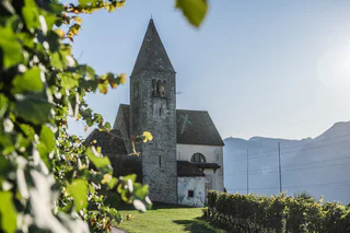
Südtirol Guide App Logo
Přeskočit na obsah

přidáno k oblíbeným

odebráno z oblíbených

Jejda! Došlo k problému, zkuste to prosím znovu

Vytváří se váš účet

Váš účet byl úspěšně vytvořen a nyní jste přihlášeni

Jste úspěšně přihlášeni!

Váš účet byl úspěšně vytvořen, ale nepodařilo se nám vás automaticky přihlásit

Jste odhlášeni

Filtr
Vybrané filtry
    Úroveň obtížnosti
    Doba trvání
    Vzdálenost v km

    Objevte krásy Jižní Tyrolsko Vinná cesta

    Jižní Tyrolsko vinicemi vás okouzlí svými vinicemi a pohostinností.
    Výsledky
    Hiking
    Circular Hike: Kalterer See Lake
    Kaltern an der Weinstraße/Caldaro sulla Strada del Vino, Alto Adige Wine Road

    Route: from the car park at Kalterer See lake, continue north to the Geier restaurant. Behind the restaurant, a narrow trail leads to the north into the orchards. Walk along these and turn off to the right in an easterly direction following the markers. At the slope on the eastern side of the valley, turn right, passing by the hotel on the left to the Klughammer road. First follow this road, then continue on a trail above the road.

    This trail ends at the southern end of the lake. Cross the road to join the Nature Discovery Trail (Naturerlebnisweg). At the end of this nature trail, turn right onto the so-called Kuchlweg trail, hiking to the vineyards on the western side of the valley. Just before the wine road, turn right into the trail through the field, following it until you reach the point where the wine road curves to the right. Cross over and now follow a trail through the field once more. Then follow the footpath next to the wine road to the church of San Giuseppe al Lago/St. Josef am See (Kirche St. Josef). Take the farm track to the right back to the starting point of the hike.

    Obtížnost: nízká
    0 m nadmořská výška
    2h:00 min doba trvání
    Leisure & Experience
    wine tour from Cornaiano to Ronco
    Eppan an der Weinstaße/Appiano sulla Strada del Vino, Alto Adige Wine Road

    short and not hard runnint tour on asphalt and road forest. Ideal throughout the day in
    spring, in summer, in summer morning or late afternoon.

    Obtížnost: střední
    116 m nadmořská výška
    1h:19 min doba trvání
    Mountaineering
    Hiking Tour St. Anton-Göller-Prazoll
    Kaltern an der Weinstraße/Caldaro sulla Strada del Vino, Alto Adige Wine Road

    Moderately difficult mountain-trail with steep sections. Starting- and endpoint: sport area S. Antonio/St. Anton. Walking time: about 7-8 hours. Difference in altitude: about 1230 meters.

    Obtížnost: vysoká
    1200 m nadmořská výška
    7h:00 min doba trvání
    Running & Fitness
    The Cross run
    Kaltern an der Weinstraße/Caldaro sulla Strada del Vino, Alto Adige Wine Road

    Running trail with a beautiful view over the lake, a steep gradient and a demanding serpentine climb. Locals also call this trail the ‘wood biter’.

    Obtížnost: vysoká
    29 m nadmořská výška
    0h:19 min doba trvání
    Summer
    Hiking tour trought the gorge Rastenbach
    Kaltern an der Weinstraße/Caldaro sulla Strada del Vino, Alto Adige Wine Road

    Hiking tour through Rastenbach gorge with some stairs and bridges. Not difficult hiking tour, but with some upgrades. Duration of walking: about 1 ½ hour. Difference of altitude: about 160 meters.  

    Obtížnost: střední
    248 m nadmořská výška
    1h:37 min doba trvání
    Summer
    Hike tour Neuhaus Castle-Montigl-Helfenberg
    Eppan an der Weinstaße/Appiano sulla Strada del Vino, Alto Adige Wine Road

    The hike leads from Terlan via Neuhaus Castle up to the hamlet of Montigl. From the “Moarhof” farm a very steep path leads up to the Helfenberg ruins. From here you go back to Terlan via the same route. Or as an alternative for sure-footed and experienced hikes: path 9 A and path 11 A down to Siebeneich. From there you can take the bus back to Terlan.

    Obtížnost: střední
    697 m nadmořská výška
    2h:34 min doba trvání
    Summer
    Informative wine trail Cortaccia Magrè Cortina
    Kurtatsch an der Weinstraße/Cortaccia sulla Strada del Vino, Alto Adige Wine Road

    The wine teaching trail Cortaccia/Kurtatsch | On the 1.6 km path through the vineyards of Cortaccia, hikers can trace all of the important things that happen over the course of the wine-growing year. You’ll learn about wine cultivation, landscape, and history at a number of different information stations along the way. You can also smell different aromas found in wine. | The wine teaching trail Cortaccia/Kurtatsch | Starting point: The main square of Cortaccia/Kurtatsch | Highest point: 400

    Obtížnost: střední
    194 m nadmořská výška
    1h:15 min doba trvání
    Summer
    A wine and walkers’ paradise: from Auer/Ora to Montan/Montagna
    Auer/Ora, Alto Adige Wine Road

    This walk takes you from Ora, through an idyllic wood, to the wine village of Montagna. The mountainside along which the path winds is particularly famous for the typical vineyards where the best Pinot Noir grapes in South Tyrol grow. Montagna is also the ideal starting point for the magnificent panoramic trail that has been made from the old railway line that led all the way into the Val di Fiemme.

    Obtížnost: nízká
    0 m nadmořská výška
    1h:30 min doba trvání
    Mountaineering
    Hiking tour Mendelpass-Roen
    Kaltern an der Weinstraße/Caldaro sulla Strada del Vino, Alto Adige Wine Road

    Beautiful, not difficult mountain-hiking tour with gentle gradients. Starting point: mountain station of the Mendel Cable Car/Mendel pass. Endpoint: peak Roen (2116 meters). Walking time: about 3.5 hours. Difference in altitude: about 750 meters.

    Obtížnost: střední
    750 m nadmořská výška
    3h:30 min doba trvání
    Summer
    Castel Sallegg wine trail in Caldaro
    Kaltern an der Weinstraße/Caldaro sulla Strada del Vino, Alto Adige Wine Road

    “Good wine begins in the vineyard” – an oft-quoted maxim whose truth is unchallenged.

    Why this is so and what happens in the vineyard is clearly described along the Castel Sallegg wine trail in Caldaro. Panels located in the midst of the vine rows explain all about Alto Adige’s grape varieties and their characteristics, relate the annual vegetation cycle of the vines and tell the history of winegrowing. Those wishing to learn more will find plenty of information about the local climate, geography and terroir. To round off the trail, visitors can visit the cellar and enjoy a wine-tasting session, thus completing the path from the vine via the barrel and into the bottle.

    The starting point of the trail, which is some 350 metres long, is the Rottenburger Platz in the centre of Caldaro. From there it leads up through the vineyard to the inner courtyard of Castel Sallegg. Visitors can follow the trail alone or take part in an individual or a group guided tour: either way you can be sure of acquiring an informative insight into the traditional viticulture of Alto Adige.

    Route: Rottenburger Platz (centre of Caldaro) to Castel Sallegg (30 minutes on foot).
    Opening times: mid-March to mid-November (guided tours only during the ripening season).
    Price: unaccompanied visits are free of charge: guided tours are €9.50 or €16.00 including cellar tour and wine tasting.
    Guided tours: from 1 April to the end of October, followed by cellar visit (except during harvest time) and wine tasting. Guided tours followed by wine tasting can be organized for small and big groups.


    Obtížnost: nízká
    20 m nadmořská výška
    0h:06 min doba trvání
    Hiking
    Hiking tour "Tschirglhöfe"
    Terlan/Terlano, Alto Adige Wine Road

    You start your hike at the church in the center of Terlan. Via the Silberleitenweg you get to Oberkreuth, where you turn right at the fountain, walk 20 m further and then take the Vorbergweg/no°4A to the left up to the Tschirglhöfe. The first path is very steep. Further up the mountain you hike past "Mugger/Zilli" and "Bergrast". You will reach the Möltner road (please pay attention to the traffic), walk downwards for approx. 150 m and turn right onto hiking trail n°4. Where the hiking trail meets the road again, you walk downwards (attention to traffic) for a short while until you turn onto the hiking trail again. After the first 20 m descent, a detour to the left to the "Wetterkreuz" is worthwhile. It is a magnificent viewpoint with the ruins of the 14th-century St.Peter miners' chapel below. The path now leads steeply down to the "Klaus in der Mühl" farm and then leads into Kirchgasse, through which you return to the starting point.

    There is no rest stop on this hike.

    Obtížnost: střední
    452 m nadmořská výška
    2h:17 min doba trvání
    Summer
    Lake Kaltern Path
    Tramin an der Weinstraße/Termeno sulla Strada del Vino, Alto Adige Wine Road

    Varied and easy Trail throw the vineyards till Caldaro lake. Suitable for the whole family. (only one way 5,4km)

    Obtížnost: nízká
    430 m nadmořská výška
    4h:25 min doba trvání
    Summer
    Überetscher walking path to Caldaro
    Eppan an der Weinstaße/Appiano sulla Strada del Vino, Alto Adige Wine Road

    The promenade route was built along the tracks of the former Überetsch railway and is therefore also known as the old railway embankment path. In several places there are benches and playgrounds, which invite you to linger for a while and let off steam.

    Obtížnost: nízká
    9 m nadmořská výška
    2h:22 min doba trvání
    Summer
    Caldaro Wine Trail (Weinweg Kaltern)
    Kaltern an der Weinstraße/Caldaro sulla Strada del Vino, Alto Adige Wine Road

    The Wine Trail is layed out in the form of an "8" and takes you from the village centre, down to the lake and back – past wine vineyards, farms and estates. Ground markings have been laid into the ground so that the hiker is aware of the various vineyard names as he passes by. You will see some of the age-old poetic vineyard names, which date back to either Rhaetian or Romantic origins: "Vial", "Prunar", "Puntara", "Palurisch" …

    Obtížnost: střední
    0 m nadmořská výška
    4h:30 min doba trvání
    Hiking
    St Peter's trail
    Kaltern an der Weinstraße/Caldaro sulla Strada del Vino, Alto Adige Wine Road

    The hike begins at the Altenburg Church above Kaltern. From there, a narrow but well-maintained forest path with a gentle incline leads first to a viewpoint offering a magnificent view over the Adige Valley. The trail is varied and winds through shady mixed forest – a head for heights is recommended in some sections.

    At the viewpoint, turn left onto the St. Peter Trail and follow trail marker No. 2. The path descends in switchbacks through a small gorge. Before long, you'll reach the ruins of the three-nave church of St. Peter, an important relic of early Christian architecture. It is considered possibly the oldest church in Tyrol and is said to have been founded in the 6th century by Saint Vigilius of Trento. The remaining wall paintings by Thomas Egnolt from around 1400 are only fragmentary, but still worth a brief stop.

    From the ruins, the trail continues to the suspension bridge – an exciting section of the tour with a fantastic view into the gorge. The path then climbs gently to a small hill. Soon you’ll reach the Rastenbach Gorge, where a turnoff leads into the gorge and the trail continues uphill. Good footwear is essential here, as the walkways can be damp and slippery in places.

    At the upper end of the gorge, you reach the Müllereck, cross the road, and follow the trail on the left back toward Altenburg. The path winds leisurely through meadows and forest, returning to the Altenburg Church – the starting point of this circular hike.

    Obtížnost: střední
    67 m nadmořská výška
    0h:43 min doba trvání
    Summer
    Hike Andriano - Hocheppan castle - Andriano
    Andrian/Andriano, Alto Adige Wine Road

    Medium-easy exkursion across beautiful deciduous forests. The view to Bolzano and Sciliar is beautiful along the path.

    Obtížnost: střední
    321 m nadmořská výška
    1h:08 min doba trvání
    Summer
    Hiking tour along the ice caves
    Kaltern an der Weinstraße/Caldaro sulla Strada del Vino, Alto Adige Wine Road

    Easy walking path through vineyards and forest. Starting point: piazza Rottenburg/Rottenburger Platz. Final point: ice caves. Duration of walking: about 2 hours. Difference of altitude: about 130 meters.

    Obtížnost: nízká
    274 m nadmořská výška
    1h:13 min doba trvání
    Running & Fitness
    Three lakes trail
    Kaltern an der Weinstraße/Caldaro sulla Strada del Vino, Alto Adige Wine Road

    Impressive trail from Lake Caldaro to both of the Monticolo lakes and back. The excursion cuts across the varied terrain and requires, due to the considerable length, a good physical condition. Not pram-friendly.

    Obtížnost: vysoká
    29 m nadmořská výška
    0h:19 min doba trvání
    Summer
    From Aldino to Pietralba
    Deutschnofen/Nova Ponente, Alto Adige Wine Road

    This beautiful hiking tour leads from Aldino to the place of pilgrimage "Maria Weissenstein/ Pietralba". We go past spectacular viewpoints and the mountain huts "Schmieder Alm" and "Schönrast Alm".

    Obtížnost: nízká
    630 m nadmořská výška
    2h:49 min doba trvání
    Long-Distance Hiking Paths
    Trail c | Montan - Gfrill
    Neumarkt/Egna, Alto Adige Wine Road

    This segment leads from the famed Pinot Noir village of Montan, situated at an elevation of 500 meters above sea-level, to Gfrill at more than 1,300 meters above sea-level. Proceed via the railroad line of the former Fleims Valley railroad until you come to the Glen Waterfall. From there, the trail is uphill via the hamlet of Gsteig (rest-stop, food/drink, and overnight lodgings) towards Gschnon, where there are additional lodging options. You will then take the last part of the route from the Kalkofen parking lot along forest paths and over the Gfrill Saddle until you arrive in Gfrill, the final destination of this segment.

    Helpful hint for this route: Take the little side-trip from Gsteig to the impressive "Kanzel" looming high above the Unterland. You'll be rewarded with a fantastic view!

    Obtížnost: střední
    1159 m nadmořská výška
    4h:28 min doba trvání
    Hiking
    From Passo Mendola to Mezzavia Hut
    Kaltern an der Weinstraße/Caldaro sulla Strada del Vino, Alto Adige Wine Road
    Start: Begin your hike at the Mendel Pass, following the wide trail toward the Enzian Hut. The path is well-marked and easy to walk. After passing the Enzian Hut, the trail continues into the forest, where you’ll encounter a gentle uphill climb.
    The wide trail remains pleasant, offering beautiful views of the surroundings. After passing the chairlift, you’ll reach the Halbweghütte, your destination. The route is 3.5 km long, takes about 1 hour and 20 minutes, and includes an elevation gain of 240 meters. This hike is perfect for families
    Obtížnost: nízká
    241 m nadmořská výška
    1h:30 min doba trvání
    Summer
    The Pinot Noir Trail
    Auer/Ora, Alto Adige Wine Road

    The Pinot Noir Trail in the south of South Tyrol is a new educational path where you can learn more about our land’s culture and its wines. It winds through the famed Pinot Noir vineyards and along the Trudner Horn Nature Park. It starts at the quaint villages of Auer, Montan, and Neumarkt in the Unterland district and leads you through Italy’s best Pinot Noir terroirs in Mazon, Glen, and Pinzon. You can choose between a 16-km-long one-day outing or three half-day tours.
    Along the way, hikers and strollers will encounter various historical spots and cultural highlights – e.g., the significant archeological sites of Castelfeder, the oldest segment of the Fiemme Valley railway, St. Stephan’s Church in Pinzon with its late-Gothic Altar by the Master Hans Klocker, the idyllic St. Michael’s Church in Mazon, the ruins of Kaldiff, and the handsome Enn Castle. Along the way, information panels and interactive stations will help you learn more about this unique wine-growing area and its history. You’ll be rewarded with stunning views of the Unterland district. The differences in elevation shouldn’t be a problem as most of the route is relatively level. But there’s a lot to explore and discover, for young and old alike! It’s easy, comfortable, and suitable for
    families. The route is open 12 months a year. A red “B” will lead the way.

    Obtížnost: střední
    607 m nadmořská výška
    4h:49 min doba trvání
    Mountaineering
    Überetscher Hütte - Roen (Klettersteig)
    Tramin an der Weinstraße/Termeno sulla Strada del Vino, Alto Adige Wine Road

    From the festival place the via Molino up, to the forest road. The wood sign “Gummererhof” points us the direction. Starting from the “Gummerhof” moving way nr. 10 to the steep “Weiße Rissen” and the “Kleinen Göller” (water place), left up to the marking T from Termeno, leads into our moving way. Through seal coniferous forest, way nr. 523, further, past at the hunter hut, up to the waterfall, then 20 min. laborious rise to the “Rifugio Oltradige – Überetscher Hütte” (mountain inn).

    To reach the peak of Roen from the „Überetscher Hütte“ there exist two variants:
    1) for those who are ambitious and doesn’t suffer from vertigo: via ferrata (marking 523), to the peak of Roen (2116m above sea level), then down through meadows (marking 500) to the mountain pasture of Roen, and again to the „Überetscher Hütte“.
    2) The marking 10/560 in the northward direction until the mountain pasture of Roen and over the trail (marking 500) to the Roen. The way back to the Passo della Mendola or descend through the „Tauris“ (marking 10A) direct to Tramin.

    Obtížnost: střední
    2610 m nadmořská výška
    8h:18 min doba trvání
    Summer
    Hike Gaid Festenstein Castle Gaid
    Andrian/Andriano, Alto Adige Wine Road

    Short hike to the Festenstein castle ruins. Check the opening days. Experience a moment of freedom in the historic buildings of Festenstein walls and enjoy a spectacular panoramic view of the Adige Valley there.

    Obtížnost: střední
    205 m nadmořská výška
    0h:45 min doba trvání
    Horses
    Oltradige riding club
    Eppan an der Weinstaße/Appiano sulla Strada del Vino, Alto Adige Wine Road

    At the beginning of the forest of Monticolo, there is a signpost that indicates the horse riding association “Überetscher Reitverein”. This is where you can find more than 60 mews for horses, that are treated and cared for in a species-appropriate manner. For adults and children the riding club offers the possibility to get in direct contact with the horses. Horse riding lessons and longer rides can be booked, as the surroundings are perfect to be discovered on the horseback.

    Obtížnost: střední
    0 m nadmořská výška
    0h:00 min doba trvání
    Long-Distance Hiking Paths
    Trail c | Gfrill - Montan
    Neumarkt/Egna, Alto Adige Wine Road

    This segment leads from the village of Gfrill (1,300 meters elevation) to Montan (500 meters above sea-level). At the beginning, the route is slightly uphill via the Gfrill Saddle and then downhill until you reach Gschnon (good place to stop for a rest). You will then ascend via Gsteig (option for refreshments and overnight lodgings) and down to the impressive Glen Waterfall. You will then take the last part along the old railroad route of the former Fleims Valley railroad to the famed Pinot Noir village of Montan.

    Helpful hint for this route: Take the little side-trip from Gsteig to the impressive "Kanzel" looming high above the Unterland district. You'll be rewarded with a fantastic view!


    Obtížnost: střední
    376 m nadmořská výška
    3h:28 min doba trvání
    Horses
    carriage ride
    Eppan an der Weinstaße/Appiano sulla Strada del Vino, Alto Adige Wine Road

    A carriage ride through the Eppaner landscape with wine tasting.
    10 am: Meeting point Tourist office Eppan
    Duration 2-3 hours
    Costs€ 18 adults, € 8 Children (2-12 years)
      Registration at the tourist office

    Obtížnost: střední
    0 m nadmořská výška
    3h:00 min doba trvání
    Summer
    Terlano's Wine Path (Terlaner Weinweg)
    Terlan/Terlano, Alto Adige Wine Road

    In Terlan you will find a "wine path" running through the upper Terlan area.
    Already existing roads and hiking paths are combined into a theme walk through the vineyards of Terlan.
    From numerous signs you can learn interesting facts about Terlan’s winemaking history and culture. Following the information boards along the path, you will enter vineyards at various altitudes and with different climatic conditions, see the varieties grown in the area and the vine training systems, and be introduced to soil and quality management.
    The accompanying brochure is available at the tourist office or at Terlan's winery.

    Obtížnost: nízká
    144 m nadmořská výška
    1h:51 min doba trvání
    Summer
    Pinot Noir Walkway - alternative route: Neumarkt/Egna - Mazon/Mazzon - Neumarkt/Egna
    Neumarkt/Egna, Alto Adige Wine Road
    The Pinot Noir walkway leads through the Pinot Nor growing area along the Trudner Horn/Monte Corno Nature Park and the characteristic villages of Auer/Ora, Montan/Montagna and Neumarkt/Egna. The Pinot Noir growing area in Montan and Mazon/Mazzon is one of the most famous in Italy. Furthermore you walk through several monuments and historical places. The walkway is family-friendly and not dangerous.
    Obtížnost: nízká
    228 m nadmořská výška
    1h:33 min doba trvání
    Summer
    Brenntalweg to Kurtatsch
    Tramin an der Weinstraße/Termeno sulla Strada del Vino, Alto Adige Wine Road
    Through the vineyards to Kurtatsch

    We hike to the wine road - junction Neumarkt/Kurtatsch and after 30 m turn left into the Brenntalweg. Follow this asphalted road for about 3 km. Continue straight on and you will see signs for the "Millastiege". We follow these and climb up through the rocks to the wine road before the village of Kurtatsch.

    For the way back we take the hiking trail Kastelaz or the less frequented panoramic road via Rungg. You will find the corresponding signs in the village of Kurtatsch.
    Obtížnost: nízká
    434 m nadmořská výška
    2h:43 min doba trvání