1/11
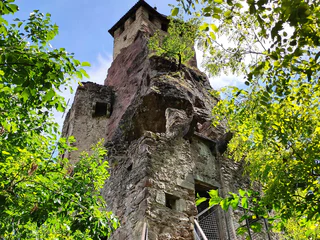
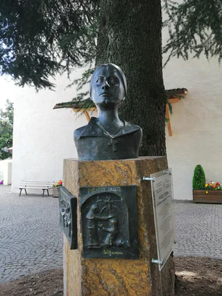
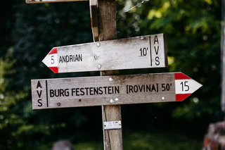
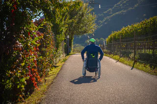
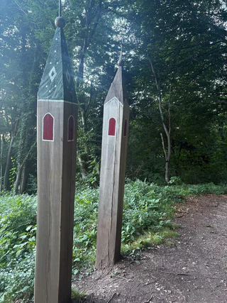
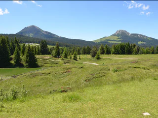
Hike Gaid Festenstein Castle Gaid
Andriano/Andrian, Andrian/Andriano, Alto Adige Wine Road
medium
Obtížnost
205 m
Převýšení
0h:45 min
doba trvání
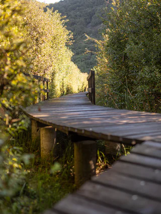
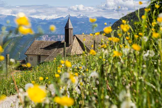
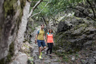
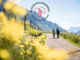
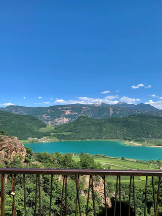
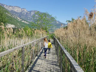
Obujte si turistické boty a prozkoumejte krajinu podél jihotyrolské vinařské stezky. Tyto tipy na výlety vás zavedou po klikatých cestách, přes malebné vinice a půvabné vesničky až na bezstarostná panoramatická místa. Od nenáročných procházek až po náročné túry - každý si zde najde doslova to své. Dokonalá kombinace požitku z přírody a kultury při vychutnávání místních vín a vřelé pohostinnosti charakterizuje Jihotyrolskou vinařskou stezku jako turistickou oblast pro znalce.
1/11
Andriano/Andrian, Andrian/Andriano, Alto Adige Wine Road
medium
Obtížnost
205 m
Převýšení
0h:45 min
doba trvání

Caldaro Campi al lago/Kalterer Klughammer, Kaltern an der Weinstraße/Caldaro sulla Strada del Vino, Alto Adige Wine Road
easy
Obtížnost
307 m
Převýšení
2h:38 min
doba trvání
Riva di Sotto/Unterrain, Eppan an der Weinstaße/Appiano sulla Strada del Vino, Alto Adige Wine Road
medium
Obtížnost
697 m
Převýšení
2h:34 min
doba trvání
1/7
Caldaro Paese/Kaltern Dorf, Kaltern an der Weinstraße/Caldaro sulla Strada del Vino, Alto Adige Wine Road
easy
Obtížnost
0 m
Převýšení
2h:00 min
doba trvání
1/12
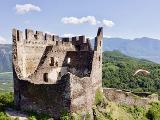
Castelvecchio/Altenburg, Kaltern an der Weinstraße/Caldaro sulla Strada del Vino, Alto Adige Wine Road
medium
Obtížnost
837 m
Převýšení
3h:00 min
doba trvání
Cortina s.s.d.V./Kurtinig, Kurtinig an der Weinstraße/Cortina sulla Strada del Vino, Alto Adige Wine Road
medium
Obtížnost
382 m
Převýšení
2h:43 min
doba trvání
1/4
Caldaro Campi al lago/Kalterer Klughammer, Kaltern an der Weinstraße/Caldaro sulla Strada del Vino, Alto Adige Wine Road
medium
Obtížnost
434 m
Převýšení
2h:28 min
doba trvání
1/5
Gand/Ganda - Eppan/Appiano, Eppan an der Weinstaße/Appiano sulla Strada del Vino, Alto Adige Wine Road
easy
Obtížnost
444 m
Převýšení
2h:00 min
doba trvání
1/12
Egna/Neumarkt, Neumarkt/Egna, Alto Adige Wine Road
easy
Obtížnost
332 m
Převýšení
1h:40 min
doba trvání
Ora/Auer, Auer/Ora, Alto Adige Wine Road
easy
Obtížnost
0 m
Převýšení
1h:30 min
doba trvání
1/7
Ora/Auer, Auer/Ora, Alto Adige Wine Road
easy
Obtížnost
151 m
Převýšení
1h:42 min
doba trvání
1/13
Avenes/Afens, Andrian/Andriano, Alto Adige Wine Road
medium
Obtížnost
726 m
Převýšení
3h:22 min
doba trvání
Sella/Söll, Tramin an der Weinstraße/Termeno sulla Strada del Vino, Alto Adige Wine Road
easy
Obtížnost
430 m
Převýšení
4h:25 min
doba trvání
1/3
St. Josef am See/S. Giuseppe al Lago, Kaltern an der Weinstraße/Caldaro sulla Strada del Vino, Alto Adige Wine Road
easy
Obtížnost
10 m
Převýšení
0h:49 min
doba trvání
1/4
Ora/Auer, Auer/Ora, Alto Adige Wine Road
medium
Obtížnost
607 m
Převýšení
4h:49 min
doba trvání
1/2
Tramin an der Weinstraße/Termeno sulla Strada del Vino, Alto Adige Wine Road
easy
Obtížnost
261 m
Převýšení
2h:30 min
doba trvání
Laghetti/Laag, Neumarkt/Egna, Alto Adige Wine Road
difficult
Obtížnost
1492 m
Převýšení
7h:49 min
doba trvání
1/6
Missiano/Missian, Eppan an der Weinstaße/Appiano sulla Strada del Vino, Alto Adige Wine Road
medium
Obtížnost
373 m
Převýšení
1h:45 min
doba trvání
Pochi/Buchholz, Salorno/Salurn, Alto Adige Wine Road
medium
Obtížnost
933 m
Převýšení
3h:04 min
doba trvání
1/3
St. Nikolaus/S. Nicolò - Kaltern/Caldaro, Kaltern an der Weinstraße/Caldaro sulla Strada del Vino, Alto Adige Wine Road
medium
Obtížnost
480 m
Převýšení
3h:00 min
doba trvání
1/3
Tramin an der Weinstraße/Termeno sulla Strada del Vino, Alto Adige Wine Road
medium
Obtížnost
776 m
Převýšení
4h:40 min
doba trvání
Magrè s.S.d.V./Margreid a.d.W., Kurtatsch an der Weinstraße/Cortaccia sulla Strada del Vino, Alto Adige Wine Road
medium
Obtížnost
0 m
Převýšení
1h:04 min
doba trvání
Vilpiano/Vilpian, Terlan/Terlano, Alto Adige Wine Road
medium
Obtížnost
580 m
Převýšení
4h:50 min
doba trvání
1/5
Magrè s.S.d.V./Margreid a.d.W., Kurtinig an der Weinstraße/Cortina sulla Strada del Vino, Alto Adige Wine Road
easy
Obtížnost
0 m
Převýšení
1h:11 min
doba trvání
Magrè s.S.d.V./Margreid a.d.W., Margreid an der Weinstraße/Magrè sulla Strada del Vino, Alto Adige Wine Road
medium
Obtížnost
1058 m
Převýšení
3h:38 min
doba trvání
1/14
Laghetti/Laag, Neumarkt/Egna, Alto Adige Wine Road
difficult
Obtížnost
1992 m
Převýšení
9h:31 min
doba trvání
1/2
Obereggen/Obereggen, Deutschnofen/Nova Ponente, Alto Adige Wine Road
medium
Obtížnost
160 m
Převýšení
2h:00 min
doba trvání
Laag/Laghetti, Neumarkt/Egna, Alto Adige Wine Road
easy
Obtížnost
19 m
Převýšení
0h:43 min
doba trvání
1/6
S. Giuseppe al Lago/St. Josef am See, Kaltern an der Weinstraße/Caldaro sulla Strada del Vino, Alto Adige Wine Road
easy
Obtížnost
0 m
Převýšení
2h:00 min
doba trvání
1/6
Caldaro Paese/Kaltern Dorf, Kaltern an der Weinstraße/Caldaro sulla Strada del Vino, Alto Adige Wine Road
medium
Obtížnost
0 m
Převýšení
3h:00 min
doba trvání


