Přeskočit na obsah

přidáno k oblíbeným

odebráno z oblíbených

Jejda! Došlo k problému, zkuste to prosím znovu

Vytváří se váš účet

Váš účet byl úspěšně vytvořen a nyní jste přihlášeni

Jste úspěšně přihlášeni!

Váš účet byl úspěšně vytvořen, ale nepodařilo se nám vás automaticky přihlásit

Jste odhlášeni

Filtr
Vybrané filtry
    Úroveň obtížnosti
    Doba trvání
    Vzdálenost v km

    Pěší túry po jihotyrolská vinařská stezka

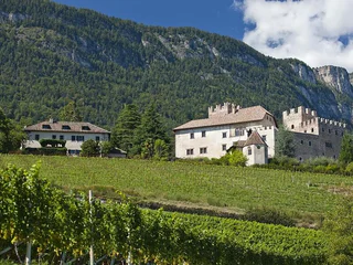
    Obujte si turistické boty a prozkoumejte krajinu podél jihotyrolské vinařské stezky. Tyto tipy na výlety vás zavedou po klikatých cestách, přes malebné vinice a půvabné vesničky až na bezstarostná panoramatická místa. Od nenáročných procházek až po náročné túry - každý si zde najde doslova to své. Dokonalá kombinace požitku z přírody a kultury při vychutnávání místních vín a vřelé pohostinnosti charakterizuje Jihotyrolskou vinařskou stezku jako turistickou oblast pro znalce.


    Výsledky
    Hiking
    Trail d | Gfrill - Altrei
    The South Tyrolean Wine Road

    On this segment, you will proceed first from Gfrill to the bogland lakes of the "Weiss" and the "Schwarz." From there, the route continues to the Horn-Alm, the highest point of the segment. Hikers can stop here for refreshments and then continue downhill via the Ziss Saddle – not far from there, you can admire the stunning "huckete Stoan," a free-standing erratic boulder made of porphyry the size of a house – until you come to Altrei.

    Obtížnost: střední
    467 m nadmořská výška
    3h:42 min doba trvání
    Hiking
    Trough the Nature Park San Lugano - Neumarkt/Egna
    Truden/Trodena, The South Tyrolean Wine Road
    San Lugano (1097 m) - Trudner Bergwiesen - Paraschupf (1428 m) - Langes Moos (1448 m) - Malga/Krabesalm (1539 m) - Zissattel (1452 m) - Malga Corno/Hornalm (1707 m) - Weißensee (1680 m) - Gfrillner Sattel (1408 m) - Gstoagerhof (889 m) - Mazon/Mazzon (365 m) - Neumarkt/Egna (257 m)
    Obtížnost: vysoká
    963 m nadmořská výška
    6h:35 min doba trvání
    Hiking
    Buchholz trail
    Salorno/Salurn, The South Tyrolean Wine Road

    From the village center, proceed to the sculpture garden where you can view various fascinating sculptures made of different materials. You can then continue through the splendid natural landscape until you come to the Niedere-Höfe Trail. You will pass by the Perkeo Restaurant and then through the village back to the starting-point. This is an easy stroll through the romantic natural surroundings and culture of Buchholz.

    Obtížnost: nízká
    119 m nadmořská výška
    0h:43 min doba trvání
    Hiking
    Trail b1 | Aldein - Gfrill
    Aldein/Aldino, The South Tyrolean Wine Road

    This challenging segment leads from Aldein via the Cislon to Gschnon and on to Gfrill. You will proceed along pleasant trails and come first to Holen, then past it to the Aldein Bridge (known as the "Little European Bridge" when first built in the 1960s). Here there are various refreshment options. And provided that you have the necessary physical fitness, you can then continue on upwards to the Cisloner Alm. A quite challenging part of the trail is over the Reiterböden. Later, you will proceed to Mühlen (option for rest-stop, refreshments, and overnight lodgings). You can then continue over a short stretch over an asphalt road and uphill to the hamlet of Gschnon (option for rest-stop, food/drink, and overnight lodgings). After that, there's a somewhat more-comfortable segment over pleasant forest paths and the Gfrill Saddle until you come to Gfrill.

    Obtížnost: vysoká
    1601 m nadmořská výška
    7h:57 min doba trvání
    Hiking
    Trail f2 | Radein - Jochgrimm - Schwarzhorn
    The South Tyrolean Wine Road

    This segment begins in Oberradein. Follow the Zirmersteig staircase uphill through the increasingly sparce high-alpine vegetation until you come to the Weisshorn (2,317 meters above sea-level). Here you can enjoy the fabulous panoramic view before embarking on the return trip down to the Jochgrimm. There are various refreshment options as well as plenty of opportunity to admire the very diverse flora of the alpine meadows. After a short breather, the segment goes up to the Schwarzhorn (2,439 m above sea-level).

    Obtížnost: vysoká
    1263 m nadmořská výška
    4h:34 min doba trvání
    Hiking
    Frühlingstal
    Kaltern an der Weinstraße/Caldaro sulla Strada del Vino, The South Tyrolean Wine Road

    Itinerary: A phenomenon that attracts visitors from all over South Tyrol, happens in Spring Valley between the two Laghi di Monticolo/Montiggl Lakes and Lago di Caldaro/Caldaro Lake: Yellow primrose, white daffodils, violet liverleaf, blue crocuses and primroses are stretching towards the sky - a colorful natural patchwork pleases everyone after the harsh winter days. Right in the middle there is as well the peaceful little Angel stream meandering southward. Best time to enjoy it is between mid February to late March.

    From the car park the walk goes across the narrow strip of asphalt (not the main street) right down to the hamlet Monticolo/Montiggl. In the village it turns right in front of the church and follow the small asphalt street for 20 minutes through orchards and then through the forest to a crossroads. After 50 meters the Spring Valley is at the left. Going right the walk ends at Lago di Caldaro/Kaltern Lake passing through the lower part of the Spring Valley. However, on the left the walk goes up through the lovely valley following the signs to the asphalt street.

    Obtížnost: střední
    200 m nadmořská výška
    3h:00 min doba trvání
    Hiking
    Hike Gaid Festenstein Castle Gaid
    Andrian/Andriano, The South Tyrolean Wine Road

    Short hike to the Festenstein castle ruins. Check the opening days. Experience a moment of freedom in the historic buildings of Festenstein walls and enjoy a spectacular panoramic view of the Adige Valley there.

    Obtížnost: střední
    205 m nadmořská výška
    0h:45 min doba trvání
    Hiking
    Trail b | Montan – Aldein
    Montan/Montagna, The South Tyrolean Wine Road

    On this segment, you will proceed from the famed Pinot Noir village of Montan uphill to Aldein – from 500 meters up to 1,200 meters above sea-level. At the beginning of the segment, you will take the "Wine Forest Water" Trail and pass by the Enn Castle and the Elsenhof farmstead which belongs to it. You will then proceed along the old tracks and through the spruce forests (common here on the southwest flank of the Cislon) and farther to the Aldein Bridge (known as the "Little European Bridge" when first built in the 1960s). This is a good opportunity for hikers to make a rest-stop and/or get some refreshments. You will then proceed to the hamlet of Holen and on to Aldein.

    Obtížnost: střední
    980 m nadmořská výška
    3h:51 min doba trvání
    Hiking
    Pinot Noir Walkway - alternative route: Montan/Montagna - Glen/Gleno - Montan/Montagna
    Montan/Montagna, The South Tyrolean Wine Road

    The Pinot Noir walkway leads through the Pinot Nor growing area along the Trudner Horn/Monte Corno Nature Park and the characteristic villages of Auer/Ora, Montan/Montagna and Neumarkt/Egna. The Pinot Noir growing area in Montan and Mazon/Mazzon is one of the most famous in Italy. Furthermore you walk through several monuments and historical places. The walkway is family-friendly and not dangerous.

    Obtížnost: nízká
    140 m nadmořská výška
    1h:10 min doba trvání
    Hiking
    Trail e | Truden - Altrei
    The South Tyrolean Wine Road

    This route will lead you through the Truden Horn Nature Park from the multi-faceted alpine village of Truden all the way to the charming little village of Altrei. The trail is first uphill to the Krabes-Alm, at an elevation of 1,540 meters above sea-level; this is a good place to stop for a short rest. You will then proceed along a forest trail until you come to the high-altitude bog of "Langes Moos." Then you can return to Altrei via an old cobblestone path.

    Obtížnost: střední
    429 m nadmořská výška
    2h:55 min doba trvání
    Hiking
    From Radein/Redagno to Weißhorn/Corno Bianco
    Aldein/Aldino, The South Tyrolean Wine Road
    On the Weißhorn, with impressive views of the GEOPARC Bletterbach World Natural Heritage Site and the surrounding Dolomite peaks. The surroundings of the Weißhorn, the local mountain of the Unterland, are geologically extremely interesting. A blanket of white shell limestone scree (glacial deposit) characterises the picture. Botanically, the area can also hold its own.
    Obtížnost: střední
    768 m nadmořská výška
    3h:45 min doba trvání
    Hiking
    From “Garbe” to Buchholz/Pochi di Salorno
    Kurtinig an der Weinstraße/Cortina sulla Strada del Vino, The South Tyrolean Wine Road

    With this excursion you reach the Pochi di Salorno sculpture garden. This “garden of desires” brings together the works of sculptor Tatz-Borgogno in a small deciduous wood. "Freedom and harmony amongst art and nature" is the motto that the artist has used to accompany the creation and installation of more than 200 sculptures in bronze and marble in the garden.

    Obtížnost: střední
    382 m nadmořská výška
    2h:43 min doba trvání
    Hiking
    Unterradein/Redagno di Sotto - Schwarzhorn/Corno Nero
    Aldein/Aldino, The South Tyrolean Wine Road
    The Weißhorn and Schwarzhorn are the two southernmost horns of the Dolomites. They are characterised by a wonderful mountain silhouette, pyramid-shaped. They belong to the local mountains of the Unterland and are known for their 360-degree distant views. Whether King Ortles, Brenta Dolomites, Lagorai Group or Schlern-Rosengarten: from here you can see them all! The Schwarzhorn is quite unjustly overshadowed by its actually "smaller brother", the Weihorn. 

    Why actually white and black? The "Trudner Line" runs through here, the geological fault line between porphyry and dolomite rock. Borders merge in this area in the tension between languages, cultures, the mediterranean south and the alpine north. A delight of enriching contrasts!
    Obtížnost: vysoká
    1246 m nadmořská výška
    6h:30 min doba trvání
    Hiking
    Trail f | Jochgrimm - Schwarzhorn - Truden
    Aldein/Aldino, The South Tyrolean Wine Road

    This challenging hike begins from the Jochgrimm. You then have to master approx. 500 meters of altitude-differential until you come to the Schwarzhorn (2,439 meters above sea-level). The trail then leads you around and down the other side of the Schwarzhorn until you come to the Kugeljoch; from this pass, you have a magnificent panoramic view of the Fleims Valley. You can now proceed down the "Leitensteig" staircase until you reach the Kaltenbrunn "Ice Holes," where it's pleasantly cool even in the summertime. From Kaltenbrunn (where hikers will find a number of refreshment options and also access to public transportation), there is still a short segment slightly uphill to Truden. This is a uniquely beautiful hike and is – in spite of the level of difficulty – an absolute "must" for ambitious hikers.

    Obtížnost: vysoká
    892 m nadmořská výška
    4h:43 min doba trvání
    Hiking
    Trail c1 | Montan - Altrei
    Altrei/Anterivo, The South Tyrolean Wine Road

    This challenging segment leads from the famed Pinot Noir village of Montan all the way to Altrei. This alpine village is situated at an elevation of almost 1,200 meters above sea-level. From Montan, the route leads via the old railroad route of the former Fleims Valley railroad, on past the Glen Waterfall, up to the hamlet of Gsteig (option for food/drink and overnight lodgings). Then, from the Kalkofen parking lot, you will take the steep uphill route to the Hackelboden forest hut (not managed!) and on to the Horn-Alm (which is managed), the highest point of this segment. After a short pause (option for food/drink and overnight lodgings), you continue downhill along an easy path via the Ziss Saddle. You might want to stop at the Kneipp hydro-therapeutic station on your way to Altrei.

    Helpful hint for this route: Take the little side-trip from Gsteig to the impressive "Kanzel" looming high above the Unterland district. You'll be rewarded with a fantastic view!

    Obtížnost: vysoká
    1402 m nadmořská výška
    5h:31 min doba trvání
    Hiking
    Altrei tour
    Altrei/Anterivo, The South Tyrolean Wine Road

    The Altrei tour will take you through extensive larch meadows - the result of clearing land of all the other species of trees while still preserving the larches, thus leading to a low-density population of trees which are then tended and cared for. You continue along the Legend and Breathing Trail to the Fraul-Alm and then to the "Kugelets Mösl." The tour then continues through the Guggal neighborhood and back to the starting-point in the village square. There are several convenient rest-stops with refreshment options along the way – plus the magnificent scenery always at your side.

    Obtížnost: nízká
    221 m nadmořská výška
    2h:01 min doba trvání
    Hiking
    Trail f | Truden - Schwarzhorn - Jochgrimm
    The South Tyrolean Wine Road

    This challenging hike from Truden via the Schwarzhorn and all the way to the Jochgrimm is a unique adventure. From Truden, you'll first proceed uphill to Kaltenbrunn (refreshment stop and access to public transportation). From here, you can then proceed to the famous "Ice Holes" – an unusual phenomenon where cold air streams out of holes in the ground even on the hottest days of summer. You will then proceed steadily uphill via the challenging "Leitensteig" staircase until you come to the Kugeljoch; from this pass, you have a magnificent panoramic view of the Fleims Valley. From the Kugeljoch, you will continue to the Schwarzhorn (2,439 meters above sea-level). Finally, you follow the descending path to the Jochgrimm, the goal of this tour. This hike offers a wealth of unique natural beauty and is – in spite of the level of difficulty – an absolute "must" for ambitious hikers.

    Obtížnost: vysoká
    1716 m nadmořská výška
    6h:05 min doba trvání
    Hiking
    Trail b | Aldein - Montan
    Montan/Montagna, The South Tyrolean Wine Road

    On this segment, you will proceed from Aldein uphill to Montan. At first, you can proceed along a relatively relaxing trail until you reach Holen. From there, it gets steeper until you reach the Aldein Bridge (known as the "Little European Bridge" when first built in the 1960s). This is a good opportunity to make a rest-stop and/or get some refreshments. You then continue along the former route of the Fleims Valley railroad, through spruce forests (common here on the southwest flank of the Cislon). Just before arriving at Montan, you'll pass by the Elsenhof farmstead and the impressive Enn Castle. Then, continue via the "Wine Forest Water" Trail to the center of the village of Montan, famed for its Pinot Noir, at an elevation of 500 meters above sea-level. This is the end of the route.

    Obtížnost: střední
    246 m nadmořská výška
    2h:55 min doba trvání
    Hiking
    Hiking tour Mendelpass - Roen
    Kaltern an der Weinstraße/Caldaro sulla Strada del Vino, The South Tyrolean Wine Road

    Beautiful, not difficult mountain hiking tour with some grades. Starting point: mountain station of the Mendel Cable Car. Final Point: pic Roen, 2116 meters. Duration of walking: about 3.5 hours. Different of altitude: about 750 meters. 

    Obtížnost: střední
    837 m nadmořská výška
    3h:00 min doba trvání
    Hiking
    Jochgrimm - Oclini - Hörner Tour
    Aldein/Aldino, The South Tyrolean Wine Road

    The Hörner Tour begins at the parking lot in Jochgrimm – there are several refreshment options there. This hike will take you to the Weisshorn and then back to the starting-point. Afterwards, you can climb the Schwarzhorn. The "Hörner" ("horns") can, of course, be climbed in the reverse order. This is a challenging hike – offering extraordinary and spectacular views.

    Obtížnost: vysoká
    1304 m nadmořská výška
    5h:34 min doba trvání
    Hiking
    Trail e | Altrei - Truden
    Truden/Trodena, The South Tyrolean Wine Road

    On this segment, you will proceed through the Truden Horn Nature Park from the picturesque little village of Altrei to the multi-faceted alpine village of Truden. You will begin on an old cobblestone trail to the high-altitude bog of "Langes Moos." The trail continues upwards via the forest trail until you come to the Krabes-Alm at an elevation of 1,540 meters above sea-level. This is a good opportunity to stop for a rest. The trail continues through the Truden Horn Nature Park and then downhill to the village of Truden.

    Obtížnost: střední
    372 m nadmořská výška
    2h:51 min doba trvání
    Hiking
    From Gschnon/Casignano to Trudner Horn
    Neumarkt/Egna, The South Tyrolean Wine Road
    This hike leads through the Trudner Horn Nature Park, a natural jewel with diverse animal and plant life.
    Obtížnost: vysoká
    764 m nadmořská výška
    3h:45 min doba trvání
    Hiking
    Trail b1 | Cauria – Aldino
    Neumarkt/Egna, The South Tyrolean Wine Road

    This challenging segment leads from Gfrill / Cauria (1,330 meters above sea-level) via the hamlet of Gschnon / Casignano and the Cisloner Alm and to Aldein (1,200 meters above sea-level). At the beginning, the route is uphill via the Gfrill Saddle until you reach Gschnon (option for rest-stop, food/drink, and overnight lodgings). From there, you will continue over the asphalt road uphill until you come to Mühlen / Molini (again: option for food/drink and overnight lodgings). After that, it's a rather steep path up to the Cisloner Alm. From here, you will proceed downhill until you reach the Aldein Bridge (known as the "Little European Bridge" when built back in the 1960s). This is a good spot to make a rest-stop (lodgings also available). You can then continue via Holen / Olmi until your come to Aldein / Aldino.


    Obtížnost: vysoká
    1492 m nadmořská výška
    7h:49 min doba trvání
    Hiking
    Trail c | Montan - Gfrill
    Neumarkt/Egna, The South Tyrolean Wine Road

    This segment leads from the famed Pinot Noir village of Montan, situated at an elevation of 500 meters above sea-level, to Gfrill at more than 1,300 meters above sea-level. Proceed via the railroad line of the former Fleims Valley railroad until you come to the Glen Waterfall. From there, the trail is uphill via the hamlet of Gsteig (rest-stop, food/drink, and overnight lodgings) towards Gschnon, where there are additional lodging options. You will then take the last part of the route from the Kalkofen parking lot along forest paths and over the Gfrill Saddle until you arrive in Gfrill, the final destination of this segment.

    Helpful hint for this route: Take the little side-trip from Gsteig to the impressive "Kanzel" looming high above the Unterland. You'll be rewarded with a fantastic view!

    Obtížnost: střední
    1159 m nadmořská výška
    4h:28 min doba trvání
    Hiking
    Trail c | Gfrill - Montan
    Neumarkt/Egna, The South Tyrolean Wine Road

    This segment leads from the village of Gfrill (1,300 meters elevation) to Montan (500 meters above sea-level). At the beginning, the route is slightly uphill via the Gfrill Saddle and then downhill until you reach Gschnon (good place to stop for a rest). You will then ascend via Gsteig (option for refreshments and overnight lodgings) and down to the impressive Glen Waterfall. You will then take the last part along the old railroad route of the former Fleims Valley railroad to the famed Pinot Noir village of Montan.

    Helpful hint for this route: Take the little side-trip from Gsteig to the impressive "Kanzel" looming high above the Unterland district. You'll be rewarded with a fantastic view!


    Obtížnost: střední
    376 m nadmořská výška
    3h:28 min doba trvání
    Hiking
    Cauria trail
    Neumarkt/Egna, The South Tyrolean Wine Road

    The Pichl is the starting-point for the Gfrill Village Route. From here, you continue to Unterstein and then along the cableway trail until you come to the remains of an abandoned cableway. From here, the Berger Trail will take you to the Old Gfrill Road. Continue along it until your get back to your starting-point at the Pichl.

    Obtížnost: nízká
    528 m nadmořská výška
    2h:38 min doba trvání
    Hiking
    Trail c1 | Altrei - Montan
    Altrei/Anterivo, The South Tyrolean Wine Road

    This challenging segment leads from the alpine village of Altrei to the famed Pinot Noir village of Montan – from 1,200 meters down to 500 meters above sea-level. From Altrei, the route continues uphill via the Ziss Saddle all the way to the Horn-Alm (managed) with a wonderful view, at an altitude of more than 1,700 meters above sea-level – the highest point of this segment. From here, the trail is almost totally downhill. The next segment will take you to the Hackelboden forest hut (not managed!) and on to the hamlet of Gsteig (option for food/drink and overnight lodgings). You will then pass by the roaring Glen Waterfall via the former Fleims Valley railroad and on to Montan.

    Helpful hint for this route: Take the little side-trip from Gsteig to the impressive "Kanzel" looming high above the Unterland district. You'll be rewarded with a fantastic view!

    Obtížnost: střední
    641 m nadmořská výška
    4h:34 min doba trvání
    Hiking
    Jochgrimm Oclini - trail of alps
    Aldein/Aldino, The South Tyrolean Wine Road

    From the Jochgrimm parking lot, you proceed through the idyllic natural landscape of Jochgrimm. During this roundtrip tour, you will pass by several hosted alpine inns where you obtain refreshments and rest before continuing your hike.

    Obtížnost: nízká
    157 m nadmořská výška
    1h:25 min doba trvání
    Hiking
    From St. Michael to the Montiggl lakes
    Eppan an der Weinstaße/Appiano sulla Strada del Vino, The South Tyrolean Wine Road

    Hiking tour from the center of St. Michael | Eppan to the Montiggl lakes.

    TIP: Go for a swim in one of the lakes and return to the starting point with the lake & hiking bus which runs from mid-June to early September.

    Obtížnost: střední
    312 m nadmořská výška
    3h:53 min doba trvání
    Hiking
    From Girlan to MMM Firmian
    Eppan an der Weinstaße/Appiano sulla Strada del Vino, The South Tyrolean Wine Road

    Easy to moderately difficult hike along pleasant hiking trails, through brushwood and past vineyards to the Messner Mountain Museum Firmian.

    Obtížnost: střední
    366 m nadmořská výška
    2h:22 min doba trvání
    1 2 3 4 5