1/2
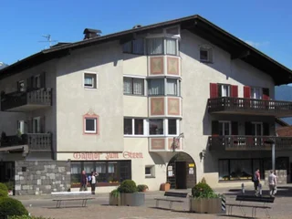
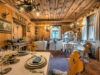
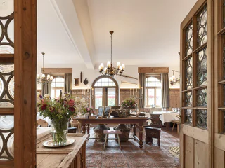
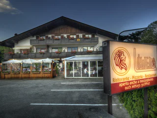
Albergo Zum Stern
Riomolino/Mühlbach - Lagundo/Algund, Algund/Lagundo, Meran/Merano and environs
1/2
Riomolino/Mühlbach - Lagundo/Algund, Algund/Lagundo, Meran/Merano and environs

Algund/Lagundo, Meran/Merano and environs
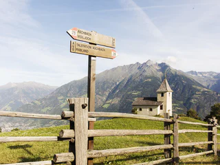
San Pancrazio/St. Pankraz, Algund/Lagundo, Meran/Merano and environs
medium
Obtížnost
658 m
Převýšení
2h:30 min
doba trvání
Plars di Mezzo/Mitterplars, Algund/Lagundo, Meran/Merano and environs
1/2
Rio Lagundo/Aschbach, Algund/Lagundo, Meran/Merano and environs

1/2
Plars di Mezzo/Mitterplars, Algund/Lagundo, Meran/Merano and environs
1/11
Rablà/Rabland, Algund/Lagundo, Meran/Merano and environs
easy
Obtížnost
0 m
Převýšení
0h:04 min
doba trvání
1/5
Lagundo/Algund, Algund/Lagundo, Meran/Merano and environs
1/5
Rio Lagundo/Aschbach, Algund/Lagundo, Meran/Merano and environs
medium
Obtížnost
84 m
Převýšení
2h:55 min
doba trvání
1/4
Lagundo/Algund, Algund/Lagundo, Meran/Merano and environs
easy
Obtížnost
252 m
Převýšení
2h:58 min
doba trvání
Lagundo/Algund, Algund/Lagundo, Meran/Merano and environs
Rio Lagundo/Aschbach, Algund/Lagundo, Meran/Merano and environs
Algund/Lagundo, Meran/Merano and environs
1/2
Plars di Mezzo/Mitterplars, Algund/Lagundo, Meran/Merano and environs
1/2
Velloi/Vellau, Algund/Lagundo, Meran/Merano and environs
1/8
Rio Lagundo/Aschbach, Algund/Lagundo, Meran/Merano and environs
easy
Obtížnost
179 m
Převýšení
1h:19 min
doba trvání

1/5
Velloi/Vellau, Algund/Lagundo, Meran/Merano and environs
easy
Obtížnost
0 m
Převýšení
0h:13 min
doba trvání

1/8
Velloi/Vellau, Algund/Lagundo, Meran/Merano and environs
difficult
Obtížnost
1061 m
Převýšení
3h:46 min
doba trvání
1/5
Velloi/Vellau, Algund/Lagundo, Meran/Merano and environs
easy
Obtížnost
244 m
Převýšení
1h:34 min
doba trvání
1/8
Foresta/Forst, Algund/Lagundo, Meran/Merano and environs
1/7
Foresta/Forst, Algund/Lagundo, Meran/Merano and environs
1/4
Lagundo/Algund, Algund/Lagundo, Meran/Merano and environs
1/4
Velloi/Vellau, Algund/Lagundo, Meran/Merano and environs
Plars di Mezzo/Mitterplars, Algund/Lagundo, Meran/Merano and environs

1/2
Velloi/Vellau, Algund/Lagundo, Meran/Merano and environs
medium
Obtížnost
451 m
Převýšení
3h:19 min
doba trvání
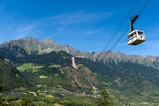
Tirol/Tirolo, Meran/Merano and environs
medium
Obtížnost
260 m
Převýšení
1h:08 min
doba trvání
1/9
Plars di Mezzo/Mitterplars, Algund/Lagundo, Meran/Merano and environs
Plars di Mezzo/Mitterplars, Algund/Lagundo, Meran/Merano and environs

1/2
Plars di Mezzo/Mitterplars, Algund/Lagundo, Meran/Merano and environs
1/9
Velloi/Vellau, Algund/Lagundo, Meran/Merano and environs
difficult
Obtížnost
1113 m
Převýšení
6h:25 min
doba trvání


